- Oakthorpe Park
-
Coordinates: 51°36′53″N 0°06′20″W / 51.614651°N 0.105585°W
Oakthorpe Park 
 Oakthorpe Park
Oakthorpe Park shown within Greater LondonLondon borough Enfield Ceremonial county Greater London Region London Country England Sovereign state United Kingdom Post town LONDON Postcode district N13 Dialling code 020 Police Metropolitan Fire London Ambulance London EU Parliament London London Assembly Enfield and Haringey List of places: UK • England • London Oakthorpe Park is a area in the London Borough of Enfield in north London, UK. It is located near Palmers Green and the Great Cambridge Junction and the A406 road (North Circular Road).
Nearest areas
References
London Borough of Enfield Districts Arnos Grove · Botany Bay · Bowes Park · Brimsdown · Bulls Cross · Bush Hill Park · Clay Hill · Cockfosters · Crews Hill · Edmonton · Enfield Chase · Enfield Highway · Enfield Island Village · Enfield Lock · Enfield Town · Enfield Wash · Forty Hill · Freezywater · Grange Park · Hadley Wood · Lower Edmonton · New Southgate · Oakwood · Palmers Green · Picketts Lock · Ponders End · Southgate · Upper Edmonton · Winchmore Hill · World's End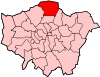
Attractions Parks and open spaces Arnos Park · Broomfield Park · Durants Park · Oakwood Park · Pymmes Park · Trent Country Park · Whitewebbs ParkConstituencies Tube and rail stations Arnos Grove · Brimsdown · Bush Hill Park · Cockfosters · Crews Hill · Edmonton Green · Enfield Chase · Enfield Lock · Enfield Town · Gordon Hill · Grange Park · Hadley Wood · Oakwood · Palmers Green · Ponders End · Silver Street · Southbury · Southgate · Turkey Street · Winchmore HillOther topics Categories:- Districts of London
- Districts of Enfield
- London geography stubs


Wikimedia Foundation. 2010.