- Nolin, Oregon
-
Nolin, Oregon — Unincorporated community — 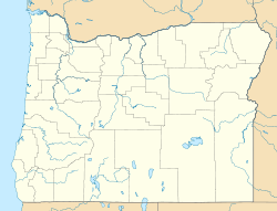
 Nolin, Oregon
Coordinates: 45°40′59″N 119°06′04″W / 45.683°N 119.101°WCoordinates: 45°40′59″N 119°06′04″W / 45.683°N 119.101°W Country United States State Oregon County Umatilla Elevation 738 ft (225 m) Time zone Pacific (PST) (UTC-8) - Summer (DST) PDT (UTC-7) ZIP code 97826 Area code(s) 458 and 541 Nolin is an unincorporated community in Umatilla County, Oregon, United States.[1] Nolin is about eight miles southeast of Echo, next to the Umatilla River.[2] At one time the area was known as "Happy Canyon".[3] Adam "Ad" W. Nye, a settler of the 1860s, named the Nolin area Happy Canyon, for the spirit of the people who lived there.[3] The name was later adopted by Pendleton Round-Up for its indoor show in commemoration of this time.[3] Nye was County Sheriff from 1872-74.[3] The nearby community of Nye was named for him.[4]
At one time Nolin had a post office, a store, and a school.[3][5][6] Nolin also has a cemetery.[7] An Oregon Railway and Navigation Company (now Union Pacific) railroad line was built through Nolin, crossing the Umatilla River on a steel bridge constructed in 1907.[8][9]
The Cunningham Sheep Ranch, founded in the 1880s by Charles Cunningham, is based in Nolin.[3] It was once one of the largest sheep-raising operations in the United States. Today it raises rambouillet sheep.[3]
References
- ^ "Nolin". Geographic Names Information System, U.S. Geological Survey. November 28, 1980. http://geonames.usgs.gov/pls/gnispublic/f?p=gnispq:3:::NO::P3_FID:1136575. Retrieved 2010-12-22.
- ^ Oregon Atlas & Gazetteer (7th ed.). Yarmouth, Maine: DeLorme. 2008. p. 73. ISBN 0-89933-347-8.
- ^ a b c d e f g "Echo's Cultural Inventory". City of Echo, Oregon. January 2002. http://www.echo-oregon.com/coeinventory1.pdf. Retrieved 2010-12-22.
- ^ McArthur, Lewis A.; McArthur, Lewis L. (2003) [First published 1928]. Oregon Geographic Names (7th ed.). Portland, Oregon: Oregon Historical Society Press. p. 711. ISBN 9780875952772. OCLC 53075956.
- ^ "Nolin Post Office (historical)". Geographic Names Information System, U.S. Geological Survey. August 1, 1994. http://geonames.usgs.gov/pls/gnispublic/f?p=gnispq:3:::NO::P3_FID:1165709. Retrieved 2010-12-22.
- ^ Furlong, Charles Wellington. "Let 'er Buck: A story of the Passing of the Old West". http://www.ebooksread.com/authors-eng/charles-wellington-furlong/let-er-buck-a-story-of-the-passing-of-the-old-west-lru/page-9-let-er-buck-a-story-of-the-passing-of-the-old-west-lru.shtml. Retrieved 2010-12-22.
- ^ "Nolin Cemetery". Geographic Names Information System, U.S. Geological Survey. May 22, 1986. http://geonames.usgs.gov/pls/gnispublic/f?p=gnispq:3:::NO::P3_FID:1129669. Retrieved 2010-12-22.
- ^ "Equipment and Supplies: Railway Bridges". The Railway Age (The Wilson Company) 43: 587. April 5, 1907. http://books.google.com/books?id=7YJNAAAAYAAJ&pg=PA587&lpg=PA587&dq=%22Nolin%22+%22Southern+Pacific%22&source=bl&ots=qlbEyXkuTt&sig=vwrW2ljX8VAVhIr3c76ofyumvu0&hl=en&ei=IJERTZuDDYTWtQOv0d3rCg&sa=X&oi=book_result&ct=result&resnum=3&ved=0CCkQ6AEwAg#v=onepage&q=%22Nolin%22%20%22Southern%20Pacific%22&f=false.
- ^ Wood, Stanley (1904). Over the Range to the Golden Gate A Complete Tourist's Guide To Colorado, New Mexico, Utah, Nevada, California, Oregon, Puget Sound, and the Great Northwest. http://www.archive.org/stream/rangeovertogolde00woodrich/rangeovertogolde00woodrich_djvu.txt.
External links
- Historic images of Nolin from the Oregon State University Extension Service
- Images of trains on the Union Pacific at Nolin from Railpictures.net
- Panorama of Nolin from Flickr, including Cunningham Sheep Company grain elevator
- Images of Nolin from Flickr
Municipalities and communities of Umatilla County, Oregon Cities 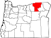
CDPs Cayuse | Gopher Flats | Kirkpatrick | Mission | Riverside | Tutuilla
Unincorporated
communitiesIndian reservation Ghost towns Categories:- Unincorporated communities in Umatilla County, Oregon
- Ghost towns in Oregon
- Oregon geography stubs


Wikimedia Foundation. 2010.