- Mission, Oregon
-
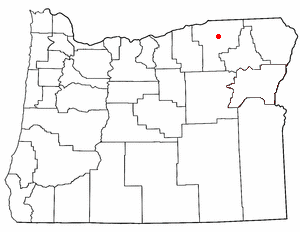
Mission, Oregon — CDP — Location of Mission, Oregon
Coordinates: 45°40′1″N 118°40′22″W / 45.66694°N 118.67278°WCoordinates: 45°40′1″N 118°40′22″W / 45.66694°N 118.67278°W Country United States State Oregon County Umatilla Area – Total 7.6 sq mi (19.8 km2) – Land 7.6 sq mi (19.8 km2) – Water 0.0 sq mi (0.0 km2) Elevation 1,217 ft (371 m) Population (2000) – Total 1,019 – Density 133.3/sq mi (51.5/km2) Time zone Pacific (PST) (UTC-8) – Summer (DST) PDT (UTC-7) ZIP code 97801 Area code(s) Area codes 541 and 458 FIPS code 41-49000[1] GNIS feature ID 1124254[2] Mission is an unincorporated community in Umatilla County, Oregon, United States. For statistical purposes, the United States Census Bureau has defined Mission as a census-designated place (CDP). The census definition of the area may not precisely correspond to local understanding of the area with the same name. The population was 1,019 at the 2000 census.
Mission is part of the Pendleton–Hermiston Micropolitan Statistical Area.
Geography
Mission is located at 45°40′1″N 118°40′22″W / 45.66694°N 118.67278°W (45.666940, -118.672899)[3], on the Umatilla Indian Reservation.
According to the United States Census Bureau, the CDP has a total area of 7.6 square miles (20 km2), all of it land.
Demographics
As of the census[1] of 2000, there were 1,019 people, 330 households, and 242 families residing in the CDP. The population density was 133.3 people per square mile (51.5/km²). There were 336 housing units at an average density of 44.0 per square mile (17.0/km²). The racial makeup of the CDP was 22.37% White, 73.80% Native American, 0.20% Asian, 0.49% from other races, and 3.14% from two or more races. Hispanic or Latino of any race were 2.65% of the population.
There were 330 households out of which 43.0% had children under the age of 18 living with them, 38.8% were married couples living together, 26.7% had a female householder with no husband present, and 26.4% were non-families. 22.1% of all households were made up of individuals and 10.0% had someone living alone who was 65 years of age or older. The average household size was 3.09 and the average family size was 3.56.
In the CDP the population was spread out with 37.8% under the age of 18, 9.0% from 18 to 24, 27.4% from 25 to 44, 18.9% from 45 to 64, and 6.9% who were 65 years of age or older. The median age was 27 years. For every 100 females there were 87.3 males. For every 100 females age 18 and over, there were 82.2 males.
The median income for a household in the CDP was $32,500, and the median income for a family was $35,417. Males had a median income of $29,125 versus $24,766 for females. The per capita income for the CDP was $12,288. About 18.9% of families and 23.3% of the population were below the poverty line, including 30.0% of those under age 18 and 18.2% of those age 65 or over.
References
- ^ a b "American FactFinder". United States Census Bureau. http://factfinder.census.gov. Retrieved 2008-01-31.
- ^ "US Board on Geographic Names". United States Geological Survey. 2007-10-25. http://geonames.usgs.gov. Retrieved 2008-01-31.
- ^ "US Gazetteer files: 2010, 2000, and 1990". United States Census Bureau. 2011-02-12. http://www.census.gov/geo/www/gazetteer/gazette.html. Retrieved 2011-04-23.
Municipalities and communities of Umatilla County, Oregon Cities 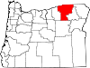
CDPs Cayuse | Gopher Flats | Kirkpatrick | Mission | Riverside | Tutuilla
Unincorporated
communitiesIndian reservation Ghost towns Categories:- Census-designated places in Oregon
- Populated places in Oregon with Native American majority populations
- Pendleton-Hermiston micropolitan area
- Unincorporated communities in Umatilla County, Oregon

Wikimedia Foundation. 2010.