- Narragansett Trail
-
- This topic is about a footpath in Connecticut.
Narragansett Trail 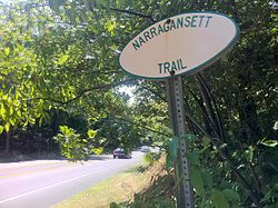
Narragansett Trail "white oval" sign at junction of Connecticut State Route 2 and Ryder Road. Length 16 miles (26 km)[1] Location Connecticut Designation CFPA Blue-Blazed Trail Use Hiking, running, cross-country skiing, snowshoeing Highest point Lantern Hill
41°27′39″N 71°56′39″W / 41.4608°N 71.9441°W
490 ft (150 m)Lowest point Lantern Hill Pond
115 ft (35 m)Sights Lantern Hill, High Ledge, Wyassup Lake, Green Falls Pond, CT/RI Border Marker Hazards Hunters, deer ticks, poison ivy, insects, snakes, black bears The Narragansett Trail is a 16-mile (26 km) Connecticut hiking trail and is one of the Blue-Blazed hiking trails maintained by the Connecticut Forest and Park Association and the Narragansett Council, the Rhode Island chapter of the Boy Scouts of America.
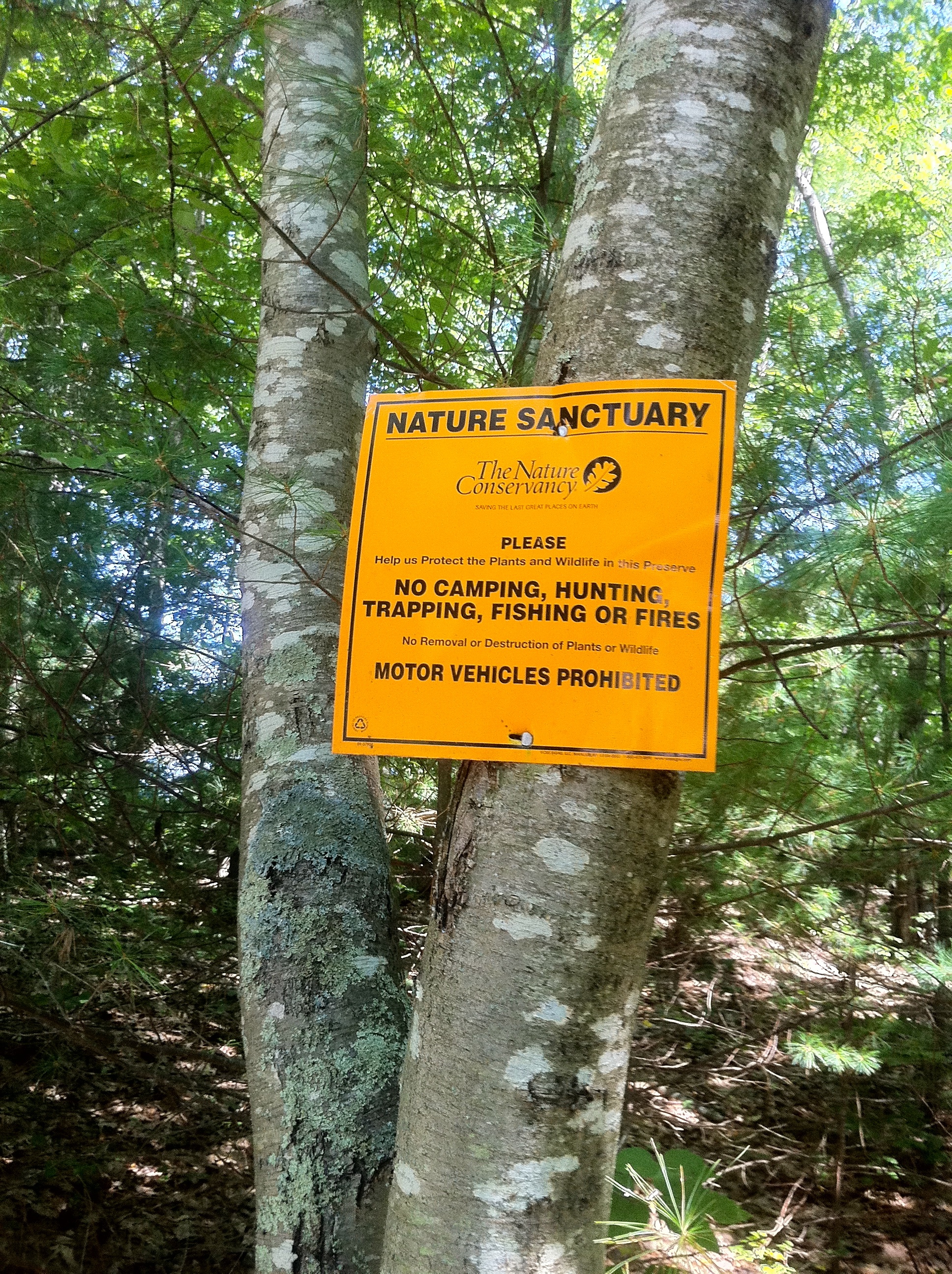
The trail is located in the towns of Ledyard, Voluntown and North Stonington in eastern Connecticut as well the Connecticut/Rhode Island border and it traverses the Lantern Hill section of the Mashantucket Pequot Reservation, the Groton Sportsman Club, the Nature Conservancy's Gladys Foster Preserve , the Pachaug State Forest Green Falls Pond area and the Rhode Island Boy Scouts Narragansett Council Camp Yawgoog reservation property.
For fifteen and one half miles the Narragansett Trail is primarily a southwest-to-northeast trail. At the easternmost end the trail becomes a north-to-south trail section which strictly follows the Connecticut/Rhode Island border south for one half mile.
Notable features include the summits of Lantern Hill and High Ledge. The trail goes near, but does not summit Cossaduck Hill and Pendleton Hill.[2]
Contents
Trail description
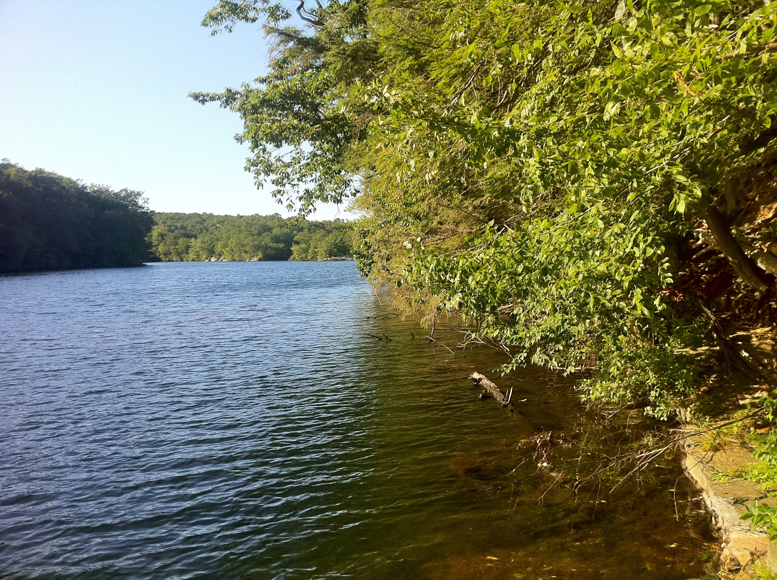
The Narragansett Trail is a Blue-Blazed hiking trail and extends from Wintechog Road near the intersection with Connecticut Route 2 in Ledyard, Connecticut to Green Fall Road in North Stonington at the Connecticut / Rhode Island state line. Much of the Narragansett Trail is on state land within the Pachaug State Forest. The Narragansett Trail connects to public recreation areas maintained by the Connecticut Department of Environmental Protection at Green Falls Pond and Wyassup Lake in Pachaug State Forest.
Much of the Narragansett Trail is flat or has gradual ascents and descents and is suitable for casual walking or hiking, running - or snowshoeing in the winter. The steepest section is where the trail traverses the closed section of Flat Rock Road. The Narragansett Trail crosses streams and wetland areas that are subject to flooding in periods of significant rain and snow melt. In particular the trail sections close to Hell Hollow Pond and Lockes Meadow Pond are low lying areas which are often under water.
The trail connects to two other Blue-Blazed trails in Connecticut's Pachaug State Forest: in the Green Falls Pond area via the Green Falls Pond Loop connector trail -- the Nehantic Trail and Pachaug Trail. The Green Falls Pond Loop trail and Narragansett Trail overlap for a section of the southern and eastern shores of Green Falls Pond.
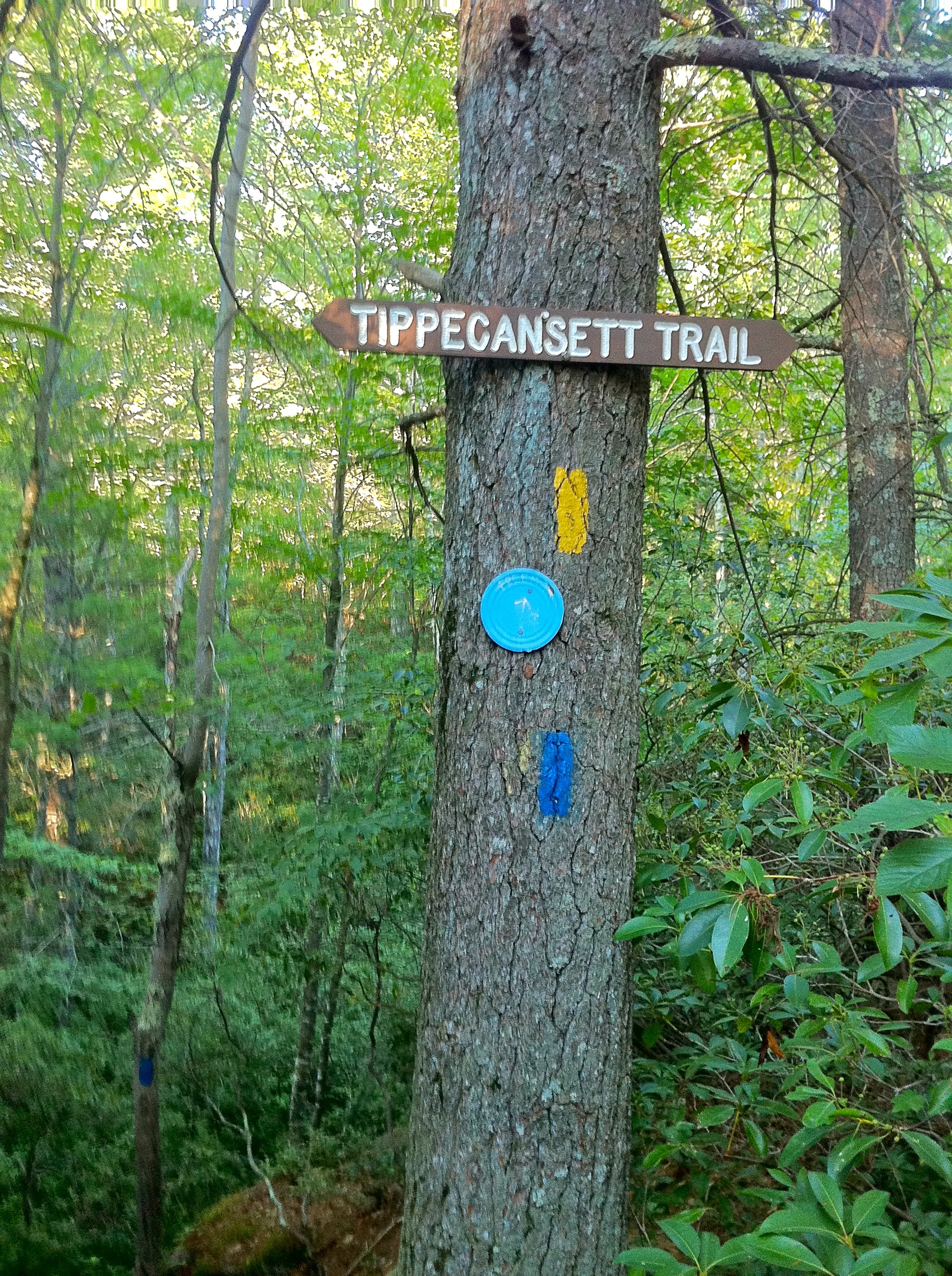
The Narragansett Trail also connects to several non-Blue-Blazed Trails. Near its western end it connects to and overlaps with sections of the Lantern Hill trail and loop trail as well as several unmarked trails. The Tippecansett Trail and a Rhode Island extension of the Narragansett Trail connect to the Narragansett Trail at the Connecticut / Rhode Island state border.
Trail route
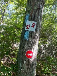 Narragansett Trail blazes with Lantern Hill and Loop Trail signs.
The western end of the Narragansett Trail starts on Wintechog Road in North Stonington Connecticut, to the southeast of the Mashantucket Pequot Tribe's Foxwoods Casino in Ledyard Connecticut. The trail climbs southward, connecting with the Lantern Hill trail and Lantern Hill Loop trail. After climbing to the Lantern Hill summit the trail descends to the west and heads north-west. It passes through the North Stonington Dog Pound and waste transfer station property before crossing Wintechog Road. The trail continues north through woods and eventually passes through two open fields (meadows). After the Gallup Pond dam bridge the trail crosses Connecticut Route 2. There is a short road walk to and down Ryder Road to the trail entrance to Nature Conservancy's Gladys Foster parcel. The trail continues to Yawbux Brook and an unnamed beaver pond before entering Pachaug State Forest. The trail then joins Wyassup Lake Road at the Lake Wyassup beach area and boat launch. From the Lake Wyassup beach area the trail climbs to the High Ledge plateau and then to the Legend Woods / Pendleton Hill area before crossing Connecticut Route 49.
Next the trail travels north-east through the private hunting preserve (and fishing pond) of the Groton Sportsmen Club (this Narragansett Trail section is closed from October to March according to posted signs), re-enters the Pachaug State Forest at Tom Wheeler Road and follows the Green Fall River (and ravine) north to Green Fall Pond. The trail follows the south-east shore of the pond before leaving the shore of the pond to head east to the Rhode Island border. At the border the trail turns ninety degrees to head south over a rock ridge over a cave. After a half mile the trail's Connecticut section ends at a very small parking lot and state line marker where Green Fall Road becomes Yawgoog Road in Rhode Island.
There is a short (four mile) extension of the trail into Rhode Island which is blazed yellow. This Narragansett Trail extension passes by the Long and Ell Ponds and passes through the Rockville Wildlife Management Area before ending at the former swimming area on Ashville Pond in Hopkinton, Rhode Island. The Narraganset Trail used to continue to Rhode Island Route 138 in Kingston, Rhode Island.
For more information on the Rhode Island Narragansett Trail yellow-blazed extension read The Story of the Yawgoog Trails - Seven Pond Path - Part I
Trail communities
The Narragansett Trail passes through land located within the following Connecticut municipalities, from west to east: Ledyard, Voluntown and North Stonington
Landscape, geology, and natural environment
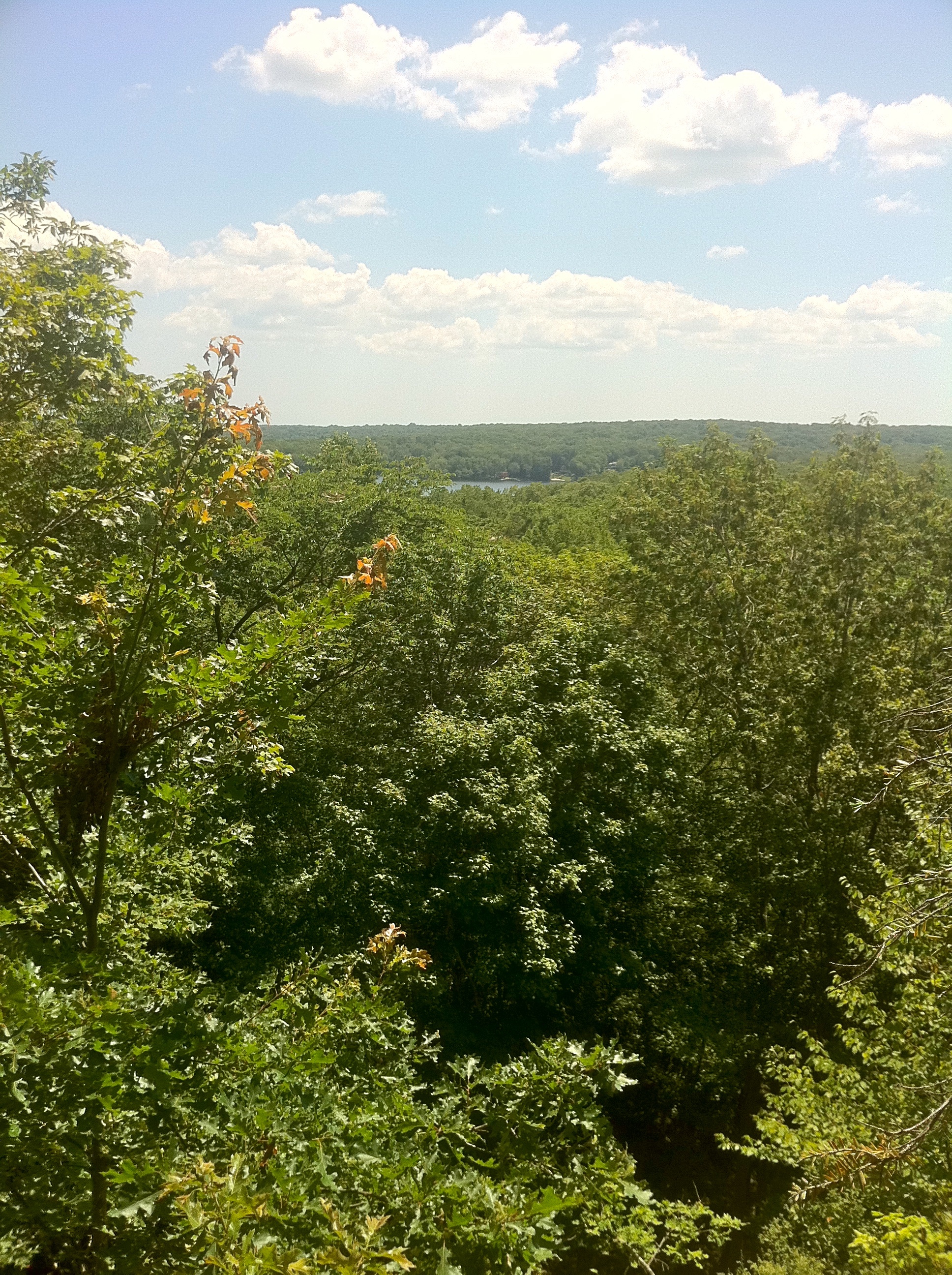
Landscape in the area is generally low-lying and flat with some rolling hills. The most prominent features are Lantern Hill and the High Ledge plateau and rocks (containing some small caves).
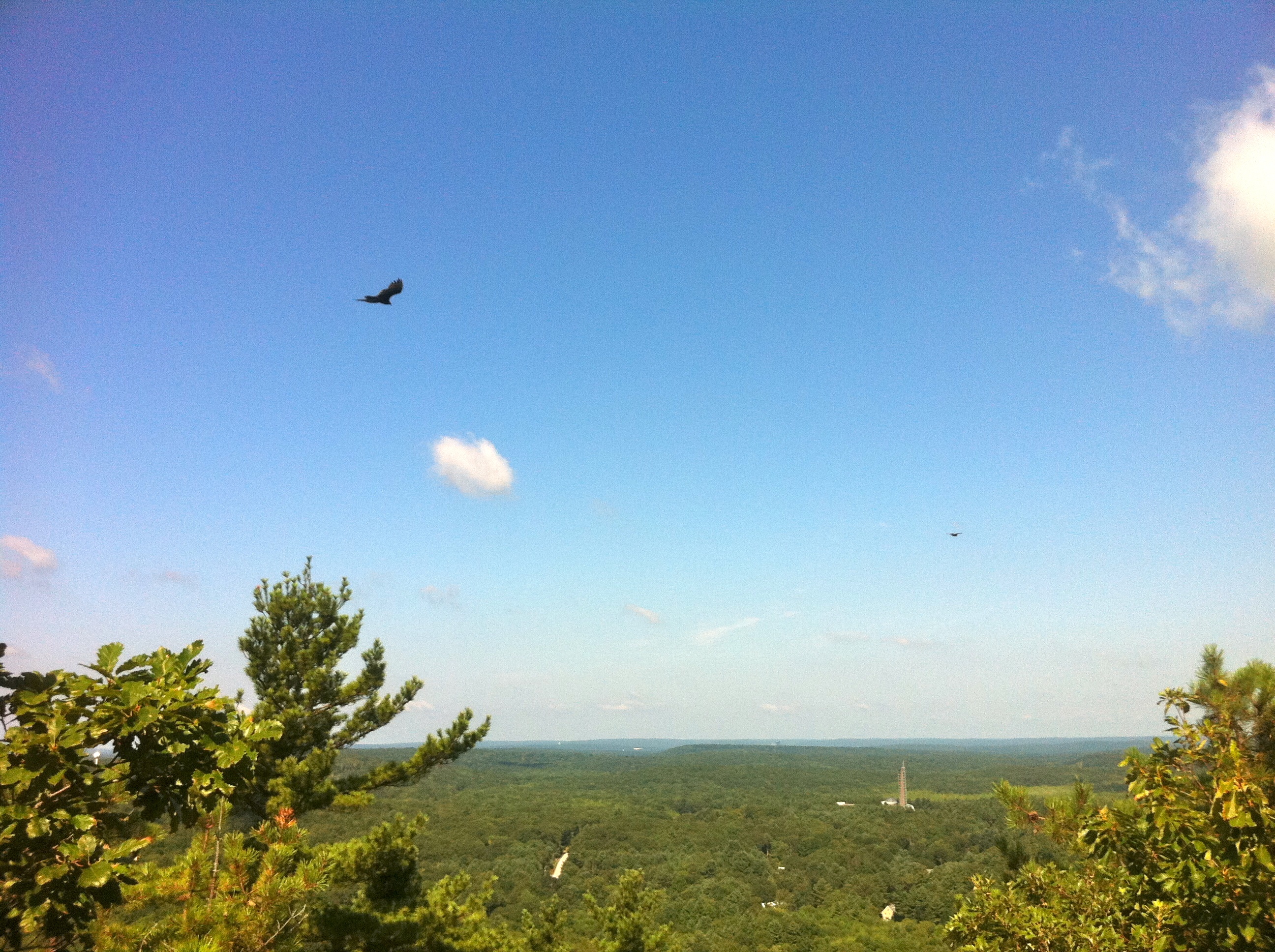
In terms of animal wildlife numerous hawks can be spotted flying around the summit of Lantern Hill and black bear sightings have been reported in the Pachaug State Forest area near the state border.
The Pachaug State Forest Green Falls Pond area features large extents of undeveloped land, consisting of mature growths of hardwood and evergreens, along with swampy areas having extensive coverage by Mountain Laurel, Rhododendron and other shrubs and smaller trees.
The Narragansett Council (Rhode Island Boy Scouts of America chapter) property at the eastern end of the trail is similar to the Pachaug State Forest terrain. In addition, the several swampy areas breed many biting insects including large horse-flys in season.
History and folklore
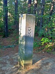 Narragansett Trail Eastern Terminus - Connecticut - Rhode Island State Line Marker on Green Fall Road.
The Blue-Blazed Narragansett Trail was created by the Connecticut Forest and Park Association as part of the Blue-Blazed Hiking Trail system. The eastern end of the original longer Pequot Trail blazed in the 1930s connected to the western end of the Narragansett Trail at the Lantern Hill section of the Mashantucket Peqout reservation. The original "connected" Pequot and Narragansett Trails can be seen in the Connecticut Forest and Park Association's 1940 Connecticut Walk Book map of major trails. [3] The missing "gap" sections are on Mashantucket Pequot Tribal Nation property and are trails used for centuries by the Pequot tribe. Plans are underway to lengthen the Pequot Trail and return the south-eastern terminus to its original location with the Narragansett Trail on Lantern Hill in North Stonington via the Mashantucket Pequot Tribal Nation property near their highly regarded museum and research center.
Origin and name
The original Blue-Blazed Hiking Trails were named after Native American people and place names, in recognition that many of the trails followed historic foot paths. Trails added since often follow this convention, so many of the BBHT's have Native American names.
The Narragansett were a tribe of Algonquian speaking people who occupied the area which is now western Rhode Island including the coast and islands in Narragansett Bay during the early colonial period. They periodically occupied areas of eastern Connecticut near the current border with Rhode Island.
The word "Narragansett" means, literally, "People of the Small Point."[4]
For more information see the Narragansett name and language section of the Wikipedia article on the Narragansett Tribe.
Historic sites
The foundations for stone cellars that can be found along the route indicate that much of the landscape was used for settlements and farms up until the late nineteenth and early twentieth century, after which much of the land was allowed to return to forests. In particular stone foundations and extensive stone walls can be found off of the trail east of High Ledge in the Legend Woods area. [5]
Pachaug State Forest was the first state forest in Connecticut and grew quickly in acreage primarily because many of the farmers and landholders in the area realized that their soil was poor for farming and sold their land to the state in the 1920s and 1930s.[6]
Folklore
The town name of Voluntown is attributed to the fact that it was settled by Volunteers of the Narragansett War in 1700 who received land grants to settle there. The land was remote and difficult to farm and many of the original settlements were subsequently abandoned, so stone walls and foundations can be found throughout the forest today.
Hiking the trail
 Narragansett Trail's south-west trail head at Wintechog Road.
The mainline trail is blazed with blue rectangles. Trail descriptions are available from a number of commercial and non-commercial sources, and a complete guidebook is published by the Connecticut Forest and Park Association. More information can be found on the CFPA website (http://ctwoodlands.org/blue-blazed-hiking-trails) including updates on trail conditions and closure or restrictions. Contact information is also available on the site for trail users to report adverse trail conditions or submit other feedback or questions.
Weather along the route is typical of Connecticut. Conditions on exposed ridge tops and summits may be harsher during cold or stormy weather.[7] Lightning is a hazard on exposed summits and ledges during thunderstorms. Snow is common in the winter and may necessitate the use of snowshoes. Ice can form on exposed ledges and summits, making hiking dangerous without special equipment.
Landscape is low-lying and trails cross wetland areas. Extensive rain and snow melt will lead to wet and muddy conditions, and in this case fairly high waterproof boots are recommended.
Biting insects can be bothersome during warm weather. Parasitic deer ticks (which are known to carry Lyme disease) are a potential hazard. Encounter with small wildlife is always possible and hikers should be alert to signs of erratic behavior or other disease symptoms and take evasive action if warranted.
Seasonal hunting is permitted on state forest land, so wearing bright orange clothing during the hunting season (Fall through December) is advised.
State regulations govern use of state forest land. The land, plants and animals should generally be left undisturbed, especially endangered and protected species. For guidelines on how to act during a black bear encounter please view the American Bear Association hiking and camping awareness page.
Conservation and maintenance of the trail corridor
Much of the trail is flooded or muddy. There are sections filled with stones and other evidence of erosion which has occurred when the trail has turned into a temporary stream.
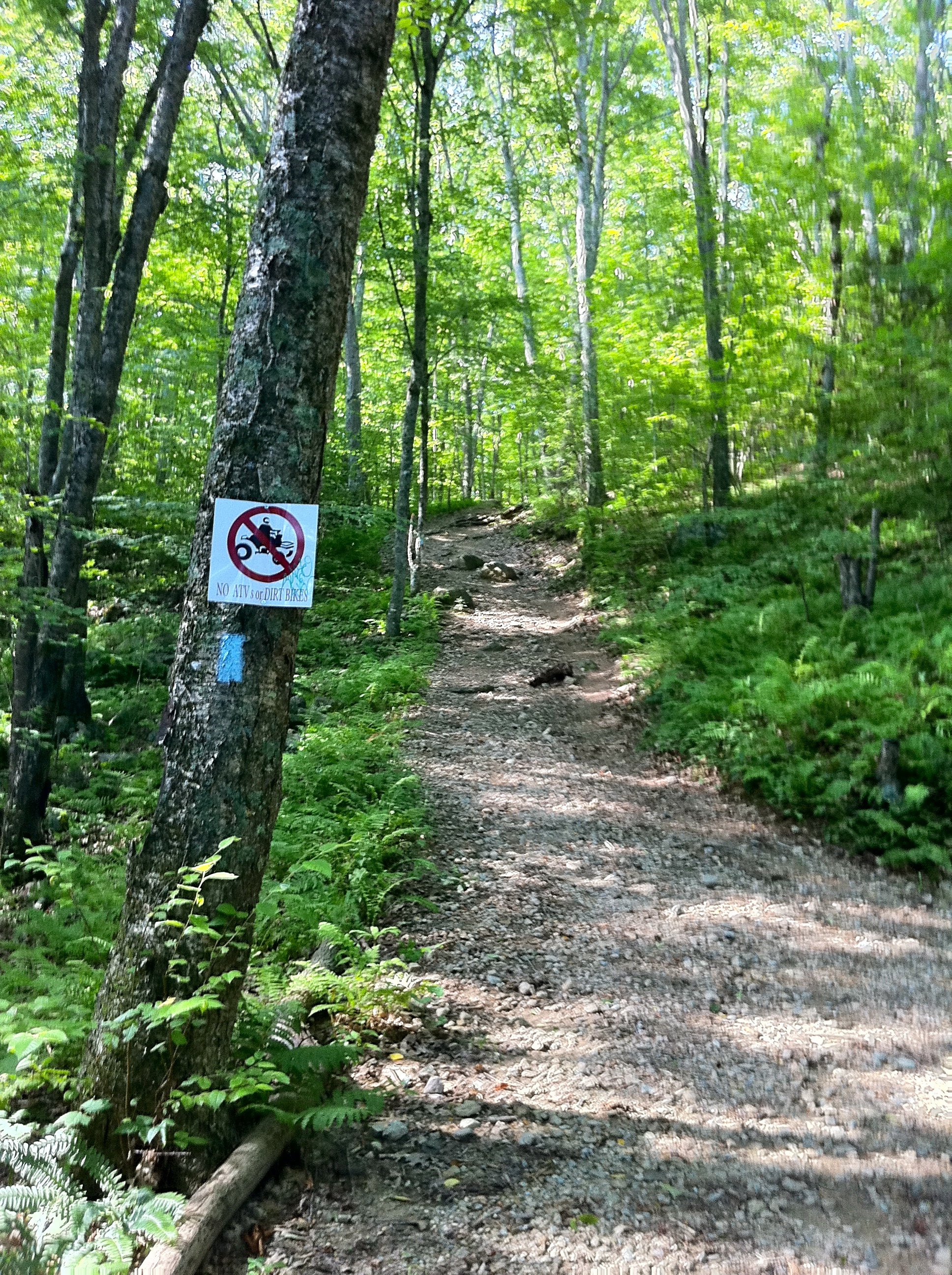
There is also evidence of use by all terrain vehicles (ATVs), dirt bikes and horses. Some sections of the Narragansett trail are explicitly multi-use (paved roads, dirt/gravel forest roads, jeep trails and the Enduro off-road motorcycle trail which winds through Pachaug State Forest), but in other sections there is clearly unauthorized vehicular and equestrian use.
The 58 mile Enduro trail in Pachaug State Forest is marked (on turns and intersections on trees) with white labels containing a red arrow pointing in the trail's direction. The route follows a mix of forest trails and public roads (therefore requiring both a valid current motorcycle registration and motorcycle driver's license rather than ATV registration).
Recognition / Inspiration Programs
This trail system is a part of the 'Connecticut 400', one of the official Blue-Blazed (or similar) trails listed in the Connecticut Walk Book by the Connecticut Forest and Park Association (CFPA) and recognized, since 1976, with an award known as the Connecticut 400 Club by the Connecticut Chapter of the Appalachian Mountain Club (AMC). In 1976 there were only four hundred miles of Blue-Blazed trail but today (2010) the total length of the trails listed in the CFPA Connecticut Walk Books (East and West) exceeds 825 miles.[8][9][10]
The State of Connecticut Department of Environmental Protection (CT DEP) Forestry Division provides two awards for locating and visiting "letterboxes" (similar to geocaches) in Connecticut's State Forests. The commemorative 'State Forest Centennial Patch' is available to those who complete five sponsored "letterbox" hikes (in each separate state forest you must hike the described route, find the "letterbox/cache" and record your visit in the "letterbox" book). The State Forest Centennial campaign dates to 2003 (the centennial of the first official state forest in Connecticut). A walking stick is available for those who complete the letterbox hike of all thirty-two (32) of the state forests. Many of the "Blue-Blazed" hiking trails in Connecticut travel through or near one or more of the State Forests, often very close to the sponsored (DEP) letterbox.[11]
There is a State of Connecticut Department of Environmental Protection letterbox hidden close to the trail on the High Ledge plateau. [12]
Image gallery
 Narragansett Trail's south-west trail head at Wintechog Road.
 Narragansett Trail blazes with Lantern Hill and Loop Trail signs.
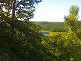 Narragansett Trail's Lantern Hill view of Lantern Hill Pond.
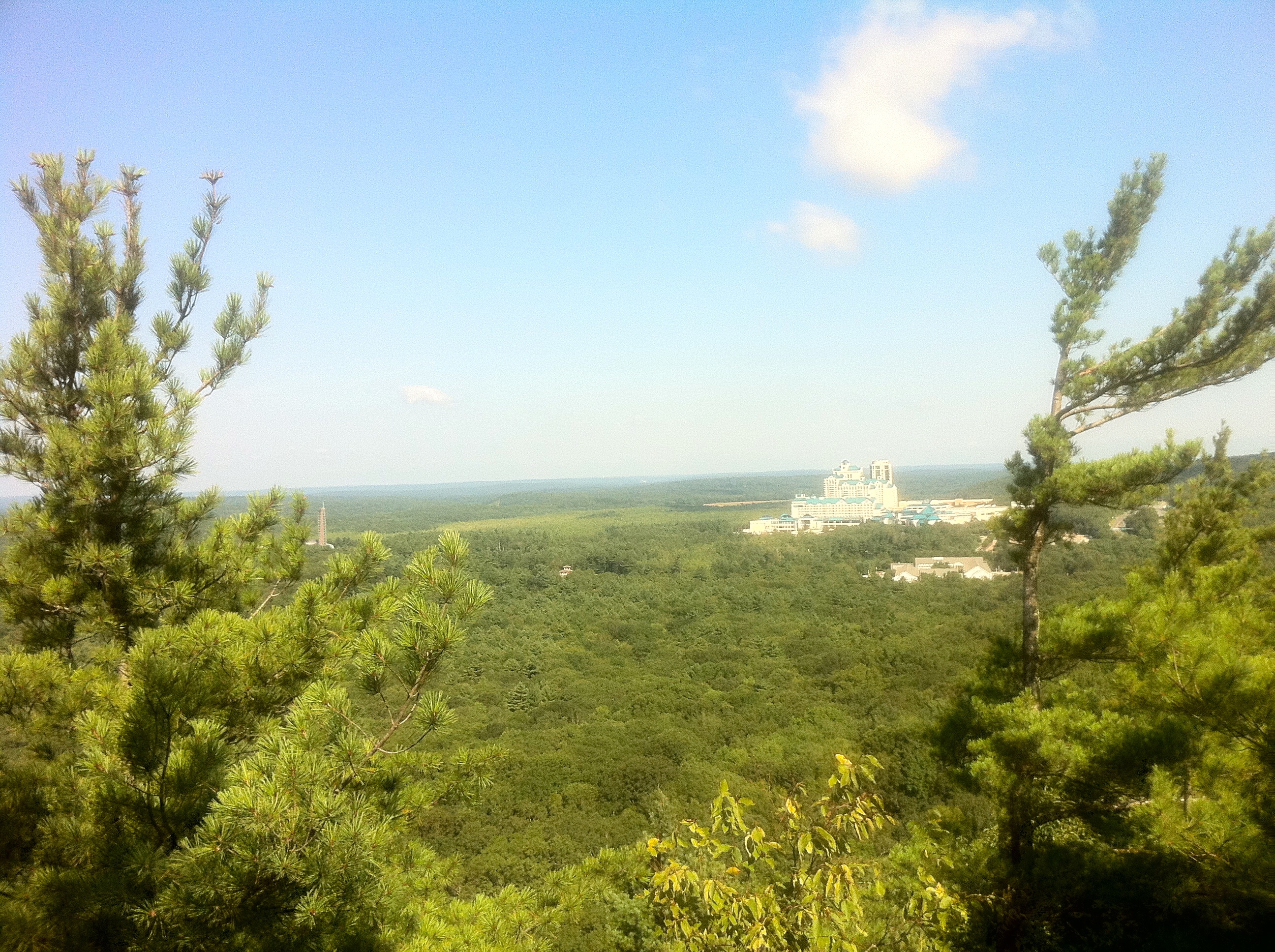
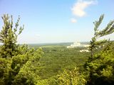 Narragansett Trail's Lantern Hill view of the Mashantucket Pequots Foxwoods Casino Resort.
 Narragansett Trail's Lantern Hill view of hawks flying. Mashantucket Pequot Museum can be seen in the far background.
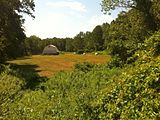 Narragansett Trail - "Shelter Cave Field" meadow with barn adjacent to "Trolley Pasture" meadow.
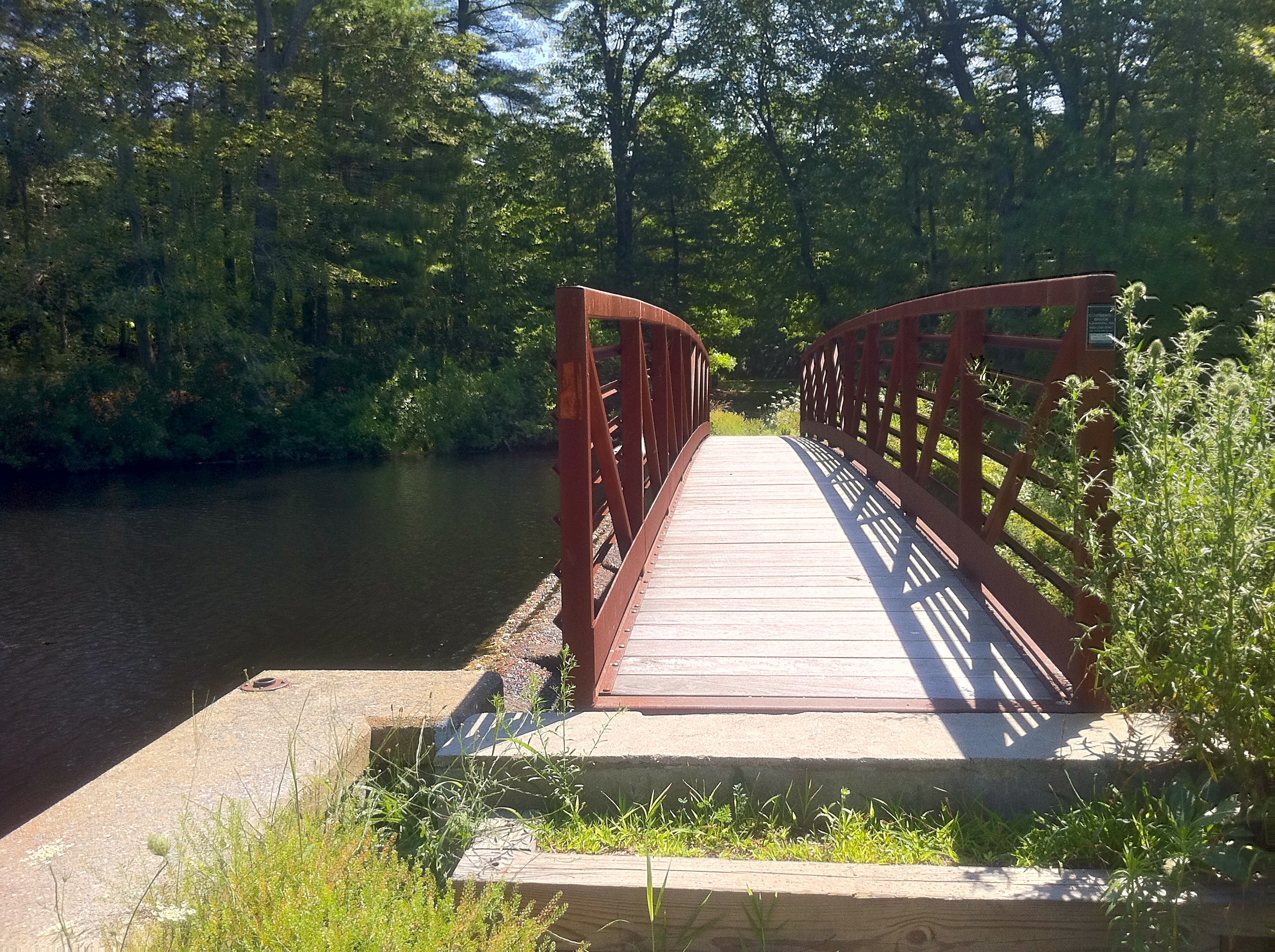
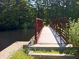 Narragansett Trail - Foot Bridge at Gallup (AKA Hewitt) Pond.
 Narragansett Trail "white oval" sign on CT Route 2 near Gallup Pond and Ryder Road.
 Narragansett Trail - entering the Nature Conservancy's Gladys Foster Preserve in North Stonington section on Ryder Road.
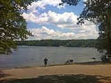 Narragansett Trail -Wyassup Lake boat launch and public access lot on Wyassup Lake Road.
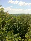 Narragansett Trail - View of Wyassup Lake from High Ledge.
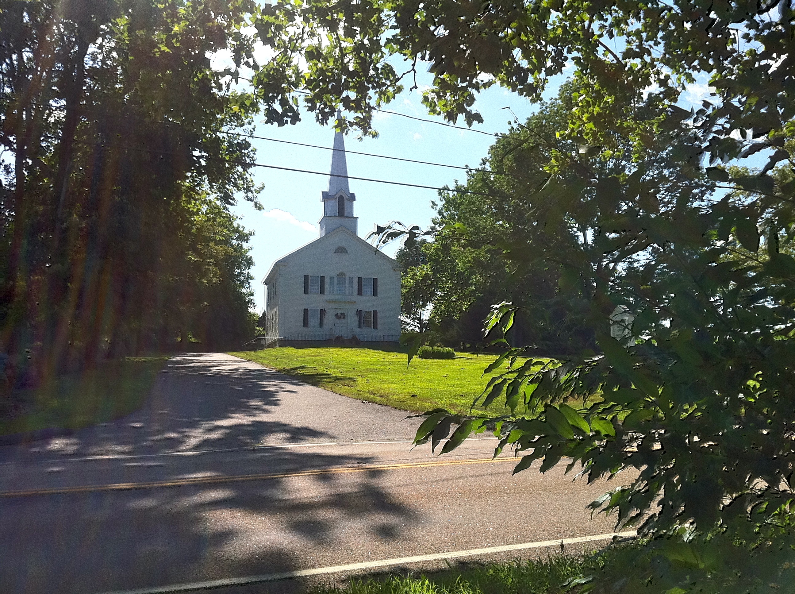
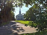 Narragansett Trail - First Baptist Church on Pendleton Hill (opposite Groton Sportsman Club preserve).
 Narragansett Trail - Groton Sportsman Club Private Hunting Preserve hunting season trail closing sign at CT-49 (Pendleton HIll Rd) entrance.
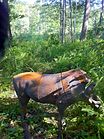 Narragansett Trail - Groton Sportsman Club Private Hunting Preserve 3D target near fishing pond.
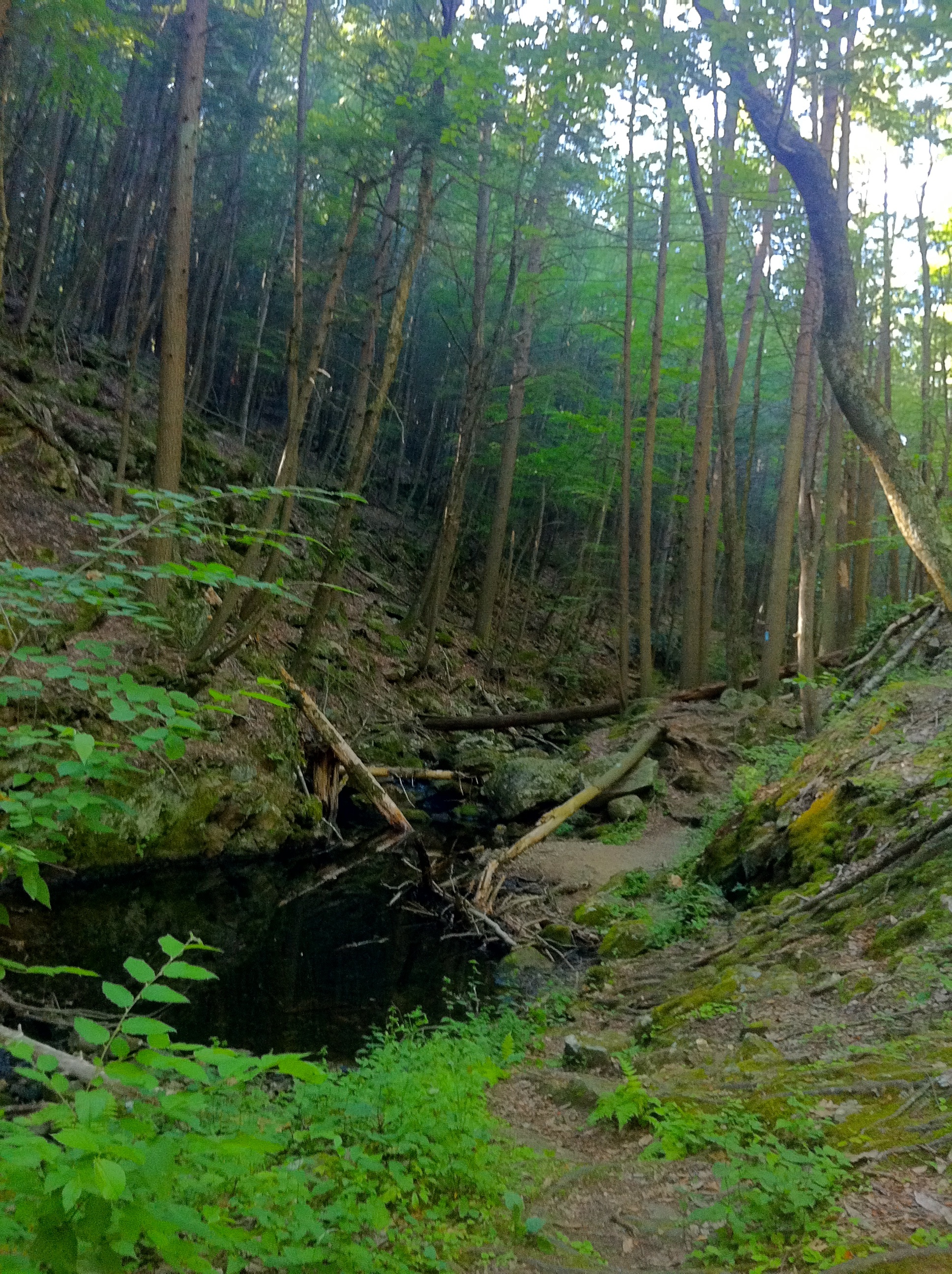
 Narragansett Trail - Green Fall River ravine south of Green Fall Pond.
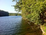 Narragansett Trail - south end of Green Fall Pond looking north.
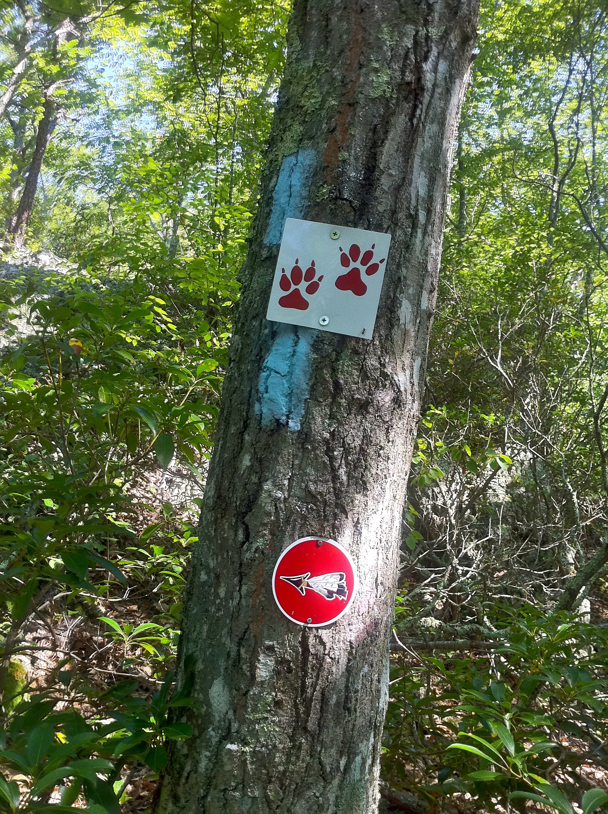
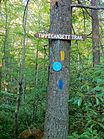 Narragansett Trail - intersection with Tippecansett Trail at the Connecticut-Rhode Island state border.
 Narragansett Trail Eastern Terminus at Connecticut - Rhode Island State Line Green Fall Road. Rhode Island Boy Scouts private property sign.
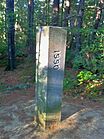 Narragansett Trail Eastern Terminus - Connecticut - Rhode Island State Line Marker on Green Fall Road.
See also
- Blue-Blazed Trails
- Foxwoods
- Pequot Trail
- Nehantic Trail
- Pachaug Trail
- Pachaug State Forest
- Lantern Hill
- Mashantucket_Pequot_Tribe
- Narragansett_(tribe)
Bibliography
Heermance, Edgar L. (1935). The Connecticut Guide: What to See and Where to Find It. Hartford: Emergency Relief Commission. pp. 246–247. OCLC 719786. http://www.archive.org/details/connecticutguide00connrich.
Haynes, Williams; Boylan, James (1976). Stonington Historical Society. ed. Stonington Chronology 1649-1976: Being a year-by-year record of the American way of life in a Connecticut town (2nd ed.). Chester Connecticut: Pequot Press. pp. 74. ISBN 0871060590. OCLC 2523265.
Philips, David E. (1992). Legendary Connecticut: Traditional Tales from the Nutmeg State (2nd ed.). Willimantic: Curbstone. pp. 122. ISBN 1-880684-05-5. OCLC 26218340.
Pritzker, Barry M. (2000). A Native American Encyclopedia: History, Culture, and Peoples. Oxford: Oxford University Press. ISBN 978-0195138771.
References
- ^ Colson, Ann T. (2006). Connecticut Walk Book West (19th edition). Connecticut Forest and Park Association. ISBN 0961905263.
- ^ Connecticut Walk Book: A Trail Guide to the Connecticut Outdoors. 17th Edition. The Connecticut Forest and Park Association. Rockfall, Connecticut. Undated.
- ^ http://chriswoodside.com/files/imagecache/fullscreen/Connecticut%20Trail%20System,%201940.jpg
- ^ Pritzker, 442
- ^ [1]
- ^ Yawgoog Trails - Hell Hollow
- ^ NOAA
- ^ "The Connecticut 400". Rocks on Top. http://www.rocksontop.com/rocks/viewtopic.php?f=22&t=3408. Retrieved 2010-05-29.
- ^ Robinson, Ruth (1993-06-06). "Hikers Seek New Trails to Conquer". The New York Times. http://www.nytimes.com/1993/06/06/nyregion/hikers-seek-new-trails-to-conquer.html?sec=&spon=&pagewanted=all. Retrieved 2010-05-29.
- ^ "Hikes". Connecticut Museum Quest. http://www.ctmuseumquest.com/?page_id=23. Retrieved 2010-05-29.
- ^ "Forestry – Looking Beyond the Trees : Letterboxing in Connecticut's State Forests". Department of Environmental Protection, State of Connecticut. http://www.ct.gov/dep/cwp/view.asp?a=2697&q=322826&depNav_GID=1631. Retrieved 2010-05-29.
- ^ Connecticut State Forests - Seedling Letterbox Series Clues for Pachaug State Forest
External links
Trail Maps:
- CT DEP - Green Falls Area Map
- CT DEP - Pachaug State Forest Enduro Motorcycle Trail Topo Map
- The Story of the Yawgoog Trails - Green Fall Pond Area Topo Map
- The Story of the Yawgoog Trails - Lantern Hill Area Topo Map
- The Story of the Yawgoog Trails - Wyassup Lake Area Topo Map
Specific to this trail:
- "Hiking a regular pastime at Narragansett Trail", MetroWest Daily News, Sept. 6, 2007
- The Story of the Yawgoog Trails - Narragansett Trail and Lantern Hill
- The Story of the Yawgoog Trails - Connecticut Countryside - Part I
- The Story of the Yawgoog Trails - Connecticut Countryside - Part II
- The Story of the Yawgoog Trails - Green Fall Pond Area - Part I
- The Story of the Yawgoog Trails - Green Fall Pond Area - Part II
- Geocaching on the Narragansett Trail - Geocaching.com
- CT DEP - Letterbox Clues for Pachaug State Forest
- CT DEP - Wyassup Lake Boat Launch, North Stonington
Nearby areas and the Pachaug State Forest:
- Narragansett Council BSA - Boy Scouts of America Rhode Island Chapter
- Groton Sportsmen Club
- Mashantucket_Pequot_Tribe
- Pequot Tribe History - First Nations Issues of Consequence
- Narragansett Tribe History - First Nations Issues of Consequence
- CT DEP-Pachaug State Forest
- CT DEP-Green Falls Area
- North Stonington Historical Society
- The Story of the Yawgoog Trails
Connecticut hikes and related information:
Further reading
- Books – Connecticut Hiking
- Colson, Ann (2005). Connecticut Walk Book East (19 ed.). Rockfall, Connecticut: Connecticut Forest and Park Association. pp. 1–261. ISBN 0961905255. http://books.google.com/books?id=x3vXPQAACAAJ.
- Colson, Ann (2006). Connecticut Walk Book West (19 ed.). Rockfall, Connecticut: Connecticut Forest and Park Association. pp. 1–353. ISBN 0961905263. http://books.google.com/books?id=5hZSAAAACAAJ.
- Emblidge, David (1998). Hikes in southern New England: Connecticut, Massachusetts, Vermont (1 ed.). Mechanicsburg, Pennsylvania: Stackpole Books. pp. 1–304. ISBN 0-8117-2669-X. http://books.google.com/books?id=H_4A-XrPYggC&lpg=PP1&pg=PP1#v=onepage&q&f=false.
- Keyarts, Eugene (2002). Pietrzyk, Cindi Dale. ed. Short Nature Walks: Connecticut Guide Book (7 ed.). Guilford, Connecticut: Falcon Publishing. pp. 1–192. ISBN 0-7627-2310-6. http://www.globepequot.com/isbn/0-7627-2310-6.
- Laubach, Rene; Smith, Charles W. G. (2007). AMC's Best Day Hikes in Connecticut (1 ed.). Guilford, Connecticut: Appalachian Mountain Club Books. pp. 1–320. ISBN 1-934028-10-X. http://www.globepequot.com/isbn/1-934028-10-X.
- Ostertag, Rhonda; Ostertag, George (2002). Hiking Southern New England (2 ed.). Guilford, Connecticut: Falcon Publishing. pp. 1–336. ISBN 0-7627-2246-0. http://www.globepequot.com/isbn/0-7627-2246-0.
- Books – Connecticut History and Geography
- De Forest, John (1853). History of the Indians of Connecticut from the earliest known period to 1850. Hartford, Connecticut: Wm. Jas. Hamersley. pp. 1–509. http://books.google.com/books?id=QysTAAAAYAAJ&dq=editions%3AHARVARD32044014634349&pg=PP1#v=onepage&q&f=false.
- Hayward, John (1857). New England Gazetteer: Containing Descriptions of the States, Counties, Cities and Towns of New England (2 ed.). Boston, Massachusetts: Otis Clapp. pp. 1–704. http://books.google.com/books?id=vMcMAAAAYAAJ&ots=qbWGmJHe8A&dq=New%20England%20Gazetteer%20states%20counties%20towns&pg=PR1#v=onepage&q=&f=false.
- Trumbull, Benjamin (1797). Volume One A Complete History of Connecticut - Civil and Ecclesiastical. Volume I (1818 printing ed.). New Haven, Connecticut: Maltby, Goldsmith & Co. and Samuel Wadsworth. pp. 1-1166. http://books.google.com/books?id=I2Z4ACHdrIoC Volume One.
- Trumbull, Benjamin (1797). Volume Two A Complete History of Connecticut - Civil and Ecclesiastical. Volume II (1818 printing ed.). New Haven, Connecticut: Maltby, Goldsmith & Co. and Samuel Wadsworth. pp. 1-1166. http://books.google.com/books?id=qwgWAAAAYAAJ&ots=N7363Fc8D4&dq=A%20Complete%20History%20of%20Connecticut%20-%20Civil%20and%20Ecclesiastical&pg=PR3#v=onepage&q&f=false Volume Two.
Hiking Trails in Connecticut Airline State Park Trail • Alain and May White Trails • American Legion • Appalachian Trail • Aspetuck Valley • Bigelow Hollow • Case Mountain • Charter Oak Greenway • Chatfield • Cockaponset • East Coast Greenway • Falls Brook • Farmington Canal Heritage Trail • Gay City • Hancock Brook • Hop River State Park Trail • Housatonic Range • Jericho • Kettletown • Lillinonah • Lone Pine • Macedonia Brook • Mattabesett • Mattatuck • McLean Game Refuge • Menunkatuck • Metacomet • Mohawk • Moosup Valley State Park Trail • Muir • Narragansett • Natchaug • Naugatuck • Nayantaquit • Nehantic • New England National Scenic Trail • Nipmuck • Old Furnace • Patchaug • Paugussett • Peoples • Pequot • Pine Knob • Pomperaug • Quinebaug • Quinnipiac • Ragged Mountain • Regicides • Salmon River • Saugatuck • Shenipsit • Sleeping Giant • Sleeping Giant State Park • Stony Creek Quarry • Sunny Valley Preserve • Tunxis • Washington–Rochambeau Revolutionary Route • Westwoods • Whitestone Cliffs • Wolcott Trail • Zoar

Protected areas of Connecticut National Park Service National Wildlife Refuges Silvio O. Conte • Stewart B. McKinney National Wildlife Refuge
National Trails State Parks Airline • Beckley Iron Furnace Industrial Monument • Bigelow Hollow • Black Rock • Bluff Point • Burr Pond • Camp Columbia • Campbell Falls • Chatfield Hollow • Collis P. Huntington • Connecticut Valley Railroad • Day Pond • Dennis Hill • Devil's Hopyard • Dinosaur • Fort Griswold Battlefield • Fort Trumbull • Gardner Lake • Gay City • George W. Seymour • Gillette Castle • Haddam Meadows • Haley Farm • Hammonasset Beach • Hampton Beach • Harkness Memorial • Haystack Mountain • Hop River State Park Trail • Hopeville Pond • Housatonic Meadows • Hurd • Indian Well • John A. Minetto • Kent Falls • Kettletown • Lake Waramaug • Larkin State Park Trail • Levy • Lovers Leap • Macedonia Brook • Mansfield Hollow • Mashamoquet Brook • Millers Pond • Mohawk Mountain • Moosup Valley State Park Trail • Mount Tom • Old Furnace • Osbornedale • Penwood • Putnam Memorial • Quaddick • Quinnipiac River • River Highlands • Rocky Neck • Selden Neck • Seth Low Pierrepont • Sherwood Island • Silver Sands • Sleeping Giant • Southford Falls • Squantz Pond • Stratton Brook • Talcott Mountain • Wadsworth Falls • West Rock Ridge • Wharton Brook • Windsor Locks Canal State Park Trail
State Forests Algonquin • American Legion • Centennial Watershed • Cockaponset • Enders • James L. Goodwin • Housatonic • Massacoe • Mattatuck • Meshomasic • Mohawk • Mohegan • Nassahegon • Natchaug • Nathan Hale • Nehantic • Nepaug • Nipmuck • Nye-Holman • Pachaug • Paugnut • People's • Pootatuck • Quaddick • Salmon River • Shenipsit • Topsmead • Tunxis • Wyantenock
Connecticut Department of Environmental Protection (web)Categories:- Hiking trails in Connecticut


Wikimedia Foundation. 2010.