- Mohawk State Forest
-
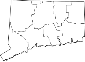
Mohawk State Forest Map of Connecticut Location Litchfield County Nearest city Corwall, CT Coordinates 41°49′N 73°17′W / 41.817°N 73.283°WCoordinates: 41°49′N 73°17′W / 41.817°N 73.283°W Area 3,703 acres (14.99 km²) Established 1921 Governing body Connecticut Department of Environmental Protection Mohawk State Forest is the sixth oldest forest in the Connecticut state forest system. It is located in the southern Berkshires of Litchfield County, in the towns of Cornwall, Goshen, and Litchfield. Beginning in 1921, 2,900 acres (12 km2) of land was donated by the White Memorial Trust. Today, the park encompasses 3,703 acres (14.99 km2).
The name only comes indirectly from the Mohawk Indians, who did not live in the area. It is said that the local tribes would light fires at the top of the mountain to warn neighboring communities further south of approaching Mohawks.
The area is most popular in the winter for cross-country skiing, and skiers and snowboarders using the nearby Mohawk Mountain Ski Area. It is also popular in the fall for leaf-peeping and offers hiking and camping opportunities. It is one of the few forests in Connecticut where hunting is prohibited.
Contents
Points of interest
Black Spruce Bog
Mohawk State Forest is home to one of the few bogs in Connecticut. Plants such as Sheep Laurel, Leatherleaf, Sphagnum Moss, Sundew, and Pitcher plant are found here, with White Pine, Black Spruce, Eastern Hemlock, and Tamarack comprising the overstory. A boardwalk leads visitors into the bog, and there is a separate area for disabled visitors.
Cunningham Tower
An old gutted stone tower stands along the blue trail in the northern section of the forest.
Mohawk Mountain
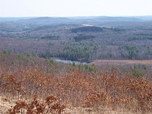
The top of Mohawk Mountain (elev. 1683 feet) offers sweeping views of the Taconic Mountains and Berkshire Mountains to north and northwest, with peaks well into New York and Massachusetts being visible. On a clear day, Mount Greylock and the eastern Catskills can be seen. The blue-blazed Mattatuck trail crosses the mountain.
Some peaks visible from the top of the mountain are:
- Bear Mountain (CT)
- Race Mountain (MA)
- Mount Everett (MA)
- Canaan Mountain (CT)
- Cream Hill (CT)
- Wetuwanchu Mountain (CT)
Mohawk Pond
The southern section of the state forest borders Mohawk Pond, a small kettle pond. It is stocked with brown trout, brook trout, and rainbow trout.
Red Mountain
Accessible on on foot via the blue-blazed Mohawk Trail (formerly the Appalachian Trail), Red Mountain (elev. 1652') occupies the northernmost section of Mohawk State Forest. Due to the shallow bedrock of the peak, the higher elevations of the mountain are home to shrubby oak trees and several scenic views.
See also: List of Connecticut state forests
References
Protected areas of Connecticut National Park Service National Wildlife Refuges Silvio O. Conte • Stewart B. McKinney National Wildlife Refuge
National Trails State Parks Airline • Beckley Iron Furnace Industrial Monument • Bigelow Hollow • Black Rock • Bluff Point • Burr Pond • Camp Columbia • Campbell Falls • Chatfield Hollow • Collis P. Huntington • Connecticut Valley Railroad • Day Pond • Dennis Hill • Devil's Hopyard • Dinosaur • Fort Griswold Battlefield • Fort Trumbull • Gardner Lake • Gay City • George W. Seymour • Gillette Castle • Haddam Meadows • Haley Farm • Hammonasset Beach • Hampton Beach • Harkness Memorial • Haystack Mountain • Hop River State Park Trail • Hopeville Pond • Housatonic Meadows • Hurd • Indian Well • John A. Minetto • Kent Falls • Kettletown • Lake Waramaug • Larkin State Park Trail • Levy • Lovers Leap • Macedonia Brook • Mansfield Hollow • Mashamoquet Brook • Millers Pond • Mohawk Mountain • Moosup Valley State Park Trail • Mount Tom • Old Furnace • Osbornedale • Penwood • Putnam Memorial • Quaddick • Quinnipiac River • River Highlands • Rocky Neck • Selden Neck • Seth Low Pierrepont • Sherwood Island • Silver Sands • Sleeping Giant • Southford Falls • Squantz Pond • Stratton Brook • Talcott Mountain • Wadsworth Falls • West Rock Ridge • Wharton Brook • Windsor Locks Canal State Park Trail
State Forests Algonquin • American Legion • Centennial Watershed • Cockaponset • Enders • James L. Goodwin • Housatonic • Massacoe • Mattatuck • Meshomasic • Mohawk • Mohegan • Nassahegon • Natchaug • Nathan Hale • Nehantic • Nepaug • Nipmuck • Nye-Holman • Pachaug • Paugnut • People's • Pootatuck • Quaddick • Salmon River • Shenipsit • Topsmead • Tunxis • Wyantenock
Categories:- Connecticut state forests
- Cornwall, Connecticut
- Goshen, Connecticut
- Litchfield, Connecticut
- Parks in Litchfield County, Connecticut
- Protected areas established in 1921
- Connecticut geography stubs
Wikimedia Foundation. 2010.


