- Mount Trickett
-
Mount Trickett 
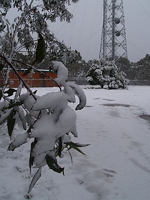
Mount Trickett under snow, 14 June 2007Elevation 1,362 m (4,469 ft) AHD Location Location New South Wales, Australia Range Great Dividing Range, NSW Coordinates 33°50′36.19″S 149°58′15.98″E / 33.8433861°S 149.9711056°ECoordinates: 33°50′36.19″S 149°58′15.98″E / 33.8433861°S 149.9711056°E Climbing Easiest route drive Mount Trickett is a mountain located on the Great Dividing Range six kilometres west of Jenolan Caves and can be seen from the nearby Jenolan-Oberon Road. The summit is topped by a high tower, and stands over 500 metres above Jenolan Caves in the valley below. Snowfalls are relatively common on Mount Trickett from autumn through to spring with perhaps ten to fifteen falls per season. Five or six of these snowfalls are typically heavy enough to close the roads near the summit. Icy roads during the colder months can also make travel in the area hazardous although it is usually navigable by 2WD vehicles. Particularly strong cold outbreaks make an approach from the Jenolan Caves side quite risky and the Oberon road is preferred. There is a non-descript gravel turnoff that leads you to a brick building at the summit with a sign that says "Navigational Facility".
As with nearby Mount Bindo and Shooters Hill, this is a common spot for 'snow chasers' to look for snow when coming in from Sydney and the Blue Mountains.
External links
- Relief maps of the area - Provided by NSW Central Ranges Weather - see link below.
- NSW Central Ranges Weather - Local site with weather information and maps etc for the Oberon Plateau area.
- Blackheath Weather - Another site with snow and general weather information for the area.
Blue Mountains topics Towns, suburbs
& localitiesBell • Berambing • Bilpin • Blaxland • Blackheath • Bullaburra • Faulconbridge • Glenbrook • Hartley Vale • Hazelbrook • Katoomba • Kings Tableland • Lapstone • Lawson • Leura • Linden • Little Hartley • Medlow Bath • Megalong • Mount Irvine • Mount Riverview • Mount Tomah • Mount Victoria • Mount Wilson • North Katoomba • Shipley • Springwood • Sun Valley • Valley Heights • Warrimoo • Wentworth Falls • Winmalee • Woodford • Yellow Rock • Yosemite
Mountain peaks Mount Banks · Mount Bindo · Mount Boyce · Mount Hay · Mount Irvine · Mount Piddington · Mount Solitary · Mount Trickett · Mount Wilson · Mount York · Narrow Neck PlateauTourist attractions Valleys Waterfalls Wentworth FallsHistory National Parks Miscellaneous Categories:- Mountains of New South Wales
- Mountain peaks of the Blue Mountains
- New South Wales geography stubs
Wikimedia Foundation. 2010.