- Hartley Vale, New South Wales
Infobox Australian Place | type = town
name = Hartley Vale
state = nsw
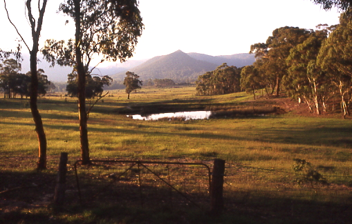
caption = Countryside at Hartley Vale
lga = City of Lithgow
postcode = 2790
coordinates = coord|33|32|S|150|14|E|type:city_region:AU|display=inline,title
pop =est =
elevation= 820maxtemp = 18.3
mintemp = 6.3
rainfall = 860.1
county =
parish = Lett
fedgov =Macquarie (formerly Calare)
stategov=Bathurst
dist1 =
location1=Sydney
near-nw =Lithgow
near-n =River Lett
near-ne =
near-w =Hartley
near-e =
near-sw =Mount York
near-s =
near-se =Mount Victoria Hartley Vale is a small village in the
Blue Mountains area of New South Wales, Australia. It is approximately 150 kilometres west of Sydney and 12 kilometres south-east ofLithgow . It is in the Local Government Area of theCity of Lithgow .Description
Hartley Vale is centred on Hartley Vale Road, which stretches from the Governors Causeway to the
Great Western Highway . The area is largely open countryside with many substantial private properties, bounded by the River Lett to the north andMount York to the south. The village is approximately five kilometres west of the Main Western Railway -- which runs from Sydney to Lithgow and beyond -- and ten kilometres from the nearest railway station atBell .History
The valley is an historic area where the early roads over the Blue Mountains came down into the plains found to the west of the mountains. The first road through the mountains was built by
William Cox from 1814-1815. Parts of his original road can still be seen atMount York , immediately south of Hartley Vale, and have been incorporated into a walking track.A kilometre east of Cox's road is Lockyers Road, which was started in 1828 by Major Lockyer as an alternative crossing to Cox's road, but was never finished. It goes down into the valley and finishes slightly west of the Hartley Vale village. Another kilometre east is Lawsons Long Alley, which was started as an alternative road by
William Lawson , with the aim of avoiding the steep grades of Cox's road at Mount York. While building the road, Lawson discovered what he thought was coal, but which was in fact shale. Mining began in the 1860s and a rail line was constructed into the valley of Kerosene Creek. [ [http://www.infobluemountains.net.au/rail/upper/hartley.htm Blue Mountains Website:Retrieved 1st October 2008] ] Hartley Vale Station was created on the Main Western Line, but later was abandoned, as was shale mining.Lawsons Long Alley goes through the valley of Kerosene Creek and joins Waltons Road, which goes to Hartley Vale Road on the east side of the village. Lawsons Long Alley and Lockyers Road, along with Cox's road, were developed as walking tracks by the Department of Lands, New South Wales. They all lead to the Hartley Vale area, culminating at a picnic area just west of the village. [Sydney and Blue Mountains Bushwalks, Neil Paton (Kangaroo Press) 2004, pp.336-338]
Other notable landmarks in the area are the Comet Inn, which dates back to 1879 and is located in the center of the village, and Collits Inn, which dates back to 1823 and is approximately one and a half kilometres west of the village. [How to See the Blue Mountains, Jim Smith (Second Back Row Press) 1986, p.84] The Hartley Vale Cemetery is just a small distance south-west of Collits Inn.
The Hartley Vale area also includes a range of other tourist facilities. [ [http://www.lithgow.com Official Lithgow Website:Retrieved 30th September 2008] ]
ee Also
*
List of Blue Mountains articles References
Wikimedia Foundation. 2010.