- Mount Victoria, New South Wales
-
Mount Victoria
New South Wales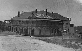
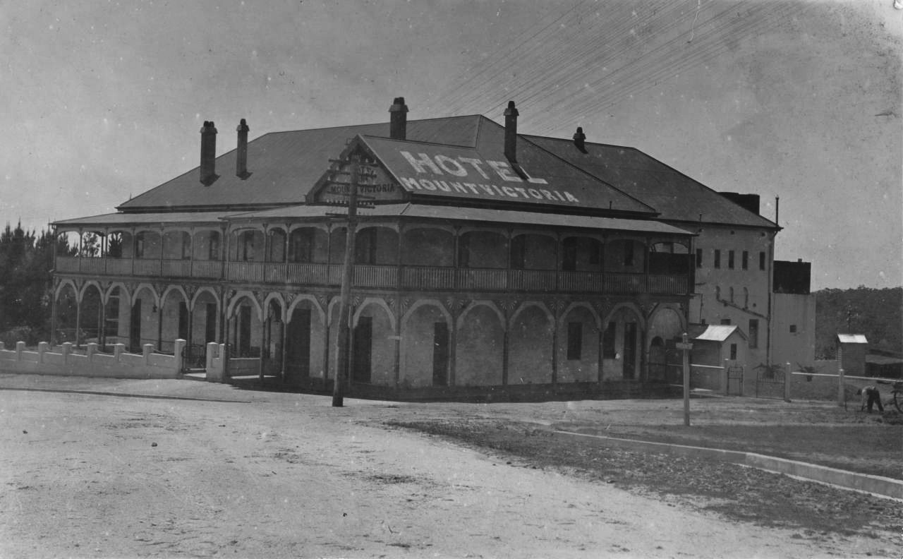
Mount Victoria Hotel in the 1920s
 Mount Victoria
Population: 828 (2006)[1] Postcode: 2786 Coordinates: 33°35′S 150°15′E / 33.583°S 150.25°ECoordinates: 33°35′S 150°15′E / 33.583°S 150.25°E Elevation: 1,059 m (3,474 ft) [2] Location: LGA: City of Blue Mountains[3] County: Cook[3] Parish: Hartley[3] State District: Blue Mountains[4] Federal Division: Macquarie[5] Mean max temp Mean min temp Annual rainfall 16.3 °C
61 °F7.2 °C
45 °F1,061.5 mm
41.8 inLocalities around Mount Victoria: Hartley Vale Bell Little Hartley Mount Victoria Blackheath Mount Victoria is a small township in the Blue Mountains of New South Wales, Australia. It is the westernmost village in the City of Blue Mountains, located approximately 120 kilometres via road from Sydney and 1043 metres above sea-level.[6] The settlement has a population of 828 people as of the 2006 Census.[1]
Contents
History
Mount Victoria is located on an escarpment plateau extension of Mount York, the site of a camp on the original Blaxland, Wentworth and Lawson 1813 crossing of the Blue Mountains. The area was originally marked as One Tree Hill on an early map dating from 1834 by the Surveyor General, Sir Thomas Mitchell.[6]
After the road across the Blue Mountains was constructed a toll bar was opened approximately 1 kilometre (0.62 mi) east from the present township in 1849 and the area was also known as Broughton's Waterhole Toll Bar.[7] Coaches were charged at the toll according to how well sprung they were, ones without springs were not charged as it was believed they would help crush the road surface.[6]
After the railway station, marking the termination of the Main Western railway line, was opened in 1869 the town also became known as Mount Victoria.[7][8] The town's name was officially changed after the first Post Office was built in 1876.[6]
By the late 19th century, the town had become a prosperous settlement and many private schools were founded in the area, which become somewhat of a hill station retreat for wealthy Sydney families.[6]
Present day
Today, Mount Victoria is a small township with a large number of historic buildings and a few attractions including the Post Office, a Hall which is used as a cinema, the Imperial Hotel, the Toll Keepers Cottage and a museum at the railway station.[6]
The town is the starting point for many bushwalks and features several lookouts over the Kanimbla Valley including the lookout from Mount Piddington.[6]
The station along with Lithgow is the terminus for the Blue Mountains line as part of the CityRail network. The town is located at the junction of the Great Western Highway and the Darling Causeway to Bell. The Roads and Traffic Authority is at present researching a major upgrade to the Great Western Highway with the view to bypass the township and the steep Victoria Pass down to Little Hartley to the west.[9]
References
- ^ a b Australian Bureau of Statistics (25 October 2007). "Mount Victoria (L) (Urban Centre/Locality)". 2006 Census QuickStats. http://www.censusdata.abs.gov.au/ABSNavigation/prenav/LocationSearch?collection=Census&period=2006&areacode=UCL155800&producttype=QuickStats&breadcrumb=PL&action=401. Retrieved 2009-04-15.
- ^ http://www.altitude.nu/ Elevation at any place.
- ^ a b c "Geographical Names Register Extract". Geographical Names Board of NSW. http://www.gnb.nsw.gov.au/name_search/extract?id=anwGZxtLSX. Retrieved 2009-04-15.
- ^ "Blue Mountains". NSW Electoral Commission. http://www.elections.nsw.gov.au/state_government_elections/electoral_districts/all_districts_/blue_mountains. Retrieved 2009-04-15.
- ^ "Macquarie". Australian Electoral Commission. http://www.aec.gov.au/profiles/m/macquarie.htm. Retrieved 2009-04-15.
- ^ a b c d e f g "Mount Victoria - New South Wales". Travel. The Age. 2004-02-08. http://www.theage.com.au/news/New-South-Wales/Mount-Victoria/2005/02/17/1108500197701.html. Retrieved 2009-04-16.
- ^ a b "Mount Victoria, New South Wales". About Australia. http://www.about-australia.com/new-south-wales/blue-mountains/destinations/mount-victoria/. Retrieved 2009-04-16.
- ^ "Mount Victoria Station". NSWRail.net. http://www.nswrail.net/locations/show.php?name=NSW:Mount+Victoria&line=NSW:main_west:0. Retrieved 2009-04-16.
- ^ "Mount Victoria to Lithgow - upgrade of the Great Western Highway". Roads and Traffic Authority. http://www.rta.nsw.gov.au/constructionmaintenance/majorconstructionprojectsregional/greatwesternhighway/mt_victoria_lithgow/index.html. Retrieved 2009-04-15.
- "Summary statistics MOUNT VICTORIA (SELSDON STR)". Climate statistics for Australian locations. Bureau of Meteorology. http://www.bom.gov.au/climate/averages/tables/cw_063056.shtml. Retrieved 2009-04-15.
External links
Towns, suburbs and localities of the City of Blue Mountains | Blue Mountains | New South Wales Towns, suburbs
& localitiesBell • Blaxland • Blackheath • Bullaburra • Faulconbridge • Glenbrook • Hazelbrook • Katoomba • Kings Tableland • Lapstone • Lawson • Leura • Linden • Medlow Bath • Megalong • Mount Irvine • Mount Riverview • Mount Tomah • Mount Victoria • Mount Wilson • North Katoomba • Shipley • Springwood • Sun Valley • Valley Heights • Warrimoo • Wentworth Falls • Winmalee • Woodford • Yellow Rock • Yosemite
Other places &
points of interestCategories:- Towns in New South Wales
- Suburbs of the City of Blue Mountains

Wikimedia Foundation. 2010.