- Mount York
-
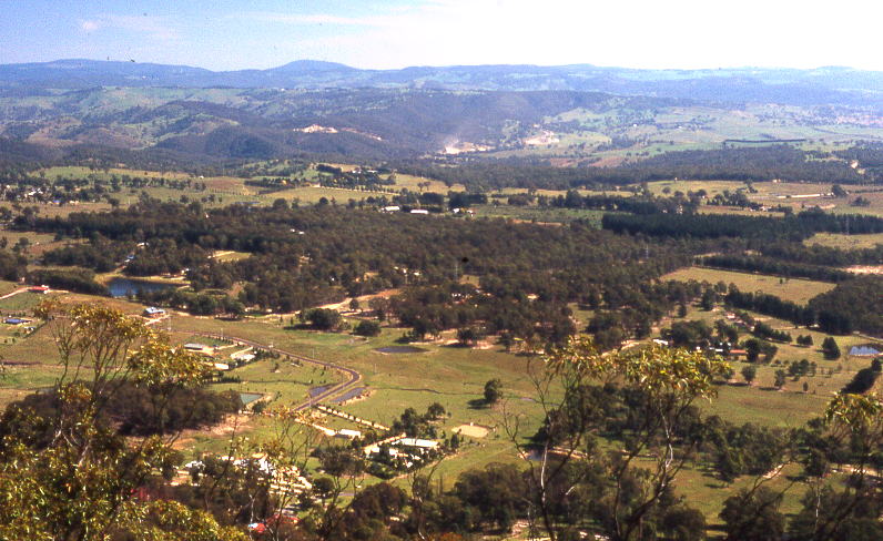
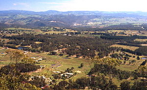 View from Mount York
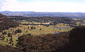
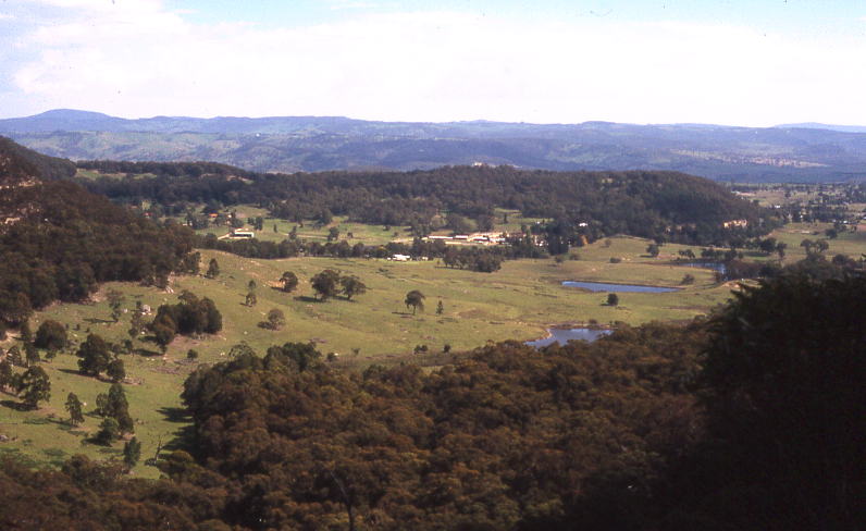
Mount York is a 1061 metre high mountain in the western Blue Mountains of New South Wales, Australia, located approximately 150 kilometres west of Sydney.[1] It is in fact a projection of the Blue Mountains plateau, creating a promontory of the western escarpment with a minor rise at its summit.
Description
Mount York is mainly forested in Eucalypt growth, mostly open canopied. Several small creeks that flow into the Coxs River system run down its side. A twin promontory to its immediate east branching from the southern origin of Mount York promontory is also an extension of the western escarpment. Lockley Promontory and Mount York Promontory both jut northwest from the western escarpment, and begin at Mount Victoria, a small mountain village. Several bushwalking tracks are to be found here, including Berghofers Pass, Lockyers Road and Coxs Road.[2] The tracks branch off from Mount York and descend into the valley below, or in the case of Berghofers, in the direction of Little Hartley, west of Mount Victoria.[3] Atop the summit plateau near the lookouts are two wells used in early days, and remains of early settlement like walls are still visible on the tracks. Birdwatching is good here and many native species like the Yellow Cheeked Black Cockatoo and King Parrot reside here. Many termite mounds can be seen along the road. The mountain is about two to three hundred metres above the Hartley Valley.
History
Mount York was the point where Gregory Blaxland, William Lawson and William Wentworth viewed the Hartley Valley and the 'west' for the first time, although some Europeans had already reached the valley before them. However, their famous 'first crossing' and opening of the west to farming in 1813 is commemorated with several memorials atop the summit, one with their faces set in stone. There are two metal fenced lookouts here, a westward facing and northward facing one.
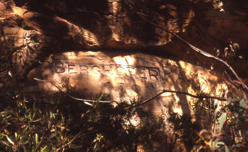
Mount York was the site of various attempts to build a pass to the plains west of the Blue Mountains. The first was Cox's Road, constructed in 1813. The next was Lockyers Road, which was begun not long after Cox's Road, but which was never finished. Still another was Lawsons Long Alley, which was a little east of Lockyers Road. These roads were all abandoned eventually, but in recent years they have been developed into walking tracks by the Department of Lands in New South Wales. Also still visible is Berghofers Pass, which was abandoned because of later developments, and which has also been turned into a walking track.[4]
-
The view at the end of Berghofers Pass
-

Historic inscriptions along Berghofers Pass
References
- ^ Gregory's New South Wales State Road Map, Map 220, 11th Edition, published by Gregory's Publishing Company
- ^ Sydney and Blue Mountains Bushwalks, Neil Paton, Kangaroo Press, 2004, pp.337-338
- ^ Hartley Topographic Map, 8930-4N, Land and Property Information, New South Wales
- ^ Sydney and Blue Mountains Bushwalks, Neil Paton, Kangaroo Press, 2004, p.338
Blue Mountains topics Towns, suburbs
& localitiesBell • Berambing • Bilpin • Blaxland • Blackheath • Bullaburra • Faulconbridge • Glenbrook • Hartley Vale • Hazelbrook • Katoomba • Kings Tableland • Lapstone • Lawson • Leura • Linden • Little Hartley • Medlow Bath • Megalong • Mount Irvine • Mount Riverview • Mount Tomah • Mount Victoria • Mount Wilson • North Katoomba • Shipley • Springwood • Sun Valley • Valley Heights • Warrimoo • Wentworth Falls • Winmalee • Woodford • Yellow Rock • Yosemite
Mountain peaks Mount Banks · Mount Bindo · Mount Boyce · Mount Hay · Mount Irvine · Mount Piddington · Mount Solitary · Mount Trickett · Mount Wilson · Mount York · Narrow Neck PlateauTourist attractions Valleys Waterfalls Wentworth FallsHistory National Parks Miscellaneous Coordinates: 33°33′11″S 150°13′12″E / 33.553°S 150.220°E
Categories:- Mountains of New South Wales
- Mountain peaks of the Blue Mountains
- New South Wales geography stubs
-
Wikimedia Foundation. 2010.