- Monroe–Bastrop combined statistical area
-
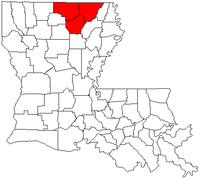 Map of Louisiana highlighting the Monroe-Bastrop combined statistical area.
The Monroe-Bastrop Combined Statistical Area is made up of three parishes in northern Louisiana. The statistical area consists of the Monroe Metropolitan Statistical Area and the Bastrop Micropolitan Statistical Area. As of the 2000 census, the CSA had a population of 201,074 (though a July 1, 2009 estimate placed the population at 202,309).[1]
Contents
Parishes
Communities
Places with more than 50,000 people
- Monroe (Principal city)
Places with 10,000 to 25,000 people
- Bastrop (Principal city)
- West Monroe
Places with 5,000 to 10,000 people
Places with fewer than 5,000 people
- Bernice
- Bonita
- Collinston
- Downsville
- Farmerville
- Lillie
- Marion
- Mer Rouge
- Oak Ridge
- Richwood
- Spearsville
- Sterlington
- Swartz
Demographics
As of the census[2] of 2000, there were 201,074 people, 75,455 households, and 53,051 families residing within the CSA. The racial makeup of the CSA was 63.74% White, 34.49% African American, 0.21% Native American, 0.53% Asian, 0.02% Pacific Islander, 0.40% from other races, and 0.61% from two or more races. Hispanic or Latino of any race were 1.21% of the population.
The median income for a household in the CSA was $28,744, and the median income for a family was $35,866. Males had a median income of $31,165 versus $20,894 for females. The per capita income for the CSA was $15,033.
See also
- Louisiana census statistical areas
- List of cities, towns, and villages in Louisiana
- List of census-designated places in Louisiana
References
- ^ "Table 2. Annual Estimates of the Population of Combined Statistical Areas: April 1, 2000 to July 1, 2009 (CBSA-EST2009-02)" (CSV). 2009 Population Estimates. United States Census Bureau, Population Division. 2010-03-23. http://www.census.gov/popest/metro/tables/2009/CBSA-EST2009-02.csv. Retrieved 2010-03-25.
- ^ "American FactFinder". United States Census Bureau. http://factfinder.census.gov. Retrieved 2008-01-31.
Categories:- Geography of Ouachita Parish, Louisiana
- Geography of Morehouse Parish, Louisiana
- Geography of Union Parish, Louisiana

Wikimedia Foundation. 2010.