- Walden–Wallkill Rail Trail
-
Coordinates: 41°34′28″N 74°10′52″W / 41.57434°N 74.1811°W
Walden–Wallkill Rail Trail 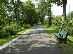
A section of the rail trail in the town of Shawangunk. Length 3.22 miles (5.18 km) Location Trailheads Use Walking, jogging, bicycling and dog walking Sights - Shawangunk Ridge
- Wooster Grove Park
- Borden Estate
Hazards Paved section may be unsuitable for horseback riders The Walden–Wallkill Rail Trail, also known as the Jesse McHugh Rail Trail, is a 3.22-mile (5.18 km) rail trail between the village of Walden in the town of Montgomery and the hamlet of Wallkill in the town of Shawangunk. Montgomery and Shawangunk are located in Orange and Ulster counties, respectively, in upstate New York.
The trail, like the Wallkill Valley Rail Trail to the north, is part of the former Wallkill Valley Railroad's rail corridor. The land was purchased by the towns of Montgomery and Shawangunk in 1985 and converted to a public trail. The portion of the trail in Shawangunk was formally opened in 1993 and named after former town supervisor Jesse McHugh. Plans to pave the trail between Walden and Wallkill were discussed since 2001, and the route was finally paved between 2008 and 2009. The trail includes an unofficial, unimproved section to the north of Wallkill, and is bounded by NY 52 and NY 208.
Contents
History
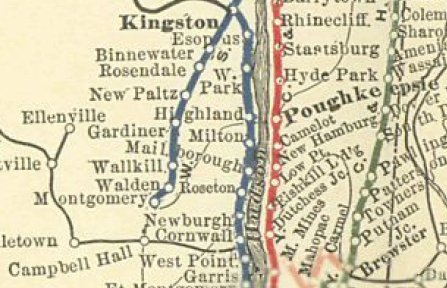
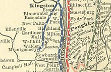 The original Wallkill Valley rail line, stretching from Montgomery to Kingston
Stretching 33 miles (53 km)[1] from Montgomery to Kingston,[2] the Wallkill Valley Railroad operated from 1866[3] until its last regular freight run on December 31, 1977.[4] In the 1980s, Conrail, then the owner of the Wallkill Valley line, attempted to sell the former rail corridor. The towns of Montgomery and Shawangunk – in Orange and Ulster counties, respectively[5] – purchased their sections of the rail line to allow "development of a commercial corridor [as well as] utility easements and access" to a local reservoir.[6]
The Montgomery section consisted of 2 miles (3.2 km) from the village of Walden to the town line with Shawangunk, and the Shawangunk section ran 2.3 miles (3.7 km) north from the town line to Birch Road. The purchases were completed in August and October 1985, respectively.[7] In November of that year, the New York State Department of Correctional Services bought 1.4 miles (2.3 km) of the former corridor in Shawangunk's hamlet of Wallkill, near the Wallkill Correctional Facility. This portion extends from Birch Road to the town line with Gardiner.[8] The Shawangunk Correctional Facility was built at that location.[9] South of Walden, the corridor remains an active rail line operated by the Norfolk Southern Railway.[6][10]
North of the prisons, the former corridor continues as the separate Wallkill Valley Rail Trail.[5] Rail trail enthusiasts have been trying to find a way to combine the two rail trails since the 1990s,[11] and in 2004 the town of Shawangunk commissioned an open space study that identified possible ways to accomplish such a connection.[12] A 2008 Ulster County transportation plan included projects to connect the trails,[13] and the town of Shawangunk is currently considering plans to connect the trails by diverting the corridor along Birch Road. The original route of the corridor is 40 feet (12 m) within the prisons' perimeter fence.[14]

The portion of the former corridor running through the center of Wallkill was converted to a road, Railroad Avenue.[6][11] The southern part of the route, running from Wallkill to the Montgomery–Shawangunk town line, was officially opened[11] as the Jesse McHugh Rail Trail on June 5, 1993.[15] Jesse McHugh was a former Shawangunk town supervisor.[6] The northern portion of the Shawangunk section, which stretches to the border of the prison grounds, is maintained by the town but not officially part of the trail.[11]
In 2001, Shawangunk, Montgomery and the Walden began applying for over $600,000[16] in TEA-21 grants to create a paved, ADA-accessible trail between Walden and Wallkill.[6] The total cost of paving the trail was expected to be $750,000,[16] though it eventually ballooned to $1.5 million.[17] The decision to pave the trail was vehemently opposed by horseback riders who felt it would endanger them,[18] and protested at several public meetings by the Mid-Hudson Horse Trails Association.[19] The decision was also opposed by nearby homeowners who believed an increase in trail use would threaten their privacy.[20]
In October 2003, Walden, Shawangunk and Montgomery acquired the $600,000 grant needed to begin paving the trail.[21] Two months later, Bob and Doris Kimball, a couple in Montgomery, donated 20 acres (8.1 ha) of their land to create a park by the trail near Lake Osiris Road.[22] The park is expected to be developed once funds are available to do so.[6] Nearly $200,000 in funding to complete pavement of the trail was lost when the outgoing 109th Congress did not approve a 2006 budget bill.[23] In February 2008, Congressman Maurice Hinchey announced the appropriation of $351,000 to complete the project.[24] Construction began on September 22, 2008,[25] and the paved 3.22-mile (5.18 km)[26] trail opened on May 2, 2009.[6]
Route
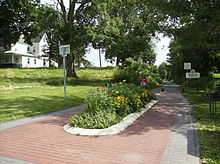
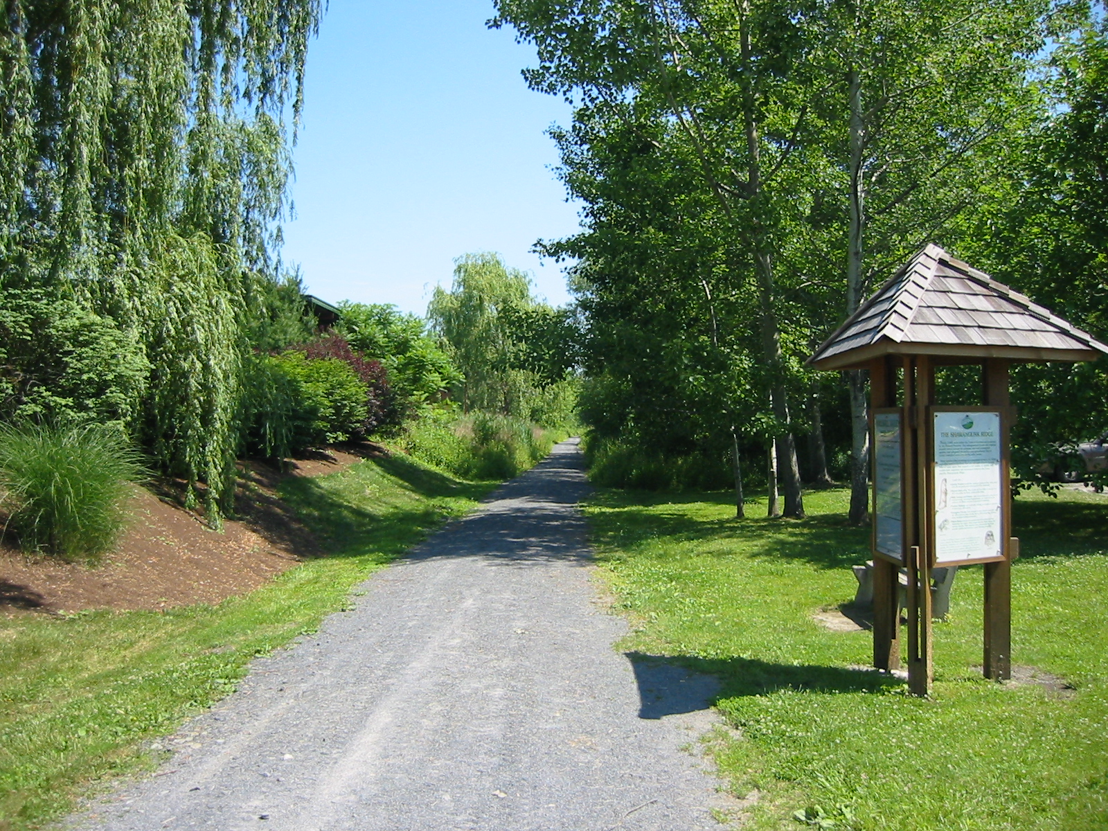
 The trailhead in the village of Walden
The trail begins at the 9.4-acre (3.8 ha) Wooster Grove Park in the village of Walden, near NY 52.[15][26][27] There is a visitor center for rail trail users at the park. The park also contains Walden's former train station, which has since been renovated as a recreational facility.[26]
The trail continues 1 mile (1.6 km) north from the trailhead before reaching Lake Osiris Road, continuing another 11⁄4 miles (2.0 km) to the Montgomery–Shawangunk town line.[15] Once in Shawangunk, the trail passes by the Borden Estate,[28] a mansion built in 1906 by the granddaughter of Gail Borden. In 1854, Gail Borden patented the process for creating condensed milk; the Borden family subsequently owned a series of milk companies. The mansion is now used by the School of Practical Philosophy for philosophy classes.[29]
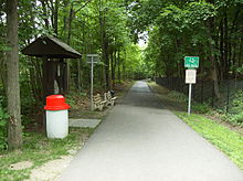
 The trailhead in the hamlet of Wallkill
About 3⁄4 miles (1.2 km) from the town line, the trail reaches its Wallkill trailhead bordering NY 208, directly across the street from the Shawangunk police station.[15] The paved section between Walden and Wallkill is flat, with only a 3% grade.[6] A portion of the former corridor in central Wallkill has since been converted to a road.[11]
An unimproved northern section in Wallkill extends 11⁄2 miles (2.4 km) from the intersection of Railroad Avenue and C. E. Penny Drive to Birch Road.[5] Birch Road marks the border between the former corridor and two state prisons.[11] This section passes through private hunting grounds[15] and is "unmarked and has no signs" but is "arguably ... the most scenic" portion of the former Wallkill Valley rail corridor, featuring "splendid" views of the Shawangunk Ridge to the west.[5]
While the total length of the trail is officially only about 3 miles (4.8 km),[26] the inclusion of the northern section increases its length to about 41⁄2 miles (7.2 km).[30] The trail is used for walking, jogging, bicycling and dog walking.[5]
See also
- Wallkill Valley Rail Trail – the northern continuation of the former rail corridor
References
- ^ Mabee 1995, p. 40.
- ^ Mabee 1995, pp. 50–51.
- ^ Mabee 1995, p. 10.
- ^ Mabee 1995, p. 135.
- ^ a b c d e Perls 2003, p. 343.
- ^ a b c d e f g h "Rail Trail". Town of Montgomery. http://www.townofmontgomery.com/rail-trail.html. Retrieved 2010-12-26.
- ^ Mabee 1995, p. 142
- ^ Mabee 1995, pp. 140, 142
- ^ Bosch, Adam (2009-06-01). "Wallkill Rail Trail could double in size". Times Herald-Record (Middletown, NY: Dow Jones Local Media Group). http://www.recordonline.com/apps/pbcs.dll/article?AID=/20090601/COMM/906010315/-1/NEWS. Retrieved 2010-11-01.
- ^ "Railroads in New York State – 2010" (PDF). New York State Department of Transportation. 2010-02-05. https://www.nysdot.gov/divisions/operating/opdm/passenger-rail/passenger-rail-repository/2010%20NYS%20Rail%20Map.pdf. Retrieved 2010-12-28.
- ^ a b c d e f Mabee 1995, p. 144.
- ^ Sisson, Angela; Hitchings, Crystal; Clague, Joshua (March 2004). "Town of Shawangunk Open Space Inventory and Analysis" (PDF). Conway, MA: Conway School of Landscape Design. pp. 68–69. http://www.shawangunk.org/pdf/enviro/Shawangunk-Open-Space-Analysis.pdf. Retrieved 2010-11-01.
- ^ "Ulster County Non-Motorized Transportation Plan" (PDF). Kingston, NY: Ulster County Transportation Council. December 2008. p. 25. http://www.co.ulster.ny.us/planning/uctc/documents/nmtp/final_plan.pdf. Retrieved 2010-11-07.
- ^ Rowley, Chris (2010-08-12). "A New Use for Prison Farmlands: Can Prison Lands Serve to Connect the Rail Trail System?". Shawangunk Journal (Ellenville, NY: Electric Valley Media LLC). http://www.ellenvillejournal.com/2010/08/12/news/1008124.html. Retrieved 2011-02-21.
- ^ a b c d e Perls 2003, p. 344.
- ^ a b Snel, Alan (2001-11-23). "Towns paving the way for rail trail". Times Herald-Record (Middletown, NY: Dow Jones Local Media Group). http://www.recordonline.com/apps/pbcs.dll/article?AID=/20011123/NEWS/311239991. Retrieved 2011-01-26.
- ^ Murphy, Meghan E. (2008-02-13). "Funds in hand for completion of Walden Rail Trail". Times Herald-Record (Middletown, NY: Dow Jones Local Media Group). http://www.recordonline.com/apps/pbcs.dll/article?AID=/20080213/COMM/802130334/-1/NEWS. Retrieved 2010-12-26.
- ^ Snel, Alan (2001-11-30). "Group would derail plan to pave trail". Times Herald-Record (Middletown, NY: Dow Jones Local Media Group). http://www.recordonline.com/apps/pbcs.dll/article?AID=/20011130/NEWS/311309991. Retrieved 2011-01-26.
- ^ Snel, Alan (2001-12-25). "Horse-backers oppose paving rail trail". Times Herald-Record (Middletown, NY: Dow Jones Local Media Group). http://www.recordonline.com/apps/pbcs.dll/article?AID=/20011225/NEWS/312259996. Retrieved 2011-01-26.
- ^ Sausa, Bianca (2003-01-25). "Walden rail trail opponents gathering steam". Times Herald-Record (Middletown, NY: Dow Jones Local Media Group). http://www.recordonline.com/apps/pbcs.dll/article?AID=/20030125/NEWS/301259993. Retrieved 2011-01-26.
- ^ Sausa, Bianca (2003-10-07). "Formalities stunt Walden trail work". Times Herald-Record (Middletown, NY: Dow Jones Local Media Group). http://www.recordonline.com/apps/pbcs.dll/article?AID=/20031007/NEWS/310079993. Retrieved 2011-01-26.
- ^ "Family donates property for park along Walden rail trail". Times Herald-Record (Middletown, NY: Dow Jones Local Media Group). 2003-12-24. http://www.recordonline.com/apps/pbcs.dll/article?AID=/20031224/NEWS/312249978. Retrieved 2010-12-26.
- ^ Brooks, Paul (2007-01-09). "Late budget bills cost region $3M-plus in project funding, Hinchey says". Times Herald-Record (Middletown, NY: Dow Jones Local Media Group). http://www.recordonline.com/apps/pbcs.dll/article?AID=/20070109/NEWS/701090313. Retrieved 2010-12-26.
- ^ "Hinchey Secures Final Approval Of $351,000 In Federal Funding For Paved Trail Between Walden & Wallkill" (Press release). 2008-02-11. http://hinchey.house.gov/index.php?option=com_content&task=view&id=1151&Itemid=70. Retrieved 2010-12-26.
- ^ "Shovels dig in on Walden Rail Trail". Times Herald-Record (Middletown, NY: Dow Jones Local Media Group). 2008-09-16. http://www.recordonline.com/apps/pbcs.dll/article?AID=/20080916/NEWS/80916022. Retrieved 2010-12-26.
- ^ a b c d "Park Description and Program Schedules" (PDF). Walden, NY: Village of Walden Recreation and Parks. http://www.villageofwalden.org/docs/Rec_Department.pdf. Retrieved 2010-12-26.
- ^ "Hit the bike trail". Hudson Valley Parent (The Professional Image Marketing & Public Relations). http://www.hvparent.com/articlepost.aspx?id=942. Retrieved 2011-01-07.
- ^ "Business and Resource Directory" (PDF). Town of Shawangunk. 2008-11-26. p. 35. http://www.shawangunk.org/pdf/business/business-directory.pdf. Retrieved 2010-12-26.
- ^ "A Brief History of the Wallkill Property". School of Practical Philosophy. http://www.philosophyworks.org/content/brief-history-wallkill-property. Retrieved 2010-12-26.
- ^ "Guide to area multi-use trails". Times Herald-Record (Middletown, NY: Dow Jones Local Media Group). 2009-03-06. http://www.recordonline.com/apps/pbcs.dll/article?AID=/20090306/SPORTS/90306023. Retrieved 2010-12-26.
Bibliography
- Mabee, Carleton (1995). Listen to the Whistle: An Anecdotal History of the Wallkill Valley Railroad. Fleishmanns, NY: Purple Mountain Press. ISBN 093579669X.
- Perls, Jeffrey (2003). Shawangunks Trail Companion: A Complete Guide to Hiking, Mountain Biking, Cross-Country Skiing, and More Only 90 Miles from New York City. Woodstock, VT: Countryman Press. ISBN 978-0-88150-563-4.
External links
- Videos
- 30 Seconds on the Walden-Wallkill Rail Trail on YouTube
- Another 30 Seconds on the Walden-Wallkill Rail Trail on YouTube
- Ascending the Switchbacks, South End of Walden-Wallkill Rail Trail on YouTube
- Descending the Switchbacks, South End of Walden-Wallkill Rail Trail on YouTube
Rail trails in New York by county Albany 
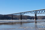

Allegany Cattaraugus Allegheny River Valley TrailCayuga Columbia Delaware Dutchess Franklin Rutland TrailLivingston Monroe New York Ontario Orange Oswego Putnam Rockland St. Lawrence Rutland TrailSchenectady Ulster Hudson Valley Rail Trail · Poughkeepsie Bridge · Walden–Wallkill Rail Trail · Wallkill Valley Rail Trail (Rosendale trestle)Westchester Categories:- Rail trails in New York
- Parks in Orange County, New York
- Parks in Ulster County, New York
- Wallkill Valley Railroad


Wikimedia Foundation. 2010.