- Desna Raion
-
Desnians’kyi Raion
Деснянський район
Coat of arms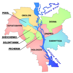
Country  Ukraine
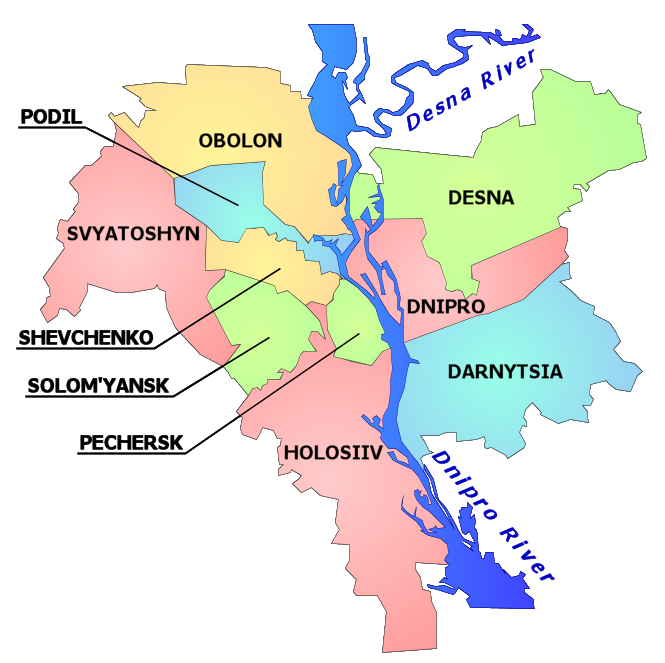
Oblast Kiev City Municipality Government - Head of District Administration Yuri Zaharychev (Leonid Chernovetskyi Block) Area - Total 148 km2 (57.1 sq mi) Population [a][1] - Total 349,538 - Density 2,315/km2 (5,995.8/sq mi) Time zone EET (UTC+2) - Summer (DST) EEST (UTC+3) Metro stations Chernihivska, Lisova Website http://www.kmv.gov.ua/divisions.asp?Id=320 Desnianskyi Raion (Ukrainian: Деснянський район, translit. Desnians’kyi raion) is an administrative raion (district or borough) of the city of Kiev, the capital of Ukraine. It is located in the north-eastern part of the city on the Left Bank[b] of the Dnieper River and is the most populous district of Kiev. It is also the second largest district with the total area of ca. 14.8 ha.
Desnianskyi Raion mainly consists of two microdistricts – Troieschyna and Lisovyi – making it predominantly residential in nature. In fact, there is only one clear-cut, (yet small) industrial zone called Kulykove on the border with Dniprovskyi Raion. This fact explains why the district has the lowest number of registered business entities among Kiev raions.[2] Much like commuter town, therefore, Desnianskyi Raion has very little commercial or industrial activity beyond a small amount of retail, oriented toward serving the locals. However, it differs from commuter towns in that it forms part of the city proper and is not regarded as suburb in a classical sense. Still, its currently weak transportation links with the major part of the city on the Right Bank make it appear as a "city inside a city", which is especially true for Troieschyna microdistrict.[3]
Contents
History
The first written reference of the lands which today form part of Desnianskyi Raion dates back to 1667.[4] Until 1927 the area of the raion belonged to the Oster uyezd of the Chernigov Governorate. Since then it became part of the city of Kiev. In 1932 the area was reorganized under the Petriv (Podil) Raion. It was not until 1987 when the area was reorganized into a separate raion partially out of the neighboring Dnipro Raion and was named as the Vatutine Raion.
Troeschyna
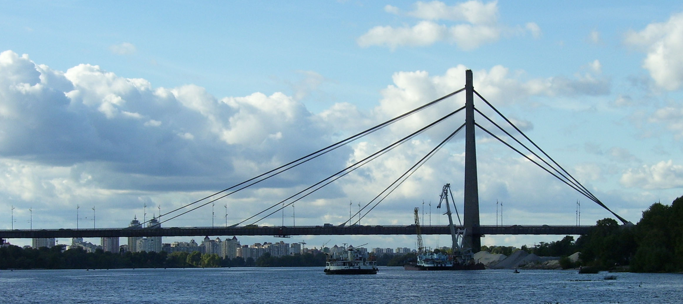
Residential development of what would become known as Troieschyna microdistrict started in 1966. However it was not until the completion of Moskovskyi Bridge in 1976 that the development became genuinely large-scale.[5]
Gallery
-
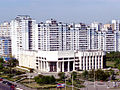
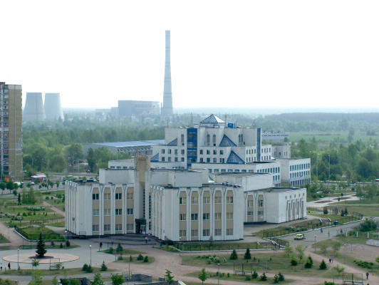
Local Government Building
-
Desnianskyi Park
-
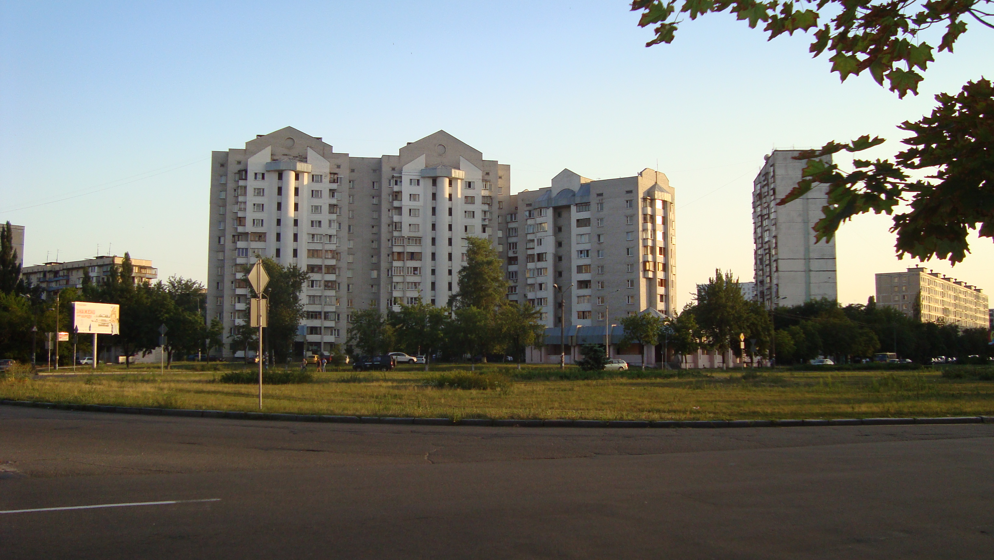
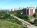
Mayakovsky Avenue – one of the main streets of Troyeshchyna microdistrict
-

Central Clinic
-

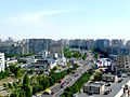
Volhogradska Square – the centre of Lisovyi microdistrict
-
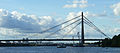
Moskovskyi Bridge – the key transportation link connecting Desnianskyi Raion with the rest of the city on west bank of the Dnieper river.
-

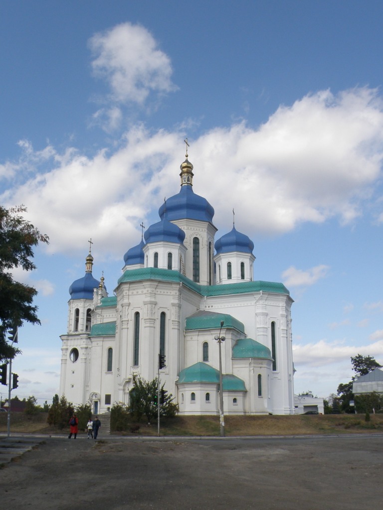
Cathedral of the Holy Trinity in Troyeshchyna microdistrict
Notes
a. ^ Resident population as of 1 January 2009.
b. ^ Informally, Kiev is subdivided into the Right Bank (Ukrainian: Правий Берег) and the Left bank (Ukrainian: Лівий Берег) on the west and east bank of the Dnieper river respectively.
References
- ^ Vilenchuk, S. R.; Yatsuk, T.B. (eds.) (2009). Kyiv Statistical Yearbook for 2008. Kiev: Vydavnytstvo Konsultant LLC. p. 212. ISBN 978-966-8459-28-3.
- ^ Vilenchuk, S. R.; Yatsuk, T.B. (eds.) (2009). Kyiv Statistical Yearbook for 2008. Kiev: Vydavnytstvo Konsultant LLC. p. 58. ISBN 978-966-8459-28-3.
- ^ Darmostyuk, Igor (16 July 2007). "Left Bank Republic" (in Russian). Delovaya Stolitsa (Kiev) 323 (29). http://www.dsnews.ua/infrastructure/art31797.html. Retrieved 11 December 2009.
- ^ Web-site of Kiev city government (Ukrainian)
- ^ "Moskovskyi Bridge Commissioned on December 3, 1976" (in Ukrainian). Ukrinform Photo. http://photo.ukrinform.ua/ukr/current/photo.php?id=302072. Retrieved 11 December 2009.
External links
- Kiev City Council Official Webportal (Ukrainian)
Subdivisions of Kiev, Ukraine Raions 

Neighborhoods Right-bank1Akademmistechko · Baikove · Batyieva Hora · Borschahivka · Chokolivka · Demiivka · Feofaniya · Holosiiv · Klov · Koncha-Zaspa · Korchuvate · Kurenivka · Lukianivka · Lypky · Lysa Hora · Minskyi Masyv · Nyvky · Obolon · Pankivschyna · Pechersk · Petrivka · Pyrohiv · Podil · Priorka · Puscha-Vodytsia · Shuliavka · Solomianka · Sovky · Sviatoshyn · Syrets · Tatarka · Telychka · Teremky · Vidradnyi · Vita · Vydubychi · Vynohradar · Yevbaz · Zabaikove · Zamkova Hora · Zhulyany · ZvirynetsLeft-bank1Berezniaky · Bortnychi · Bykivnia · Chervonyi Hutir · Darnytsia · Kharkivskyi Masyv · Lisova · Livoberezhna · Osokorky · Pozniaky · Rusanivka · Troieschyna · VoskresenkaIslands1 1 Unofficial designation. 
This article about a location in the city of Kiev is a stub. You can help Wikipedia by expanding it. -