- Obolon Raion
-
Obolon Raion
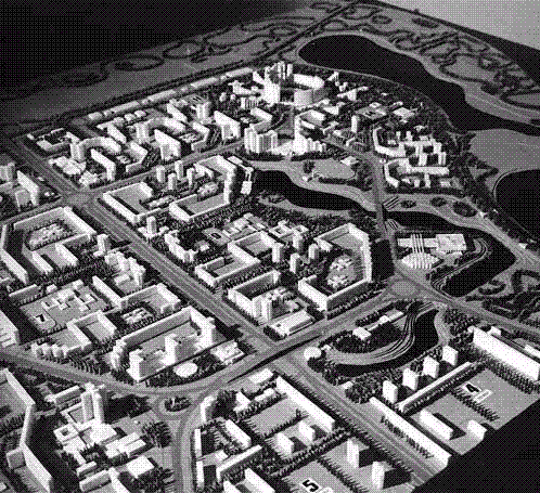
Оболонський район— Raion of Kiev — Project for the construction of Obolon, 1967.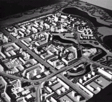

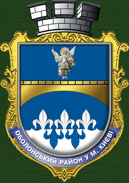
Coat of arms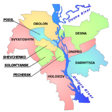
Country  Ukraine
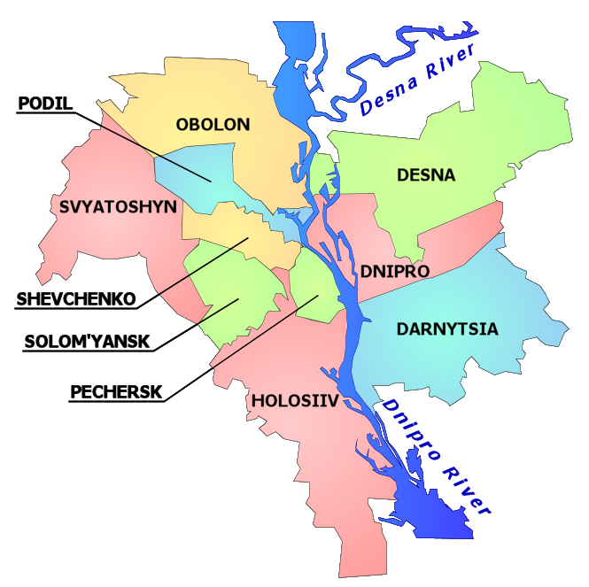
City Municipality  Kiev
KievMain neighborhoods List- Obolon itself
- Kurenivka
- Minskyi neighborhood
- Priorka
- Puscha-Vodytsia
Government – Council Head Vadym S. Yahodka Area – Total 110.2 km2 (42.5 sq mi) Population – Total 306,000 – Density 2,776/km2 (7,189.8/sq mi) Time zone EET (UTC+2) – Summer (DST) EEST (UTC+3) Landmarks Obolon CJSC Metro stations Petrivka, Obolon, Minska, Heroiv Dnipra Website http://obolonrda.gov.ua/ Obolon Raion (Ukrainian: Оболонський район, Obolons’kyi raion), is a municipal raion (administrative district) of the Ukrainian capital Kiev. Obolon Raion encompasses territories far beyond of its historical neighborhood with the same name. Its current population is 290,000 inhabitants. It was formed on March 3, 1975 and initially called as Minsk Raion. In 2001 it was decided to rename the raion to its historical name of the region.
Contents
Overview
During Soviet rule of Ukraine, Kiev had 14 administrative districts. In early 21st century, a new law was passed and the raions were reorganized into 10 raions with different borders and new names.
The Obolon district ecompasses the territories of the former Minsk district and is still sometimes referred to by that name. It also includes the former town of Pushcha-Vodytsia that used to be part of the Podil Raion. The name Obolon comes from the Old-Ukrainian word оболонь → болонь → болоньє (obolon' → bolon' → bolon'ye), which roughly translates as "flood plain" or an area that is being engulfed by water. The district was built up in the 1970s as a microdistrict in Kiev on the Obolon sands to satisfy the growth of the city. Due to the composition of the soil at the time, the majority of the buildings were at most nine-stories tall, and few trees were planted when compared to other parts of the city. That and few other reasons originally made the district not prestigious.
With the second construction period (2000–2005), the district has seen new, comfortable apartment buildings constructed closer to the Dnipro river and has become an attractive residential area. The new apartments are also more expensive, although still cheaper than in the center of Kiev. The district was connected by metro in the 1980s, with a station Obolon opened on November 5, 1980.
A yachting club for both kids and adults was opened in around 1990, and recently many of the Obolon lakes were cleaned up in order to make the area more attractive. The area closer to the Dnieper river is a popular relaxation place for Kievliany (residents of Kiev). The area is also well known for the beer factory Obolon.
Major neighborhoods
- Obolon, a residential massif and an industrial zone of the Kiev city. It is located between Dnieper river, Moscow Parkway, Verbova Street, and Dehtiarenko Street.
- Kurenivka, an area towards the downtown of Kiev. In 17th century it used to be a suburb of the Kiev city where the Kiev Cossack Kosh was garrisoned. Its name is derived from one of the cossack's military formations, kurin (company). In 18th century there was built the Petropavlivska Church that in the Soviet times was destroyed and rebuilt under one of the industrial buildings. Kurenivka is also became famous for a massive tragedy of the Kurenivka mudslide in 1961.
- Priorka, it is believed to be settled by monks of the Dominican Order on the road to Vyshhorod. Since 1834 the settlement was incorporated into the Kiev-city.
- Minsk massif, a residential area of Kiev. It is located between Shevchenko Square, Minsk Parkway, Konradyuk Street, Maiorov Street, Panch Street, Polyarna Street. The area also contains "sub-neighborhood" Kyn-Grust which carries an urban legend tied to Yekaterina II and Prince Potemkin who supposedly gave names to all the towns in Ukraine.
Gallery
-
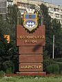
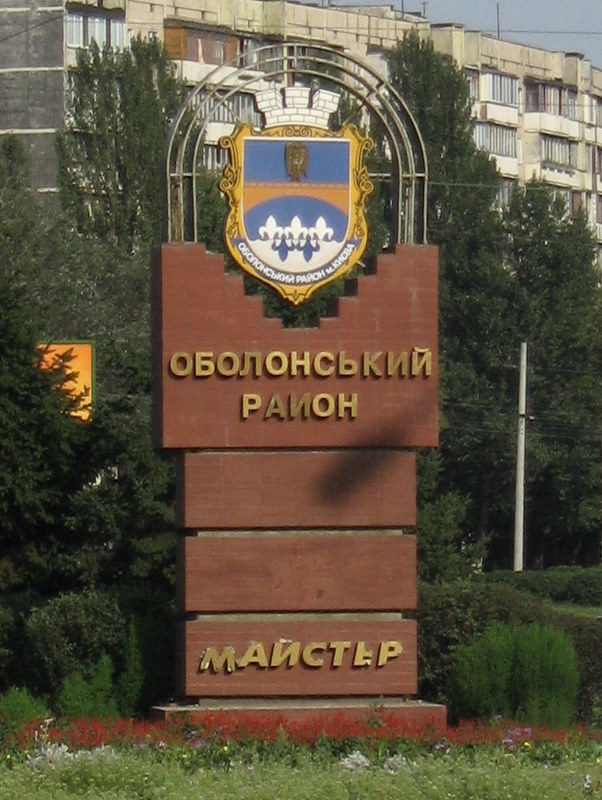
The sign when entering the zone
-
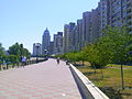
Obolon embankment
See also
External links
- Brief history of the Obolon and Minskyi districts
- (Ukrainian) obolonrda.gov.ua - Obolonskyi Raion administration website
- (Russian) Unofficial Kiev Metro site - Information about the Obolon metro station
- (Ukrainian) Оболонь in Wiki-Encyclopedia Kiev
Subdivisions of Kiev, Ukraine Raions 

Neighborhoods Right-bank1Akademmistechko · Baikove · Batyieva Hora · Borschahivka · Chokolivka · Demiivka · Feofaniya · Holosiiv · Klov · Koncha-Zaspa · Korchuvate · Kurenivka · Lukianivka · Lypky · Lysa Hora · Minskyi Masyv · Nyvky · Obolon · Pankivschyna · Pechersk · Petrivka · Pyrohiv · Podil · Priorka · Puscha-Vodytsia · Shuliavka · Solomianka · Sovky · Sviatoshyn · Syrets · Tatarka · Telychka · Teremky · Vidradnyi · Vita · Vydubychi · Vynohradar · Yevbaz · Zabaikove · Zamkova Hora · Zhulyany · ZvirynetsLeft-bank1Berezniaky · Bortnychi · Bykivnia · Chervonyi Hutir · Darnytsia · Kharkivskyi Masyv · Lisova · Livoberezhna · Osokorky · Pozniaky · Rusanivka · Troieschyna · VoskresenkaIslands1 1 Unofficial designation.Coordinates: 50°31′1.2″N 30°30′8.3″E / 50.517°N 30.502306°E

This article about a location in the city of Kiev is a stub. You can help Wikipedia by expanding it.