- Csongrád County (former)
-
Csongrád County County of the Kingdom of Hungary 12th century–1920 
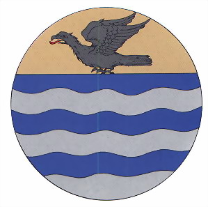
Coat of arms
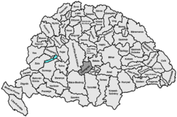
Capital Szentes History - Established 12th century - Treaty of Trianon June 4 1920 Area - 1910 3,569 km2 (1,378 sq mi) Population - 1910 325,500 Density 91.2 /km2 (236.2 /sq mi) Today part of Serbia, Hungary Csongrád (Hungarian: Csongrád, Serbian: Čongrad or Чонград) was a historic administrative county (comitatus) of the Kingdom of Hungary. Its territory, which was smaller than that of present Csongrád county, is presently in southern Hungary and northern Serbia. The capital of the county was Szentes.
Contents
Name
Name Csongrád/Čongrad is Slavic by origin. In Slavic languages, this name means "a black city" (čon/čorni = black, grad = city/town). Indeed, the county was named after a town of Csongrád.
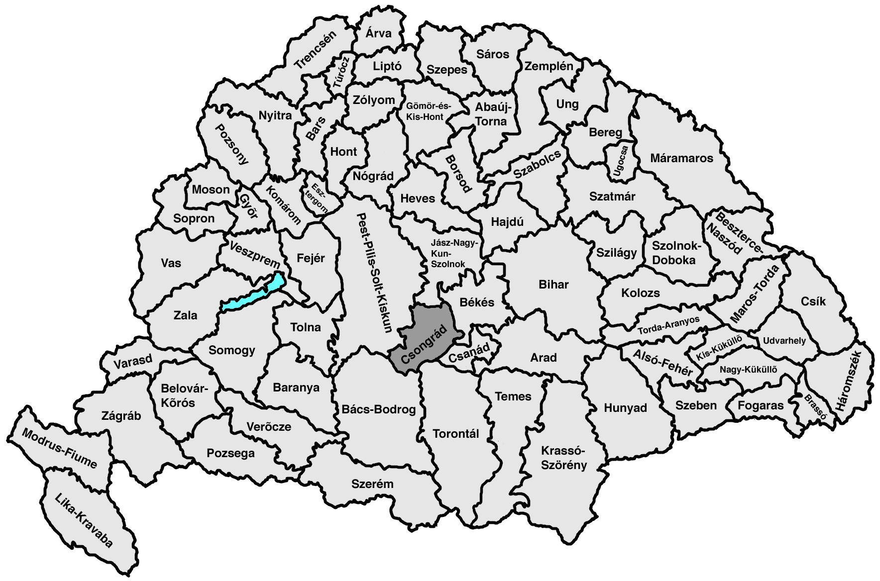
Geography
Csongrád county shared borders with the Hungarian counties Pest-Pilis-Solt-Kiskun, Jász-Nagykun-Szolnok, Békés, Csanád, Torontál and Bács-Bodrog. The river Tisza flowed through the county. Its area was 3,544 km² around 1910.
History
Csongrád county arose in the 11th century as one of the first comitatus of the Kingdom of Hungary. It was taken by the Ottoman Empire in the 16th century, and by the Habsburg Monarchy in the end of the 17th century.
In 1920, the Treaty of Trianon assigned a small part of the territory of the county (a small area around Horgoš in northern Vojvodina) to the Kingdom of Serbs, Croats and Slovenes (renamed to Yugoslavia in 1929). The rest remained in Hungary.
After World War II, the southern part of former Csanád-Arad-Torontál county (the Hungarian part of pre-1918 Torontál county and the south-western part of pre-1918 Csanád county) was added to Csongrád county.
Demographics
According to the census of 1910, the county had 325,568 inhabitants.
Population by language (1910 census):
- Hungarian = 319,274
- German = 2,862
- Serbian = 1,235
Subdivisions
In the early 20th century, the subdivisions of Csongrád county were:
Districts (járás) District Capital Csongrád Csongrád Tiszáninnen Kiskundorozsma Tiszántúl Mindszent Urban counties (törvényhatósági jogú város) Hódmezővásárhely Szeged Urban districts (rendezett tanácsú város) Szentes Counties of the Kingdom of Hungary (1886) Abaúj-Torna · Alsó-Fehér · Arad · Árva · Bács-Bodrog · Baranya · Bars · Békés · Bereg · Beszterce-Naszód · Bihar · Borsod · Brassó · Csanád · Csík · Csongrád · Esztergom · Fejér · Fogaras · Gömör-Kishont · Győr · Hajdú · Háromszék · Heves · Hont · Hunyad · Jász-Nagykun-Szolnok · Kis-Küküllő · Kolozs · Komárom · Krassó-Szörény · Liptó · Máramaros · Maros-Torda · Moson · Nagy-Küküllő · Nógrád · Nyitra · Pest-Pilis-Solt-Kiskun · Pozsony · Sáros · Somogy · Sopron · Szabolcs · Szatmár · Szeben · Szepes · Szilágy · Szolnok-Doboka · Temes · Tolna · Torda-Aranyos · Torontál · Trencsén · Turóc · Udvarhely · Ugocsa · Ung · Vas · Veszprém · Zala · Zemplén · Zólyom
Corpus separatum: Fiume
Autonomous Kingdom of Croatia-Slavonia: Bjelovar-Križevci · Lika-Krbava · Modruš-Rijeka · Požega · Srijem · Varaždin · Virovitica · Zagreb
 Categories:
- 1920 disestablishments
- Counties in the Kingdom of Hungary
- History of Serbia
- History of Vojvodina
- States and territories established in the 12th century

Wikimedia Foundation. 2010.