- Pozsony county
Infobox Former Subdivision
native_name = Comitatus
conventional_long_name = Pozsony County
common_name = Pozsony
subdivision = County
nation = theKingdom of Hungary
p1 =
s1 =
flag_s1 =
year_start = 9th century
event_end = Treaty of Trianon
year_end = 1920
date_end = June 4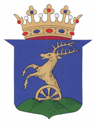
capital = Pozsony
stat_area1 = 4370
stat_pop1 = 389700
stat_year1 = 1910
today =Slovakia ,Hungary
footnotes =Bratislava is the current name of the capital.Pozsony county was a historic administrative
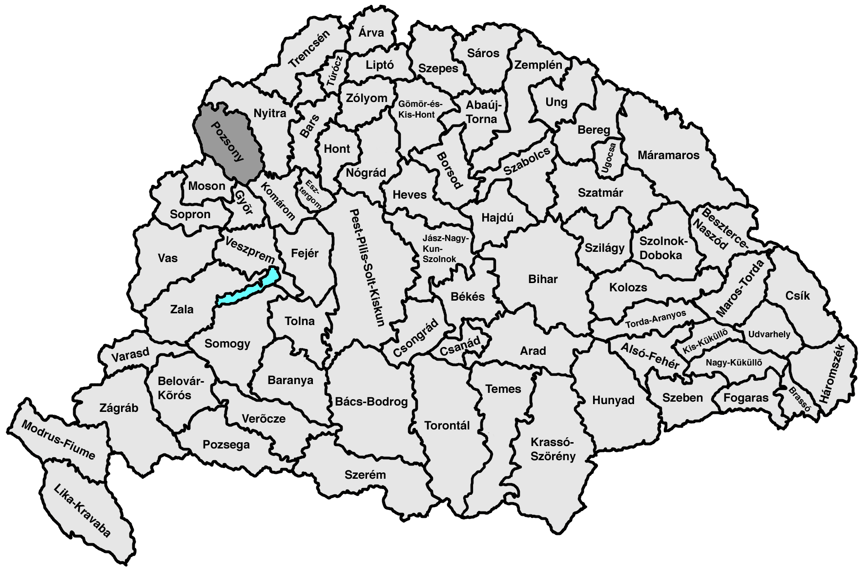
county (comitatus) of theKingdom of Hungary . Its territory lies in present-day westernSlovakia .Its name changed along with that of the city of
Pozsony , today'sBratislava . Its names around 1900 were "Pozsonyvármegye " in Hungarian, "Prešpurskážupa " in Slovak and "PreßburgerGespanschaft " in German.Geography
The county shared borders with the
Austria n land ofLower Austria and the Hungarian counties Nyitra (Nitra), Komárom (Komárno), Győr andMoson . It was situated between the river Morava in the west, the riverDanube in the south, and the riverVáh in the east. The southern part of theLittle Carpathians divided the county into two. It also covered most of the island known today asŽitný ostrov between the Danube and theLittle Danube . Its area was 4,370 km² around 1910.eats
The seats of Pozsony county were the
Bratislava Castle andŠamorín , and from the 18th century onwards the town of Pressburg (presentBratislava ).History
A sort of predecessor to Pozsony county existed as early as the 9th century during the time of
Great Moravia . After Pozsony county's territory had become part of theKingdom of Hungary , the Hungarian comitatus was created around 1000 or even earlier. It was one of the first counties created in the Kingdom Hungary. Its territory comprised roughly both the present-dayBratislava Region andTrnava Region . Throughout its history it was among the most prosperous territories of Hungary, and until the late 18th century it was particularly advanced and prosperous. In the 18th and 19th century, the population consisted ofSlovaks (mainly in the north),Hungarians (mainly in the south),Germans (mainly in Bratislava and larger towns) andCroats (mainly in the suburbs of Bratislava).In the aftermath of
World War I , most of Pozsony county became part of newly formed Czechoslovakia, as recognized by the concerned states in the 1920Treaty of Trianon . As Bratislava county, it continued to exist until 1927 inCzechoslovakia , but it had completely different powers and somewhat modified borders. A small part south of the riverDanube remained part ofHungary and joined Győr-Moson-Pozsony county.Following the provisions of the
First Vienna Award , the southeastern part of the area (Žitný ostrov, Senec, Galanta) came under Hungarian administration in November 1938. The Trianon borders were restored after World War II.Demographics
Population by language (1910 census):
*Slovak = 166,017
*Hungarian = 163,367
*German = 53,822
*Croatian = 1,934ubdivisions
In the early 20th century, the subdivisions of Pozsony/Bratislava county were:
Wikimedia Foundation. 2010.