- Csanád County
-
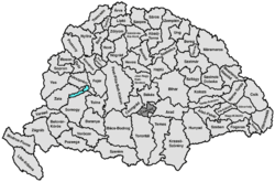
Csanád County
Csanád vármegye
Comitatul Cenad
Comitatus Chanadiensis
Komitat TschanadCounty of the Kingdom of Hungary 11th century–1920 
Coat of arms
Capital Makó History - Established 11th century - Treaty of Trianon June 4 1920 Area - 1910 1,714 km2 (662 sq mi) Population - 1910 145,200 Density 84.7 /km2 (219.4 /sq mi) Today part of Hungary, Romania
Csanád is the name of a historic administrative county (comitatus) of the Kingdom of Hungary. Its territory is presently in western Romania and southeastern Hungary. The capital of the county was Makó.Contents
Geography
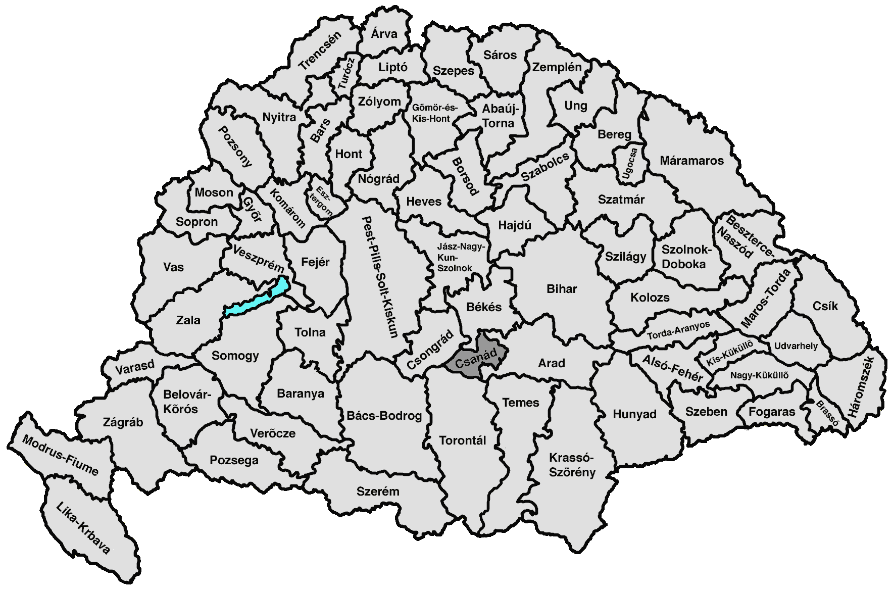
Csanád county shared borders with the Hungarian counties Csongrád, Békés, Arad and Torontál. The river Mureş/Maros formed its southern border. Its area was 1715 km² around 1910.
History
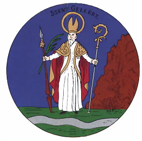
Csanád county was formed before the 11th century and was named after Castle Csanád, which in turn was named after its first comes, a cousin of Saint Stephen. The Diocese of Csanád was one of the oldest in Hungary. Its first bishop was Saint Gellért.
In 1920 the Treaty of Trianon assigned a small area in the southeast of the county (Nădlac and Şeitin) to Romania. The rest of the county was united with parts of Torontál county (a small area south of Szeged) and Arad county (a small area south of Békéscsaba) to form the new county Csanád-Arad-Torontál.
After World War II Csanád-Arad-Torontál county was divided over the Hungarian counties Békés and Csongrád. The Romanian part of former Csanád county is now part of the Romanian county Arad.
Demographics
According to the census of 1900 140,007 people lived in the county. Therefore Csanád county was one of the most densely populated counties of the Hungarian Kingdom. Among them were 103,242 (73.2%) Hungarians, 1182 (0.8%) Germans, 17,274 (12.3%) Slovaks und 13,982 (10 %) Romanians and 3981 Serbs (2.8%). The Hungarians formed an ethnic majority in every district except for the district Nagylak. The main part of the Slovaks and Romanians lived in the district Nagylak, the Serbs in the district Battonya. 71,610 of the inhabitants were Catholics, 25,234 Calvinists, 18,384 Lutherans, 4520 Greek Catholics, 16,567 Orthodox and 3254 Jews.
Subdivisions
In the early 20th century, the subdivisions of Csanád county were:
Districts (járás) District Capital Battonya Battonya Központ Makó Mezőkovácsháza Mezőkovácsháza Nagylak Nagylak, RO Nădlac Urban districts (rendezett tanácsú város) Makó The town of Nădlac is presently in Romania; the other towns mentioned are presently in Hungary.
Counties of the Kingdom of Hungary (1886) Abaúj-Torna · Alsó-Fehér · Arad · Árva · Bács-Bodrog · Baranya · Bars · Békés · Bereg · Beszterce-Naszód · Bihar · Borsod · Brassó · Csanád · Csík · Csongrád · Esztergom · Fejér · Fogaras · Gömör-Kishont · Győr · Hajdú · Háromszék · Heves · Hont · Hunyad · Jász-Nagykun-Szolnok · Kis-Küküllő · Kolozs · Komárom · Krassó-Szörény · Liptó · Máramaros · Maros-Torda · Moson · Nagy-Küküllő · Nógrád · Nyitra · Pest-Pilis-Solt-Kiskun · Pozsony · Sáros · Somogy · Sopron · Szabolcs · Szatmár · Szeben · Szepes · Szilágy · Szolnok-Doboka · Temes · Tolna · Torda-Aranyos · Torontál · Trencsén · Turóc · Udvarhely · Ugocsa · Ung · Vas · Veszprém · Zala · Zemplén · Zólyom
Corpus separatum: Fiume
Autonomous Kingdom of Croatia-Slavonia: Bjelovar-Križevci · Lika-Krbava · Modruš-Rijeka · Požega · Srijem · Varaždin · Virovitica · Zagreb
External links
Heraldry [1]
Categories:- 1920 disestablishments
- Counties in the Kingdom of Hungary
- States and territories established in the 11th century

Wikimedia Foundation. 2010.