- Torontál
Infobox Former Subdivision
native_name =
conventional_long_name = Torontál County
common_name = Torontál
subdivision = County
nation = theKingdom of Hungary
p1 =
s1 =
year_start = 15th century
event_end = Treaty of Trianon
year_end = 1920
date_end = June 4
capital = Nagybecskerek
stat_area1 = 10016
stat_pop1 = 615200
stat_year1 = 1910
today =Serbia ,Romania ,Hungary
footnotes =Veliki Bečkerek is the current name of the capital.Torontál (Hungarian: "Torontál", Serbian: "Torontal" or "Торонтал") is the name of administrative county (
comitatus ) of the historicKingdom of Hungary . Its territory is presently in northernSerbia (easternVojvodina , except the small part nearBelgrade , which is part ofCentral Serbia ), westernRomania and southernHungary . The capital of the county wasNagybecskerek (Serbian:Veliki Bečkerek ), the currentZrenjanin .Geography
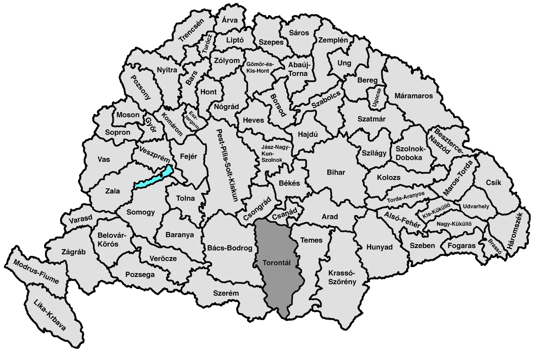
Torontál county was located in the
Banat region. It shared borders with theKingdom of Serbia and the Hungarian counties Szerém,Bács-Bodrog , Csongrád,Csanád , Arad andTemes (the first county was part ofCroatia-Slavonia ). The riverDanube formed its southern border, the riverTisza its western border, and the river Maros its northern border. Its area was 10,042 km² around 1910.History
Torontál county was formed before the 15th century. The county was taken by the
Ottoman Empire in the 16th century, and was included into the Ottoman Province of Temeşvar. After theBanat was captured by theHabsburg Monarchy in 1718, the area of the county was included into theBanat of Temeswar , a separate Habsburg province. This province was abolished in 1778, and the area of the county was incorporated into the Habsburg Kingdom of Hungary.In 1848/1849 the area of the county was part of
Serbian Voivodship , while between 1849 and 1860 it was part ofVoivodship of Serbia and Tamiš Banat , a separate Habsburg province. The Torontál county was re-established in the 1860s, when the area was incorporated into theKingdom of Hungary .In 1918, the county first became part of the newly formed
Banat Republic , and then part of the also newly formedKingdom of Serbs, Croats and Slovenes . By theTreaty of Trianon of 1920, the area of the county was divided between theKingdom of Serbs, Croats and Slovenes ,Romania , andHungary . Most of the county was assigned to theKingdom of Serbs, Croats and Slovenes (which later becameYugoslavia ). The north-eastern part of the county was assigned toRomania , and the northernmost part of the county (a small area south ofSzeged ) was assigned toHungary and became part of the new county Csanád-Arad-Torontál.The Yugoslav part of the pre-1918 Torontál county (the western
Banat region) is presently part ofSerbia (mostly in the autonomous region ofVojvodina , except the small part near Belgrade, which is part ofCentral Serbia ). The Romanian part is now part of Timiş county. The Hungarian part is now part of Csongrád county.Demographics
According to the census of 1910, the county had 615,151 inhabitants.
Population by language (1910 census):
*Serbian = 199,750 (32.47%)
*German = 165,779 (26.95%)
*Hungarian = 128,405 (20.87%)
*Romanian = 86,937 (14.13%)
*Slovak = 16,143
*Croatian = 4,203ubdivisions
In the early 20th century, the subdivisions of Torontál county were:
Wikimedia Foundation. 2010.