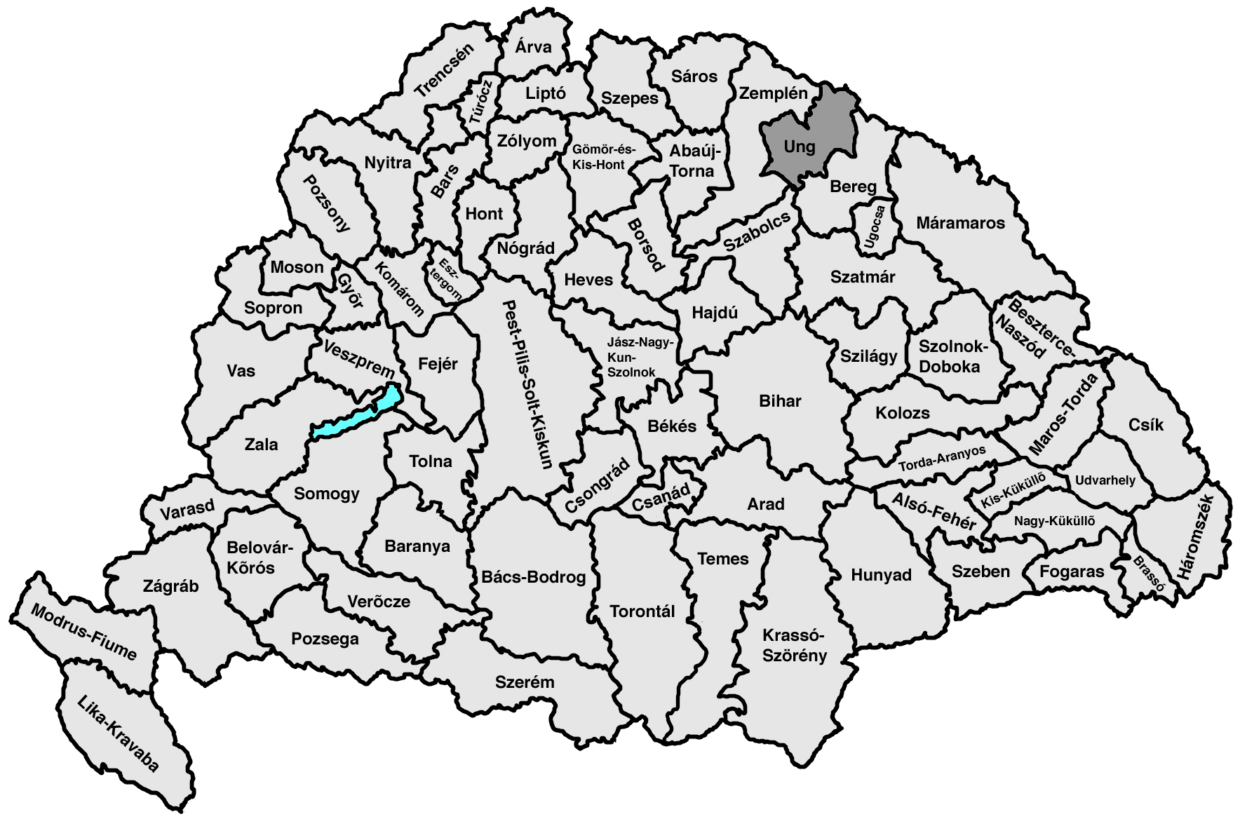
- Ung County
-
Comitatus Unghvariensis
Ung CountyCounty of the Kingdom of Hungary 11th century–1920 
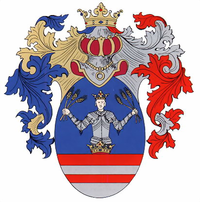
Coat of arms
Capital Ungvár History - Established 11th century - Treaty of Trianon June 4 1920 Area - 1910 3,230 km2 (1,247 sq mi) Population - 1910 162,100 Density 50.2 /km2 (130 /sq mi) Today part of Ukraine, Slovakia, Hungary Uzhhorod is the current name of the capital. Ung county (in Latin: comitatus Unghvariensis, in Hungarian: Ung (vár)megye in Slovak also: Užský komitát/ Užská župa / Užská stolica) is the name of a historic administrative county (comitatus) of the Kingdom of Hungary. Its territory is presently in eastern Slovakia (1/3) and western Ukraine (2/3).
Contents
Geography
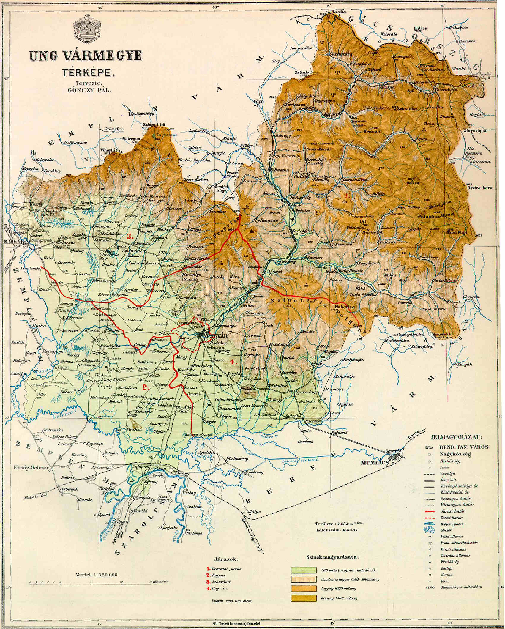
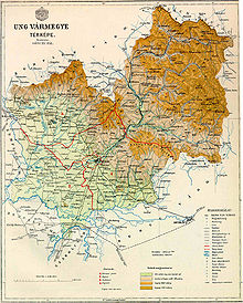 Map of Ung county around 1910.
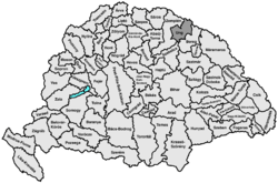
Ung county shared borders with the Austrian crownland Galicia (currently in Poland and Ukraine) and the Hungarian counties Bereg, Szabolcs and Zemplén (Zemplín). It was situated between the Carpathian Mountains in the north, the rivers Tisza and Latorica in the south, and the river Laborec in the west. The rivers Latorica and Uzh (Hungarian: Ung, hence the name of the county) flowed through the county. Its area was 3230 km² around 1910.
Capitals
Initially, the capital of the county was the Uzhhorod Castle, later the town of Uzhhorod (in Hungarian: Ungvár).
History
Ung is one of the oldest counties of the Kingdom of Hungary. In the aftermath of World War I, most of Ung county became part of newly formed Czechoslovakia, as recognized by the concerned states in the 1920 Treaty of Trianon. The town of Záhony and the village of Győröcske remained in Hungary (county Szabolcs-Ung).
Following the provisions of the controversial First Vienna Award, all but the westernmost part of the county came under Hungarian control in November 1938. After World War II, this westernmost part was returned to Czechoslovakia. The rest (except Záhony and Győröcske) became part of the Soviet Union, Ukrainian SSR, Zakarpattia Oblast.
Demographics
Population by language (1910 census)[citation needed]:
- Ruthenian = 61,711
- Hungarian = 53,824
- Slovak = 36,364
- German = 8,383
Religions (1910 census)
- Greek Catholic 55.0%
- Roman Catholic 21.3%
- Calvinist 12.4%
- Jewish 10.9%
- Lutheran 0.3%
- Greek Orthodox 0.1%
Subdivisions
In the early 20th century, the subdivisions of Ung county were:
Districts (járás) District Capital Nagyberezna Nagyberezna, UA Veliky Berezny Nagykapos Nagykapos, SK Veľké Kapušany Perecseny Perecseny, UA Perechyn Szerednye Szerednye, UA Serednye Szobránc Szobránc, SK Sobrance Ungvár Ungvár, UA Uzhhorod Urban districts (rendezett tanácsú város) Ungvár, UA Uzhhorod The towns of Veľké Kapušany and Sobrance are presently in Slovakia; the other towns mentioned are in Ukraine.
Counties of the Kingdom of Hungary (1886) Abaúj-Torna · Alsó-Fehér · Arad · Árva · Bács-Bodrog · Baranya · Bars · Békés · Bereg · Beszterce-Naszód · Bihar · Borsod · Brassó · Csanád · Csík · Csongrád · Esztergom · Fejér · Fogaras · Gömör-Kishont · Győr · Hajdú · Háromszék · Heves · Hont · Hunyad · Jász-Nagykun-Szolnok · Kis-Küküllő · Kolozs · Komárom · Krassó-Szörény · Liptó · Máramaros · Maros-Torda · Moson · Nagy-Küküllő · Nógrád · Nyitra · Pest-Pilis-Solt-Kiskun · Pozsony · Sáros · Somogy · Sopron · Szabolcs · Szatmár · Szeben · Szepes · Szilágy · Szolnok-Doboka · Temes · Tolna · Torda-Aranyos · Torontál · Trencsén · Turóc · Udvarhely · Ugocsa · Ung · Vas · Veszprém · Zala · Zemplén · Zólyom
Corpus separatum: Fiume
Autonomous Kingdom of Croatia-Slavonia: Bjelovar-Križevci · Lika-Krbava · Modruš-Rijeka · Požega · Srijem · Varaždin · Virovitica · Zagreb
 Categories:
- 1920 disestablishments
- Counties in the Kingdom of Hungary
- History of Ukraine
- States and territories established in the 11th century

Wikimedia Foundation. 2010.