- Szabolcs-Szatmár-Bereg County
Infobox Hungarian county
name =Szabolcs-Szatmár-Bereg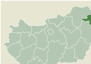
region =Northern Great Plain
seat =Nyíregyháza
area = 5936
population = 572,423
density = 96
cities = 228Szabolcs-Szatmár-Bereg is an administrative county (Hungarian: "megye") in north-eastern
Hungary , borderingSlovakia ,Ukraine andRomania . It shares borders with the Hungarian countiesHajdú-Bihar andBorsod-Abaúj-Zemplén . The capital of Szabolcs-Szatmár-Bereg county isNyíregyháza .Szabolcs-Szatmár-Bereg county was organised after
World War II from the previous counties Szatmár-Ugocsa-Bereg and Szabolcs. Before 1991, it was called Szabolcs-Szatmár county.History
Many settlements founded after the conquest of the
Magyar s were largely devastated by theMongol invasion in 1241. Recovery often took decades. The history ofNyíregyháza provides an illuminating example of this process. The Turks hardly succeeded in invading the northern parts of the region: therefore, many buildings from Árpád's age and the Medieval Era were preserved in relatively good state. In the Romanesque church ofCsaroda , there are wall paintings dating back to the 13th century, and theMedieval churches ofNyírbátor have been almost completely preserved. In the 16th century, the spread ofProtestantism andCalvinism brought about changes in town life.Geography
Szabolcs-Szatmár-Bereg is located in the north-eastern tip of
Hungary . It bordersUkraine , theSlovak Republic andRomania , and has good connections both byroad and rail. Within Hungary, the county is bordered byBorsod-Abaúj-Zemplén county and the River Tisza to the north west andHajdú-Bihar county to the south west.The early Hungarians transformed this region significantly by clearing large areas of forest to make way for
pasture s and plough-land. Approximately 5 to 6 square kilometres offorest were cleared for the construction of theSzabolcs earthwork in the ninth and tenth centuries and its ruins are still present. With the subsequent development of the country, the region became marginalized in the 15th century. On goingcivil war ,rebellion andwar exacted a heavy price and further hindered the region's development.The county's borders have been altered frequently over the years, its current territory being established in 1950 with the amalgamation of the counties of Szabolcs-Ung and Szatmár-Bereg-Ugocsa.
There are many
forest s, fields,pasture s,meadow s andmoorland forests in the county. Thebog moss moors atCsaroda , the Nyíres lake and the Bábtava lake are especially valuable, as they contain many rare species of fauna and flora.Szabolcs-Szatmár-Bereg is Hungary's sixth biggest county with a total land area of 5 936 square kilometres. From a geographical aspect, it is possible to divide the county into two main regions: The
Upper Tisza Valley and the Nyírség.Tisza is one of the most importantriver s of the county, entering Szabolcs-Szatmár-Bereg — and Hungary — atTiszabecs , and leaving atTiszadob . Its segment in Szabolcs-Szatmár-Bereg county is 235 kilometres long, out of which 208 kilometres belongs to the Upper Tisza Valley, reaching the area ofTokaj andRakamaz . The larger area named the Nyírség is derived from the word nyír meaningbirch , as the region is dominated by birch woodlands. The northern part of Nyírség is covered with sandy forest soils, the southern areas have loose wind-blown sand. Alluvial and meadow soils are found in the Upper Tisza region.The county has a
continental climate ; it is cooler than the Great Plain because it is further north. Summers are cooler than in other parts of the Plains. Annual precipitation is 550-600 millimetres. The higher than average number of days of sunshine make ideal conditions for the growing oftomato es,sunflower ,tobacco ,apple s and otherfruit s.The county has 229 settlements, of which 20 are towns. The county capital and largest city is
Nyíregyháza with apopulation of 116 900 in 2003. The other cities have relatively small populations, only those ofKisvárda andMátészalka having around 18 000 inhabitants. The eastern part of the county is lightly populated and is dotted with small villages which often have very poor economic conditions.River Tisza
The Upper Tisza region has many
stream s andriver s, but the Nyírség region has little surface water. The most important of River Tisza's tributaries is the RiverSzamos , which is also characterised by great variations in water volume. There areirrigation systems, a waterbarrage and aHydroelectric power station on the Tisza atTiszalök .Lakes of various sizes have evolved in sandy areas such as the basin of the Sóstó (Salty lake) of
Nyíregyháza , whosealkaline ,hydrogen carbonate d waters have medicinal qualities. Many waterreservoirs have been built according to local demand. Thermal waters of 55-65 °C can be brought to the surface from wells as shallow as 1 000 metres . The most important thermal water reserves are in Nyíregyháza, Kisvárda, Mátészalka and Tiszavasvári. The county'sgeothermal energy still awaits exploitation.The county has relatively few
mineral reserves. Almost all of the large energy source transport systems cross the county.Economy
The county borders three countries, and it is the only Hungarian county bordering Ukraine. The railway border crossing towards
Ukraine is well developed; its high capacity is able to meet the requirements of transit and bilateral trade. Following the reconstruction of theroad border crossing, the county is also able to cope with increased road transportation.Several regions in the county have
tourism potential, mostly unexploited. Szabolcs-Szatmár-Bereg has several agricultural products of excellent quality, with capacity for higher production. There is an abundance of low-cost, semiskilled labour.The county's biggest problem is the
economic crisis . There is a shortage of local capital and inwardinvestment , which restrains the creation of new jobs, thus the unemployment rate remains the second highest in Hungary. Manufacturing lags the rest of the country, most notably lacking high quality, high value-added products. The marginal soil quality limits the scope of agricultural production to a few products which suffer from shrinking export markets to the east.Government
Regional structure
City with county rights
*
Nyíregyháza Cities and towns
(ordered by population, according to the 2001 census)
*
Mátészalka (18,749)
*Nyírtelek (7,150)
*Kemecse (5,037)
*Kisvárda (18,220)
*Nagyecsed (6,930)
*Záhony (4,815)
*Tiszavasvári (14,585)
*Ibrány (6,891)
*Demecser (4,566)
*Újfehértó (13,657)
*Balkány (6,809)
*Dombrád (4,283)
*Nyírbátor (13,456)
*Tiszalök (6,132)
*Baktalórántháza (4,272)
*Nagykálló (10,814)
*Nagyhalász (5,934)
*Nyírlugos (3,009)
*Vásárosnamény (9,325)
*Csenger (5,234)
*Máriapócs (2,186)
*Fehérgyarmat (9,046)
*Rakamaz (5,206)
*Mándok (4,523)Villages
*Ajak
*Anarcs
*Apagy
*Aranyosapáti
*Balsa
*Barabás
*Bátorliget
*Benk
*Beregdaróc
*Beregsurány
*Berkesz
*Besenyőd
*Beszterec
*Biri
*Bököny
*Botpalád
*Buj
*Cégénydányád
*Csaholc
*Csaroda
*Császló
*Csegöld
*Csengersima
*Csengerújfalu
*Darnó
*Döge
*Encsencs
*Eperjeske
*Érpatak
*Fábiánháza
*Fényeslitke
*Fülesd
*Fülpösdaróc
*Gacsály
*Garbolc
*Gávavencsellő
*Géberjén
*Gégény
*Gelénes
*Gemzse
*Geszteréd
*Gulács
*Győröcske
*Győrtelek
*Gyügye
*Gyüre
*Gyulaháza
*Hermánszeg
*Hetefejércse
*Hodász
*Ilk
*Jánd
*Jánkmajtis
*Jármi
*Jéke
*Kállósemjén
*Kálmánháza
*Kántorjánosi
*Kék
*Kékcse
*Kérsemjén
*Kisar
*Kishódos
*Kisléta
*Kisnamény
*Kispalád
*Kisszekeres
*Kisvarsány
*Kocsord
*Kölcse
*Komlódtótfalu
*Komoró
*Kömörő
*Kótaj
*Laskod
*Levelek
*Lónya
*Lövőpetri
*Magosliget
*Magy
*Mánd
*Márokpapi
*Mátyus
*Méhtelek
*Mérk
*Mezőladány
*Milota
*Nábrád
*Nagyar
*Nagycserkesz
*Nagydobos
*Nagyhódos
*Nagyszekeres
*Nagyvarsány
*Napkor
*Nemesborzova
*Nyírbéltek
*Nyírbogát
*Nyírbogdány
*Nyírcsaholy
*Nyírcsászári
*Nyírderzs
*Nyírgelse
*Nyírgyulaj
*Nyíribrony
*Nyírjákó
*Nyírkarász
*Nyírkáta
*Nyírkércs
*Nyírlövő
*Nyírmada
*Nyírmeggyes
*Nyírmihálydi
*Nyírparasznya
*Nyírpazony
*Nyírpilis
*Nyírtass
*Nyírtét
*Nyírtura
*Nyírvasvári
*Ököritófülpös
*Olcsva
*Olcsvaapáti
*Ömböly
*Ópályi
*Őr
*Panyola
*Pap
*Papos
*Paszab
*Pátroha
*Pátyod
*Penészlek
*Penyige
*Petneháza
*Piricse
*Pócspetri
*Porcsalma
*Pusztadobos
*Ramocsaháza
*Rápolt
*Rétközberencs
*Rohod
*Rozsály
*Sényő
*Sonkád
*Szabolcs
*Szabolcsbáka
*Szabolcsveresmart
*Szakoly
*Szamosangyalos
*Szamosbecs
*Szamoskér
*Szamossályi
*Szamosszeg
*Szamostatárfalva
*Szamosújlak
*Szatmárcseke
*Székely
*Szorgalmatos
*Tákos
*Tarpa
*Terem
*Tiborszállás
*Timár
*Tiszaadony
*Tiszabecs
*Tiszabercel
*Tiszabezdéd
*Tiszacsécse
*Tiszadada
*Tiszadob
*Tiszaeszlár
*Tiszakanyár
*Tiszakerecseny
*Tiszakóród
*Tiszamogyorós
*Tiszanagyfalu
*Tiszarád
*Tiszaszalka
*Tiszaszentmárton
*Tiszatelek
*Tiszavid
*Tisztaberek
*Tivadar
*Tornyospálca
*Tunyogmatolcs
*Túristvándi
*Túrricse
*Tuzsér
*Tyukod
*Újdombrád
*Újkenéz
*Ura
*Uszka
*Vaja
*Vállaj
*Vámosatya
*Vámosoroszi
*Vasmegyer
*Zajta
*Zavidfalva
*Zsarolyán
*Zsurk Notable people from Szabolcs-Szatmár-Bereg
*
Krúdy Gyula - Nyíregyháza
*Kállay Miklós - Nyíregyháza
*Váci Mihály - Mandabokor II-
*Friderikusz Sándor - Nyíregyháza
*Benedek János - Balkány
*Gencsy Sámuel - Balkány
*Madár János - Balkány

Wikimedia Foundation. 2010.