- Chimney Peak
-
Chimney Peak Location in Alberta and British Columbia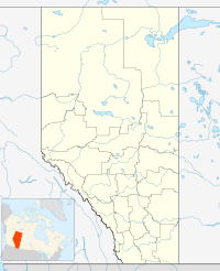
 Chimney Peak
Elevation 3,002 m (9,849 ft) [1] Prominence 137 m (449 ft) Location Location Alberta
British ColumbiaRange Bow Range Coordinates 51°15′48″N 116°09′15″W / 51.26333°N 116.15417°WCoordinates: 51°15′48″N 116°09′15″W / 51.26333°N 116.15417°W Topo map NTS 82N/08 Climbing First ascent 1910 E.O. Wheeler, T.G. Longstaff Chimney Peak is located on the border of Alberta and British Columbia on the Continental Divide. It was named in 1910 by T.G. Longstaff.[1][2]
See also
- List of peaks on the British Columbia-Alberta border
- Mountains of Alberta
- Mountains of British Columbia
References
- ^ a b "Chimney Peak". PeakFinder.com. http://peakfinder.com/peakfinder.asp?PeakName=Chimney+Peak.
- ^ "Chimney Peak". Bivouac.com. http://www.bivouac.com/MtnPg.asp?MtnId=1564.
Categories:- Mountains of Alberta
- Mountains of British Columbia
- Alberta geography stubs
- British Columbia geography stubs

Wikimedia Foundation. 2010.