- Chimney Tops
-
Chimney Tops 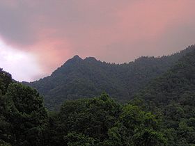
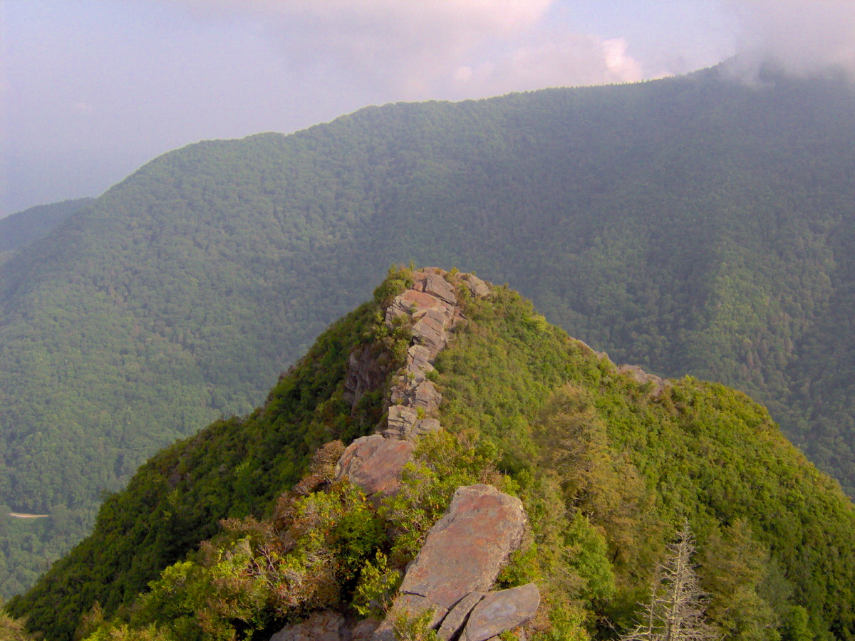
Chimney Tops, looking south from Newfound Gap Road (US-441).Elevation 4800+ feet (1463+ m) NGVD 29[1] Prominence 120 ft (37 m) [1] Location Location Sevier County, Tennessee Range Great Smoky Mountains Coordinates 35°37′45″N 83°28′35″W / 35.6292607°N 83.476273°WCoordinates: 35°37′45″N 83°28′35″W / 35.6292607°N 83.476273°W[2] Topo map USGS Mount Le Conte Climbing Easiest route Chimney Tops Trail, short climb Chimney Tops is a mountain in the central Great Smoky Mountains, located in the Southeastern United States. It has an elevation of 4,800 feet (1463 m). It is one of the park's most recognizable geological structures and a popular hiking destination.
Chimney Tops is a double-capstone knob on the eastern slope of the Sugarland Mountain massif. This massif stretches north-to-south across the north-central section of the Smokies. Mount Le Conte dominates the area immediately east of Chimney Tops, and Mt. Mingus rises to the north. Thus, while the view from the summit is 360 degrees, Chimney Tops is practically "walled in" on three sides.
Contents
Geology
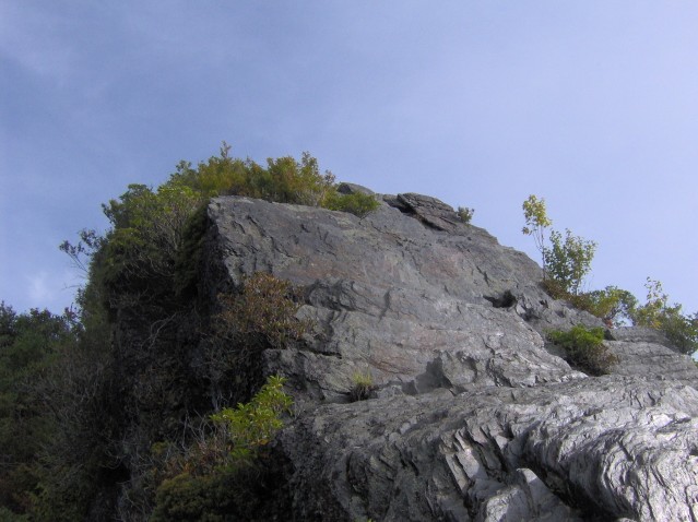
Chimney Tops is one of the few instances of a bare rock summit in the Smokies.[3] Over the centuries, the bedrock atop the mountain has been exposed through natural weathering of the upper layers of soil strata. This rock is mostly Anakeesta Formation metamorphic rock, especially slate, phyllite, and metasiltsone.[4] The grainy, contorted capstones offer excellent footholds and handholds for climbing.
Like most of the Appalachian Mountains, Chimney Tops was formed 200 million years ago when the North American and African plates collided during the Appalachian orogeny.[5]
History
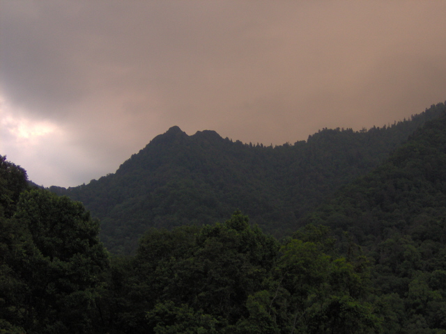
 The lower capstone of Chimney Tops, looking north from the higher capstone.
The Cherokee name for Chimney Tops is Duniskwalgunyi, or "forked antler", referring to its resemblance to the antlers of a deer.[6] In the Cherokee legend "Aganunitsi and the Uktena", the captured medicine man, Aganunitsi, in exchange for his freedom, searches remote parts of the Smokies in hopes of finding the giant reptile, the Uktena, and seizing a powerful amulet from its forehead. In his quest, Aganunitsi searches distant gaps and peaks in the Smokies before he "went on to Duniskwalgunyi, the Gap of the Forked Antler, and to the enchanted lake of Atagahi, and at each found monstrous reptiles, but he said they were nothing."[7]
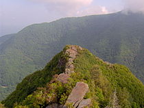
 Folded metamorphic rock characterizes the capstones of Chimney Tops.
The Road Prong Trail, which follows the stream of the same name at the base of Chimney Tops, is one of the oldest trails in the Smokies. In the 18th and 19th centuries, this ancient path was known commonly as the Indian Gap Trail. In 1832, the Oconaluftee Turnpike was constructed between Indian Gap and Smokemont. This road was expanded during the Civil War by Cherokee leader Col. Will Thomas, running parallel to the modern trail.[8]
The mountain's current name was probably given to it by residents of the Sugarlands, a valley to the north of the mountain that was home to a small Appalachian community before the national park was formed. Before the Sugarlands was reforested, Chimney Tops was clearly visible from most of the valley. Local legend even suggested that the top of the mountain was covered in soot.[9]
Access
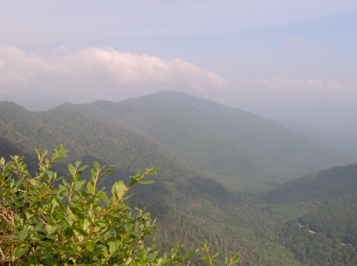
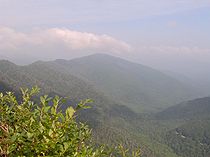 Sugarland Mountain, looking northwest from the summit of Chimney Tops.
By far the most common route to the top of Chimney Tops is the Chimney Tops Trail, which can be accessed from Newfound Gap Road (US-441). While the trailhead is clearly marked, it shouldn't be confused with the Chimneys Campground, which is a few miles to the north. The trail ends at the foot of the south capstone (the higher of the two), but various unmaintained spurs cross over to the lower summit.
Another route is to follow the Appalachian Trail west from Newfound Gap to the Road Prong Trail. The Road Prong Trail, following the river at the base of the mountain, connects the Appalachian Trail with the Chimney Tops Trail. This route is twice as long as the route from the Chimney Tops parking lot.
While no technical gear is needed, a short climb is necessary to reach the top of the capstones. From the summit, Mount Le Conte and Mount Kephart dominate the view to the east and Sugarland Mountain dominates the view to the west. On a clear day, the Sugarlands valley is visible to the north.
References
- ^ a b "Chimney Tops, Tennessee". Peakbagger.com. http://www.peakbagger.com/peak.aspx?pid=25487.
- ^ "Chimney Tops". Geographic Names Information System, U.S. Geological Survey. http://geonames.usgs.gov/pls/gnispublic/f?p=gnispq:3:::NO::P3_FID:1280482.
- ^ Brewer, Carson (1993). Great Smoky Mountains National Park. Portland, Ore: Graphic Arts Center Publishing. p. 101. ISBN 1558681264.
- ^ Moore, Harry (1988). A Roadside Guide to the Geology of the Great Smoky Mountains National Park. Knoxville: University of Tennessee Press. pp. 7, 107. ISBN 0870495585.
- ^ Moore, Harry (1988). pp. 26–27.
- ^ Mooney, James (1972). Myths of the Cherokee and Sacred Formulas of the Cherokee. Nashville: Charles Elder. p. 516..
- ^ Mooney, James (1972) p. 299.
- ^ Strutin, Michael (2003). History Hikes of the Smokies. Gatlinburg: Great Smoky Mountains Association. pp. 322–324. ISBN 0937207403.
- ^ Frome, Michael (1994)). Strangers In High Places: The Story of the Great Smoky Mountains. Knoxville: University of Tennessee Press. p. introduction.
External links
- "Great Smoky Mountains Trail Map and Guide". National Park Service. http://www.nps.gov/grsm/planyourvisit/upload/GSMNP%20Backcountry%20Map.pdf. Retrieved 2011-05-09.
- "Chimney Tops". SummitPost.org. http://www.summitpost.org/page/151581. Retrieved 2011-05-09.
- "Mount Le Conte Geological Study". Appalachian Blue Ridge Project. United States Geological Survey. http://geology.er.usgs.gov/eespteam/smoky/ResearchAreas/smokys/MountLeConte/trails1.htm. Retrieved 2011-05-09. Contains an excellent section on the geology of Chimney Tops.
Categories:- Great Smoky Mountains National Park
- Mountains of Tennessee
- Protected areas of Sevier County, Tennessee
- Cherokee tribe
Wikimedia Foundation. 2010.