- Charles Center (Baltimore Metro Subway station)
-
Charles Center 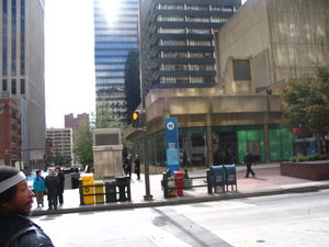
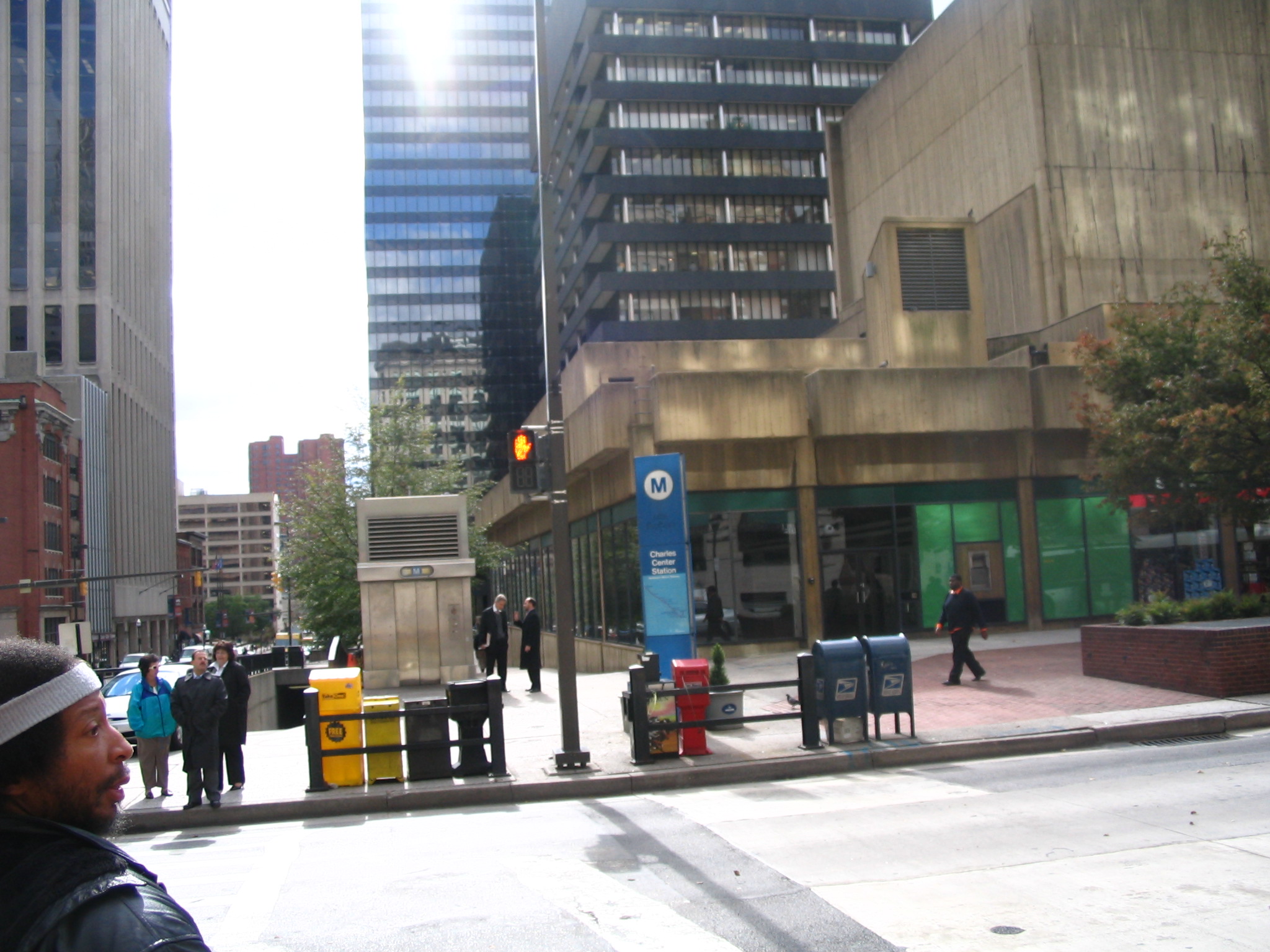
The outside of the Charles Center Metro Subway StationStation statistics Address Baltimore & Charles Streets
Baltimore, MDCoordinates 39°17′22″N 76°36′57″W / 39.28945°N 76.61582°WCoordinates: 39°17′22″N 76°36′57″W / 39.28945°N 76.61582°W Lines Connections MTA Maryland Buses and Charm City Circulator Platforms 1 Tracks 2 Other information Opened 1983 Rebuilt (2016 Red Line Connection) Owned by Maryland Transit Administration Services Preceding station MTA Maryland Following station Shot Tower / Market Placetoward Johns Hopkins HospitalMetro Subway toward Owings MillsThe Charles Center Metro Subway Station is one of 14 stops along the Baltimore Metro Subway line. It is the area of the city considered to be most central, and until 1995, when the extension to Johns Hopkins Hospital was opened, it was the final stop on the line. At this location, it is possible to walk to many downtown Baltimore landmarks and to transfer to many buses.
The Red Line, a proposed but not yet funded light rail line, would if built include an underground station here providing a transfer point to the currently existing Metro Subway system.[1]
Maryland MTA Bus Connections
- 1 to Sinai Hospital or Mondawmin Metro Subway Station (NB)/ Fort McHenry (SB)
- 3 to Cromwell Bridge Park & Ride or Sheppard Pratt Hospital (NB)
- 5 to Mondawmin Metro Subway Station (WB)/ Cedonia (EB)
- 8 to University Maryland Transit Center (SB) or Lutherville (NB)
- 10 to Catonsville or Paradise (WB)/ Dundalk (EB)
- 11 to Towson (NB); Canton (SB)
- 20 to Security Square Mall or CMS (WB)/ C.C.B.C. Dundalk or Marine Terminal (EB)
- 23 to Catonsville or Wildwood (WB)/ Fox Ridge (EB)
- 30 to Edmondson Village (WB)/ City Hall or Hopkins Bayview (EB)
- 35 to UMBC or Blind Industries (WB)/ White Marsh (EB)
- 36 to Riverview[disambiguation needed
 ] (SB)/ Cedarcroft (NB)
 - 40 (QuickBus) to CMS (WB)/ Middle River (EB)
- 46 (QuickBus) to Paradise (WB)/ Cedonia (EB)
- 48 (QuickBus) to University Medical Transit Center (SB)/ Towson (NB)
- 61 to Mount Washington (NB)/ Inner Harbor (SB)
- 64 to North Avenue (NB)/ Curtis Bay or Energy Parkway or Riviera Beach (SB)
- 91 to Sinai Hospital (NB)/ City Hall (SB)
- 120 (Express) to Johns Hopkins Hospital (SB)/ White Marsh (NB)
- 150 (Express) to City Hall (EB)/ Columbia (WB)
- 160 (Express) to Johns Hopkins Hospital (WB)/ Whispering Woods or Fox Ridge (EB)
- 310 (Commuter) to Johns Hopkins Hospital (EB); Columbia (WBB)
- 410 (Commuter) to State Center Metro Subway Station (SB)/ Churchville or Belair (NB)
- 411 (Commuter) to Johns Hopkins Hospital (SB)/ Hickory or Belair (NB)
- 420 (Commuter) to Johns Hopkins Hospital (SB)/ Havre de Grace (NB)
- Charm City Circulator Purple Route via Federal Hill (SB); Penn Station (NB)
References
External links
- Hanover Street entrance from Google Maps Street View
- Charles Street entrance from Google Maps Street View
Categories:- United States rapid transit stubs
- Baltimore Metro Subway stations
Wikimedia Foundation. 2010.