- Chandwa (community development block)
-
Chandwa — community development block — Coordinates 23°41′N 84°44′E / 23.68°N 84.73°ECoordinates: 23°41′N 84°44′E / 23.68°N 84.73°E Country India State Jharkhand District(s) Latehar Time zone IST (UTC+05:30) Area
• 525 metres (1,722 ft)
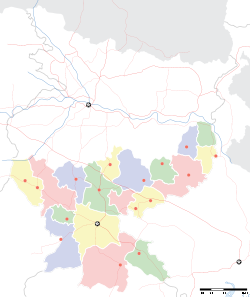
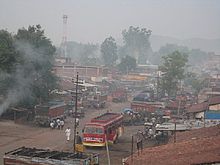
Website latehar.nic.in/ Chandwa, is a community development block in Latehar district, in Indian state of Jharkhand. It is located around 75 km from Ranchi, the state capital. It is surrounded by picturesque scenery and is well known for abundance of bauxite and coal mines. It is mineral rich like most of Jharkhand State.
Contents
Geography
Chandwa is located at 23°41′N 84°44′E / 23.68°N 84.73°E[1]. It has an average elevation of 525 m (1,722 ft).
Demographics
As of 2001 India census,[2] Chandwa Community Block had a population of 81,479 and is the third largest Community Block in Latehar District after Balumath and Latehar respectively. Males constitute 51% of the population and females 49%. Chandwa has an average literacy rate of 41.06%, much lower than the national average of 59.5%: male literacy is 54.91%, and female literacy is 26.58%. Obviously, the people of Chandwa need access to good schools to catch up with the rest of the nation in terms of literacy.
There are a total of 86 villages and 17 panchayats in this Chandwa community block.
Education
Hindi is the main language used in Chandwa. There are 2 government run middle schools and 3 high schools. One of the high schools is exclusively for Girls and the other two are co educational in nature. SS High school is the oldest of all while Chirst Raja High School is regarded prestigious in Palamau Commissionary.
Even though there are not many english medium schools in Chandwa, in the last 10 years the local educational youth have come forward and set up a few english medium primary schools. Some of the youths have also started a few coaching centers to impart private coaching to the needy students.
Recently Abhijeet Group has decided to open up a Dayanand Anglo Vedic (DAV) public school near Nagar, about 10 Kilometers from Chandwa. This will be a huge boost to the students and the parents of Chandwa who would otherwise need to send their kids to the Jharkhand state capital Ranchi for getting basic education in English medium.
Economy
The main economy is agriculture and the local business activities that people of chandwa are engaged into.
Recently there have been many positive news about a handful of companies like Essar, Abhijeet Group etc planning to set up power plant projects in the vicinity of Chandwa. The power plant project by Abhijit group has already started in "Chakla", about 10 km away from chandwa on chandwa-chatra highway.
The local business has got a boost in the recent times with the coming of Abhijeet Group and Essar Group in the local area. In the main town, the rental prices of homes and office spaces have been soaring and the local people have adopted this as a good money earning business plan.
Places of interest
(a) Maa Nagar Bhagwati Temple: - This is a famous temple situated in the "Nagar" village at the foot of the picturesque and lush green Mountains about 8 km away from the center of chandwa town in Chandwa-Chatara main road. This holds a very high religious value for the people of the surrounding area. A Marriage Hall has also been recently built up there as this temple hosts many marriages during the marriage season every year. Many religious people from Chandwa town visit the temple on a regular basis.
(b) Kranti Fall: - This beautiful fall is located in the picturesque Amjharia Ghati and once it used to be a picnic spot but now it is abandoned mostly because of Naxal activities in the surrounding area.
(c) Hindalco Park: - About 5 km from Chandwa town on the Chandwa-Ranchi Road. This park has been developed and maintained by Hindalco industries and serves as a good picnic spot for the people of Chandwa town especially on the arrival of new year (1 January).
Transport
Road
Chandwa is well connected to the nearby major towns of Jharkhand Chatra, Daltonganj, Lohardaga, Gumla and the state capital Ranchi by road. The national highway NH-75 connecting State capital Ranchi to the Palamau headquarter Daltonganj via Chandwa town is undergoing the widening currently and it would be a major relief for the local people for commuting to Ranchi and Daltonganj. The common mode of transport usually is privately run buses and other vehicles.
Rail
Chandwa has a beautiful Railway station which is known as TORI. It has big reputation in the local area as trains to National Capital Delhi go through this station and due to lack of railway infrastructure in the other nearby towns, TORI serves as a common railway station for many people. Train services to Dhanbad, Delhi, Patna, Ranchi, Howrah are available on a daily basis from Tori station.
Tori Station would soon be elevated to the status of a Railway Junction as the new rail route from Lohardaga would connect here. A railway line is also proposed to connect Chatra and Hazaribagh from Tori later in the future.
Air
The nearest airport for chandwa would be the Birsa Munda Airport at the state capital Ranchi(75 KM).
Healthcare
There is one Government hospital near the Chandwa Daltonganj Mod (road turn). Some doctors run their own private clinics in the town. The nearest hospitals are: (a) Tumbagadha in Palamau (b) Sadar Hospital in Lohardaga (c) Mandar Hospital
Sports
Cricket is the primary sport in Chandwa. The ground of SS High School is the main playing ground for the local children. Tennis ball cricket is the primary version of cricket that is played there, and local tournaments are held annually.
Apart from cricket, other sports popular in Chandwa include hockey, football and badminton.
Entertainment
There is no cinema hall in the Chandwa town. The nearest cinema halls are Manmati Chitra Mandir in district headquarter Latehar and Alka and Menka Cinema Halls in Lohardaga. Local residents purely rely on Television and a few privately run Video centers in the town.
References
- ^ Falling Rain Genomics, Inc - Chandwa
- ^ "Census of India 2001: Data from the 2001 Census, including cities, villages and towns (Provisional)". Census Commission of India. Archived from the original on 2004-06-16. http://web.archive.org/web/20040616075334/http://www.censusindia.net/results/town.php?stad=A&state5=999. Retrieved 2008-11-01.
External links
- http://envfor.nic.in/divisions/cltech/Damodar/1.1.htm
- http://in.news.yahoo.com/070820/32/6jopc.html
- http://latehar.nic.in/overview.htm
- http://www.hindustantimes.com/Chandwa-town-doesn-t-sleep-at-6-anymore/Article1-601053.aspx
Palamu division topics General Betla National Park • Palamau Tiger Reserve • Chota Nagpur Plateau • Palamu FortDistricts Community development blocks Latehar district Balumath • Chandwa Palamu district Bishrampur • Chainpur • Chatarpur • Daltanganj • Hussainabad • Lesliganj • Manatu • Pandu • Panki • Patna • SatbarwaRivers, Waterfalls, Dams Amanat • Auranga • Burha • Kanhar • North Koel • Son • Punpun • Lodh or Burhaghaugh Falls • Lower Ghaghri FallsLanguages, people Transport Lok Sabha constituencies PalamuVidhan Sabha constituencies Chatra Latehar • Panki • Manika Palamu Daltonganj • Garhwa • Bhawanathpur • Chhatarpur • HussainabadSee also Cities and towns in Palamu Division • Villages in Palamu district • Son BasinOther Divisions North Chotangapur • South Chaotanagpur • Kolhan • Santhal ParganaCities and towns in Palamu division Garhwa district Latehar district Palamu district Related topics Palamu Division topicsCities and towns
in other DivisionsCategories:- Community development blocks in Latehar district
Wikimedia Foundation. 2010.


