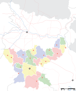
- Netarhat
-
Netarhat — town — Coordinates 23°29′00″N 84°16′00″E / 23.4833°N 84.2667°ECoordinates: 23°29′00″N 84°16′00″E / 23.4833°N 84.2667°E Country India State Jharkhand District(s) Latehar Time zone IST (UTC+05:30) Area
• 1,071 metres (3,514 ft)
Website gumla.nic.in/ Netarhat (Hindi: नेतरहाट) is a town in Latehar district[1](earlier in the erstwhile Palamu district[2]) in the Indian state of Jharkhand.[3]Referred to as the “Queen of Chotanagpur”, it is a popular hill station. [4]
Contents
Geography
Netarhat is located at 23°29′00″N 84°16′00″E / 23.4833°N 84.2667°E, at a height of 1,071 metres (3,514 ft).[5]
It is a plateau covered with thick forest.[4]Located in the Pat region of Chota Nagpur Plateau, Netarhat plateau is about 4 miles (6.4 km) long and 2.5 miles (4.0 km) broad. It consists of crystalline rocks and has a summit capped with sandstone trap or laterite. The highest point is 3,696 feet (1,127 m)[2]
Transport
It is located 156 kilometres (97 mi) west of Ranchi, the state capital.[3]It is 210 kilometres (130 mi) from Daltonganj.
Tourism
Netarhat is famous for its glorious sunrises and sunsets during the summer months.[3]
Netarhat has several places of tourist interests including Magnolia Point (10 km from Netarhat, ideal site for viewing sunset), Upper Ghaghri Falls (4 km from Netarhat), Lower Ghaghri Falls (10 km from Netarhat), Koel View Point (3 km from Netarhat), Lodh Falls (60 km from Netarhat, the highest waterfall in Jharkhand), Sadni Falls (35 km from Netarhat).[4]
Education
Netarhat Vidyalaya is a residential public school set up in 1954.[6]
References
- ^ "Latehar Road Map". mapsofindia. http://www.mapsofindia.com/maps/jharkhand/roads/latehar.htm. Retrieved 2010-04-29.
- ^ a b "Gazetteer of Palamu District". http://www.palamu.nic.in/gazette/general_gazette.doc. Retrieved 2010-04-29.
- ^ a b c "Gumla -'The land of Gaw-Mela'". traveljharkhand.com. http://www.traveljharkhand.com/jharkhand-tourism/jharkhand-districts/gumla-netarhat.html. Retrieved 2010-04-17.
- ^ a b c "Destinations". Bihar State tourism Development Corporation. http://bstdc.bih.nic.in/Netarhat.htm. Retrieved 2010-04-17.
- ^ "Netarhat, India page". Falling Rain Genomics. http://www.fallingrain.com/world/IN/38/Netarhat.html. Retrieved 2010-04-23.
- ^ "Netarhat Vidyalaya". http://www.netarhatvidyalaya.com/. Retrieved 2010-04-17.
Cities and towns in Palamu division Garhwa district Latehar district Palamu district Related topics Palamu Division topicsCities and towns
in other DivisionsCategories:- Cities and towns in Latehar district
- Jharkhand geography stubs
Wikimedia Foundation. 2010.


