- Graubünden
-
The title of this article contains the character ü. Where it is unavailable or not desired, the name may be represented as Graubuenden.
Kanton Graubünden
Chantun Grischun
Cantone dei Grigioni— Canton of Switzerland — 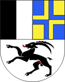
Coat of arms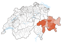
Coordinates: 46°45′N 9°30′E / 46.75°N 9.5°ECoordinates: 46°45′N 9°30′E / 46.75°N 9.5°E Capital Chur Subdivisions 180 municipalities, 11 districts Government – Executive Regierungsrat, Regenza, Governo (5) – Legislative Grosser Rat, Cussegl Grond, Gran Consiglio (120) Area[1] – Total 7,105.44 km2 (2,743.4 sq mi) Population (12/2009)[2] – Total 191,861 – Density 27/km2 (69.9/sq mi) Highest point 4,049 m (13,284 ft) - Piz Bernina Lowest point 260 m (853 ft) - border to Ticino at San Vittore Joined 1803 Abbreviation GR Languages German, Romansh, Italian Website GR.ch Map of Graubünden
Graubünden or Grisons (German: Graubünden, [ɡraʊˈbʏndən] (
 listen); Italian: Grigioni[3][4] [ɡriˈdʒoːni]; Romansh: Grischun [ɡʁiˈʒun] ( listen); see also other names) is the largest and easternmost canton of Switzerland. The canton shares borders with the cantons of Ticino, Uri, Glarus and St. Gallen and international borders with Italy, Austria and Liechtenstein. The name Graubünden translates as the "Grey Leagues," referring to the canton's origin in three local alliances, the League of God's House, the Grey League, and the League of Ten Jurisdictions. Graubünden is also home to three of Switzerland's ethnic groups and the subsequent languages of Swiss German, Italian and Romansh are all native to the state. It is also the only canton where the dialects of the ancient Romansh language are still spoken.
 Chur, capital of Graubünden seen to the west and the Rhine valley towards its source.
Contents
Geography
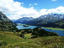 The Upper Engadin valley near St Moritz
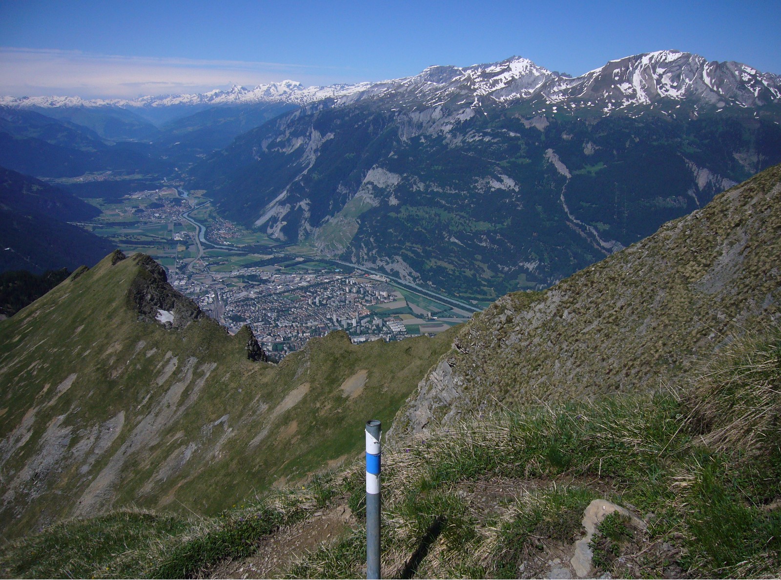
The area of this largest of the cantons of Switzerland is 7,105.2 square kilometres (2,743.3 sq mi).[5] Only about a third of this is commonly regarded as productive land of which forests cover about a fifth of the total area.[5] The canton is entirely mountainous, comprising the highlands of the Rhine and Inn river valleys. In its southeastern part lies the only official Swiss National Park. In its northern part the mountains were formed as part of the thrust fault that was declared a geologic UNESCO World Heritage Site, under the name Swiss Tectonic Arena Sardona, in 2008. Another Biosphere Reserve is the Biosfera Val Müstair adjacent to the Swiss National Park whereas Ela Nature Park is one of the regionally supported parks.
There are many significant elevations in the Grison Alps, including the Tödi at 3,614 metres (11,857 ft) and the highest peak Piz Bernina at 4,049 metres (13,284 ft). Many of the mountain ranges feature extensive glaciers, such as at the Adula, the Albula, the Silvretta, the Bernina, the Bregaglia and the Rätikon ranges. The mountain ranges in the central area are very deep, some of which are considered the deepest valleys in Europe. These valleys were originally settled by the Raetians (Rhaeti).
Graubünden borders on the cantons of St. Gallen to the northwest, Glarus, Uri to the west, and Ticino to the southwest. It also shares international borders with Italy (South Tyrol and Lombardy), Austria (Tyrol and Vorarlberg) and Liechtenstein. The capital city is Chur. The world-famous resorts of St. Moritz and Davos-Klosters are located in the canton, completed by the larger all year round tourism destinations of Arosa, Flims, Lenzerheide, Scuol-Sammnaun and more.[6]
The Inhabitants of Grisons are called grisonians.
History
Further information: Three LeaguesMost of the lands of the canton were once part of a Roman province called Raetia which was established in 15 BC. The current capital of Graubünden, Chur, was known as Curia in Roman times. The area later was part of the lands of the diocese at Chur.
In 1367 the League of God's House (Cadi, Gottes Haus, Ca' di Dio) was founded to resist the rising power of the Bishop of Chur. This was followed by the establishment of the Grey League (Grauer Bund), sometimes called Oberbund, in 1395 in the Upper Rhine valley. The name Grey League is derived from the homespun grey clothes worn by the people and was used exclusively after March 16, 1424.[7] The name of this league later gave its name to the canton of Graubünden. A third league was established in 1436 by the people of ten bailiwicks in the former Toggenburg countship, as the dynasty of Toggenburg had become extinct. The league was called League of the Ten Jurisdictions (Zehngerichtebund).
The first step towards the canton of Graubünden was when the league of the Ten Jurisdictions allied with the League of God's House in 1450. In 1471 the two leagues allied with the Grey League. In 1497 and 1498 the Leagues[8] allied with the Old Swiss Confederacy after the Habsburgs acquired the possessions of the extinct Toggenburg dynasty in 1496,[9] siding with the Confederacy in the Swabian War three years later. The Habsburgs were defeated at Calven Gorge and Dornach, helping the Swiss Confederation and the allied leagues of the canton of Grisons to be recognised. However the Three Leagues remained a loose association until the Bundesbrief of September 23, 1524.[10]
The last traces of the Bishop of Chur's jurisdiction were abolished in 1526. The Musso war of 1520 drove the Three Leagues closer to the Swiss Confederacy. In 1798, the lands of the canton of Graubünden became part of the Helvetic Republic as the Canton of Raetia. With the Act of Mediation the "perpetual ally" of Switzerland became a canton in 1803. The constitution of the canton dates from 1892. In the following century, there have been about 30 changes made to the constitution.[11]
The arms of the three original leagues are were combined into the modern cantonal coat of arms in 1933.
Government
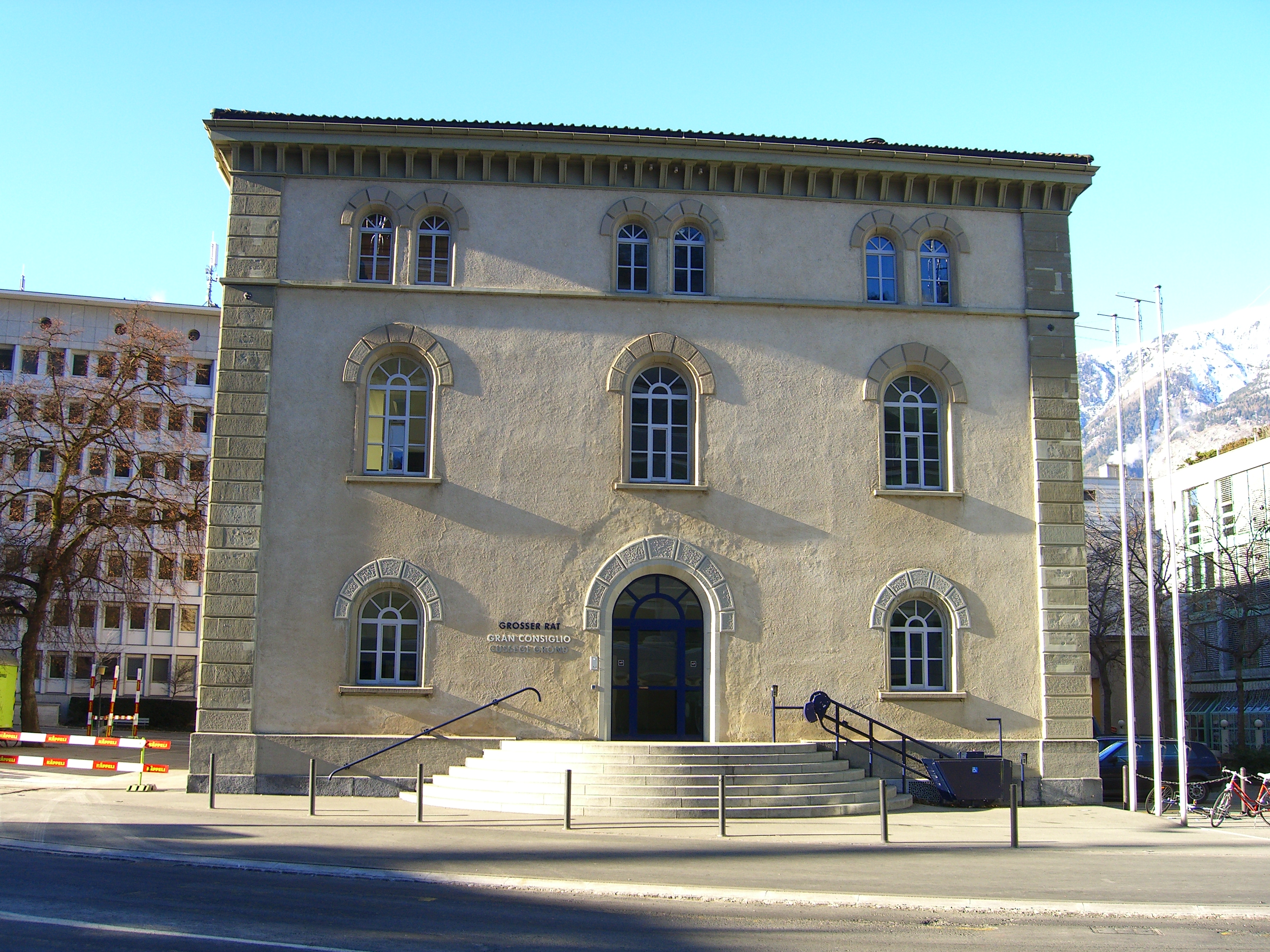
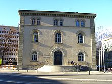 Grand Council building in Chur
The Grand Council (German: Grosse Rat; Italian: Gran Consiglio, Romansh: Cussegl Grond), the legislature of the canton, sits in Chur, the cantonal capital. Its 120 members, elected in 39 districts using a majority system, are in office for four years. The next district elections are scheduled for 2014.[12] The cantonal government, exercising executive authority, is made up of five members, elected by the parliament for a term of four years and limited to two terms. The current President of Government is Hansjörg Trachsel.[13]
The constitution of Graubünden, last revised on 14 September 2003, states in its preamble that the canton's purpose is to "safeguard freedom, peace, and human dignity, ensure democracy and the Rechtsstaat, promote prosperity and social justice and preserving a sane environment for the future generations, with the intention of promoting trilingualism and cultural variety and conserving them as part of our historical heritage".[14]
The constitution allows for the enfranchisement of foreign residents at a municipal level, at discretion of the local governments. In 2009, the municipality of Bregaglia became the first in the canton to make use of this provision, granting voting rights to foreigners.[15]
Political subdivisions
Districts
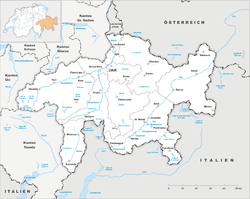
 Districts of Graubünden
Graubünden is divided into 11 districts:
- Albula with capital Tiefencastel
- Bernina with capital Poschiavo
- Hinterrhein with capital Thusis
- Imboden with capital Domat/Ems
- Inn with capital Scuol
- Landquart with capital Igis
- Maloja with capital Samedan
- Moesa with capital Roveredo
- Plessur with capital Chur
- Prättigau/Davos with capital Davos
- Surselva with capital Ilanz
Municipalities
There are 190 municipalities in the canton (as of January 2009[update]).[16]
Demographics
The population of the canton (as of 31 December 2009) is 191,861.[2] As of 2007[update], the population included 28,008 foreigners, or about 14.84% of the total population.[17] The main religions are Catholicism and Protestantism. Both are well-represented in the canton, with Roman Catholics forming a slight plurality (47% Catholic to 41% Protestant).[18] There is a linguistic element to the religions, for the canton's German-speakers have been majority Protestant, whereas the Italian and Romansh speakers (and their descendants who may no longer speak those languages) are majority Roman Catholic.
Languages
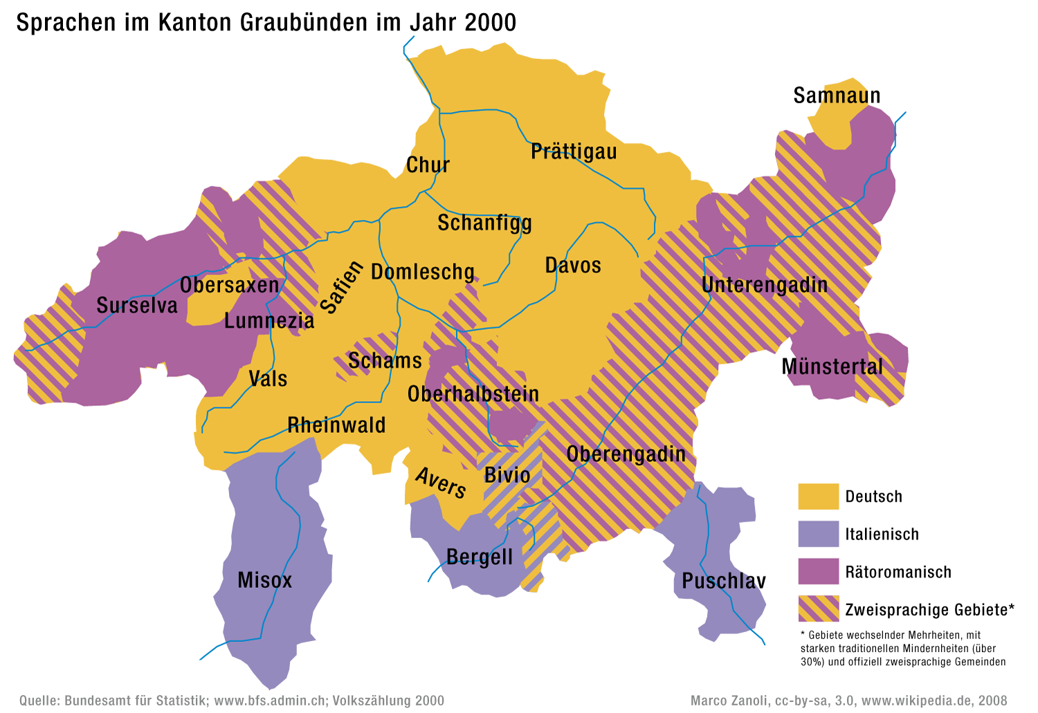
See also: Italian Graubünden Geographical distribution of languages in Graubünden
Graubünden is the only canton of Switzerland with three official languages: German in the northwest (68%), Romansh in the Engadin and around Disentis/Mustér (15%), and Italian in the Italian Graubünden (10%) with the remaining 7% speaking another language.[19] Western Lombard is also spoken, primarily in the region of Val Poschiavo, though it has no official recognition.
Romansh is an umbrella term covering a group of closely related dialects, spoken in southern Switzerland and all belonging to the Rhaeto-Romance language family. These dialects include Sursilvan, Sutsilvan, Surmiran, Puter and Vallader. Romansh was nationally standardised in 1982 by Zürich-based linguist Heinrich Schmid. The standardised language, called Rumantsch Grischun, has been slowly accepted. Romansh has been recognized as one of four "national languages" by the Swiss Federal Constitution since 1938. It was also declared an "official language" of the Confederation in 1996, meaning that Romansh speakers may use Rumantsch Grischun for correspondence with the federal government and expect to receive a response in the same language. Romansh has a status of an official language at a cantonal level. Municipalities in turn are free to specify their own official languages. Before the introduction of the official written form of Rumantsch Grischuni in 2003, books for pupils in public schools were printed in the five different idioms throughout the state.
Economy

Agriculture is still essential to keep remote valleys inhabited and is therefore supported by subsidies by the authorities both national and regional. Eight percent of the population work in agriculture and forestry, where 50 per cent of the production is certified as organic. Agriculture includes forests and mountain pasturage in summer, particularly of cows, sheep and goats. There is wine production in the Rhine Valley north to the capital Chur. 24 per cent of the workforce are employed in industry whereas 68 per cent work in the service industry where tourism reaches a remarkable 14 per cent of the GDP. Tourism is concentrated around the towns of Davos/Arosa, Flims and St. Moritz/Pontresina. There are, however, a great number of other tourist resorts in the canton, divided by the official tourist board for winter sports for example into categories "Top - Large - Small and beautiful" -yet still not including all of them...[20]
The Chur area is also an industrial centre. In the southern valleys of Mesolcina and Poschiavo there is corn (maize) and chestnut farming.
Transport
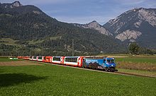
Transport has always been an important issue in the area; cart tracks from the Roman era were found on Julierpass and Septimerpass was rebuilt for cart use in 1387 and, although it later became unimportant, it is still in its 1800 form (for hikers only). Corniche paths were necessary for long stretches, and gorges such as the Viamala gave construction problems for any kind of transport. The first real roads of 4 yards width were built across the Alps from around 1816, one of which is still in a very good historical condition[21] as this connection across Splügen Pass lost its importance after the opening of rail tunnels crossing the alps. The last valley to be connected to the road system in the state of Graubünden was Avers, whose remote hamlet of Juf was only reached in 1897. Eventually, the inhabitants of Graubünden gave up their resistance against individual motor traffic in 1926,[22] and the 1967 opened San Bernardino road tunnel, built to host tourism traffic, is used also by heavy goods vehicles nowadays although not really suitable for them for its ascent gradients. Most other passes have lost their importance for goods transport nowadays. Huge efforts ensure Public transport to (nearly) every settlement by an integrated timetable of postbuses and the Rhaetian Railway, the largest narrow-gauge railway network in Switzerland, in which the cantonal government is the largest shareholder. Even Juf, inhabited by some 30 people only but holding an European record, is reached 5 times a day by public transport. The Swiss Federal Railways extend only a few kilometres into the canton, to the capital, Chur, where passengers transfer to the Rhaetian Railway. "Rhaetia" is the Latin name for the area. The Albula Line became a UNESCO world heritage as did the Bernina Railway, the highest and only railway to cross the alps without the use of a tunnel at the pass. In winter some of the road passes are closed [23] whereas several high mountain passes such as the Julier, Bernina and Lukmanier are kept open all winter (subject to restrictions). Being the highest elevated state in Switzerland, Graubünden hosts huge alpine areas that are not accessible by any means of transport but have to be walked to.[24]
Culture
The canton is known as a region with a high density of medieval castles (and ruins) for example in the Domleschg area. Close by lies the church of Zillis, where 1130/40 a famous romanesque illustrated ceiling was added which is now treated as national heritage. Three World Heritage Sites are located in the canton: the Benedictine Convent of Saint John, the Swiss Tectonic Arena Sardona and the Rhaetian Railway in the Albula and Bernina Landscapes.
The Graubünden are known for a dried-beef delicacy called Bündnerfleisch and for a nut and honey pie known as Bündner Nusstorte. Another specialty, predominantly made in the western part of Grison, is Capuns[25] a hearty meal of meat, cheese and chard leaves.
See also
References
- ^ Arealstatistik Standard - Kantonsdaten nach 4 Hauptbereichen
- ^ a b Swiss Federal Statistical Office, MS Excel document – Bilanz der ständigen Wohnbevölkerung nach Kantonen, Bezirken und Gemeinden (German) accessed 25 August 2010
- ^ European Commission for Democracy through Law, The protection of national minorities by their kin-state, Council of Europe, 2002, ISBN 978-92-87-1508-20, p.308
- ^ American Geophysical Union, Journal of geophysical research, Vol. 110, William Byrd Press for Johns Hopkins Press, 2005
- ^ a b Federal Department of Statistics (2008). "Regional Statistics for Graubünden". http://www.bfs.admin.ch/bfs/portal/de/index/regionen/regionalportraets/graubuenden/blank/kennzahlen.html. Retrieved 2008-11-23.
- ^ Destinations on official tourism board Graubünden, Switzerland holiday destinations
- ^ Grauer Bund in Romansh, German, French and Italian in the online Historical Dictionary of Switzerland.
- ^ Eidgenossenschaft - Konsolidierung und Erweiterung (1353-1515) in German, French and Italian in the online Historical Dictionary of Switzerland.
- ^ Graubünden, section 3.1.4 - Landesherrschaft und Widerstand im Norden in German, French and Italian in the online Historical Dictionary of Switzerland.
- ^ Graubünden, section 3.2.4 - Verfassung und Landesgesetze in German, French and Italian in the online Historical Dictionary of Switzerland.
- ^ Graubünden, section 4.2.2-Von 1848 bis heute in German, French and Italian in the online Historical Dictionary of Switzerland.
- ^ ""Der Grosse Rat" Parliament of the Canton Grisons". Portal of the Canton Grisons. http://www.gr.ch/EN/institutions/parliament/Seiten/Parlament.aspx. Retrieved 8 July 2009.
- ^ "Government of the Canton Grisons". Portal of the Canton Grisons. http://www.gr.ch/EN/INSTITUTIONS/GOVERNMENT/Seiten/Regierung.aspx. Retrieved 8 July 2009.
- ^ "Constitution of the canton of Graubünden" (in Italian and German). Federal Authorities of the Swiss Confederation. http://www.admin.ch/ch/i/rs/131_226/index.html. Retrieved 8 July 2009.
- ^ "Comune Bregaglia accorda diritto di voto e di eleggibilità a stranieri domiciliati" (in Italian). swissinfo. 2009-05-17. http://www.swissinfo.ch/ita/prima_pagina.html?siteSect=105&ty=nd&ref=fb&sid=10708358. Retrieved 8 July 2009.
- ^ "Répertoire officiel des communes de Suisse". Statistique Suisse. 2009-01-01. http://www.bfs.admin.ch/bfs/portal/fr/index/infothek/nomenklaturen/blank/blank/gem_liste/03.Document.90142.xls. Retrieved 10 July 2009.
- ^ Federal Department of Statistics (2008). "Ständige Wohnbevölkerung nach Staatsangehörigkeit, Geschlecht und Kantonen" (Microsoft Excel). http://www.bfs.admin.ch/bfs/portal/de/index/themen/01/02/blank/key/raeumliche_verteilung/kantone__gemeinden.html. Retrieved November 5, 2008.
- ^ Federal Department of Statistics (2008). "Wohnbevölkerung nach Religion, nach Kantonen und Städten" (Microsoft Excel). http://www.bfs.admin.ch/bfs/portal/de/index/themen/01/05/blank/key/religionen.html. Retrieved 2008-10-06.
- ^ (German) (Italian)Canton of Graubünden Website accessed October 26, 2008
- ^ Switzerland holidays Graubünden winter
- ^ (English)Historic route across Alps Splügen Pass hike in Switzerland
- ^ (English)Facts for Graubünden Switzerland
- ^ (German)statistical pass closures in Graubünden
- ^ (English)Hike the alps in Switzerland; Information, Graubünden
- ^ Capuns recipe
External links
- Portal of the Canton Grisons – Official website
- Graubünden Tourism
- Official Statistics
- Graubünden in Romansh, German, French and Italian in the online Historical Dictionary of Switzerland.
Three Cantons · Eight Cantons · Thirteen Cantons · coats of arms historical cantons: Unterwalden ·
  Basel ·
  Appenzell · Baden · Bellinzona · Fricktal · Léman · Linth · Lugano · Oberland · Raetia · Säntis · WaldstättenCategories:
- Cantons of Switzerland
- Graubünden
- Regions of Europe with multiple official languages


Wikimedia Foundation. 2010.