- Maienfeld
-
Maienfeld 
Country Switzerland 
Canton Graubünden District Landquart 47°0′N 9°33′E / 47°N 9.55°ECoordinates: 47°0′N 9°33′E / 47°N 9.55°E Population 2,588 (Dec 2009)[1] - Density 80 /km2 (207 /sq mi) Area 32.34 km2 (12.49 sq mi) Elevation 635 m (2,083 ft) - Highest 2574 m - Hinter Grauspitz Postal code 7307 SFOS number 3953 Mayor Christian Möhr (as of 2008) Surrounded by Bad Ragaz (SG), Balzers (LI), Fläsch, Igis, Jenins, Malans, Mastrils, Nenzing (AT-8), Schaan (LI), Seewis im Prättigau, Triesen (LI), Zizers Twin towns Cortaillod (Switzerland) Website www.maienfeld.ch
SFSO statistics
 Maienfeld
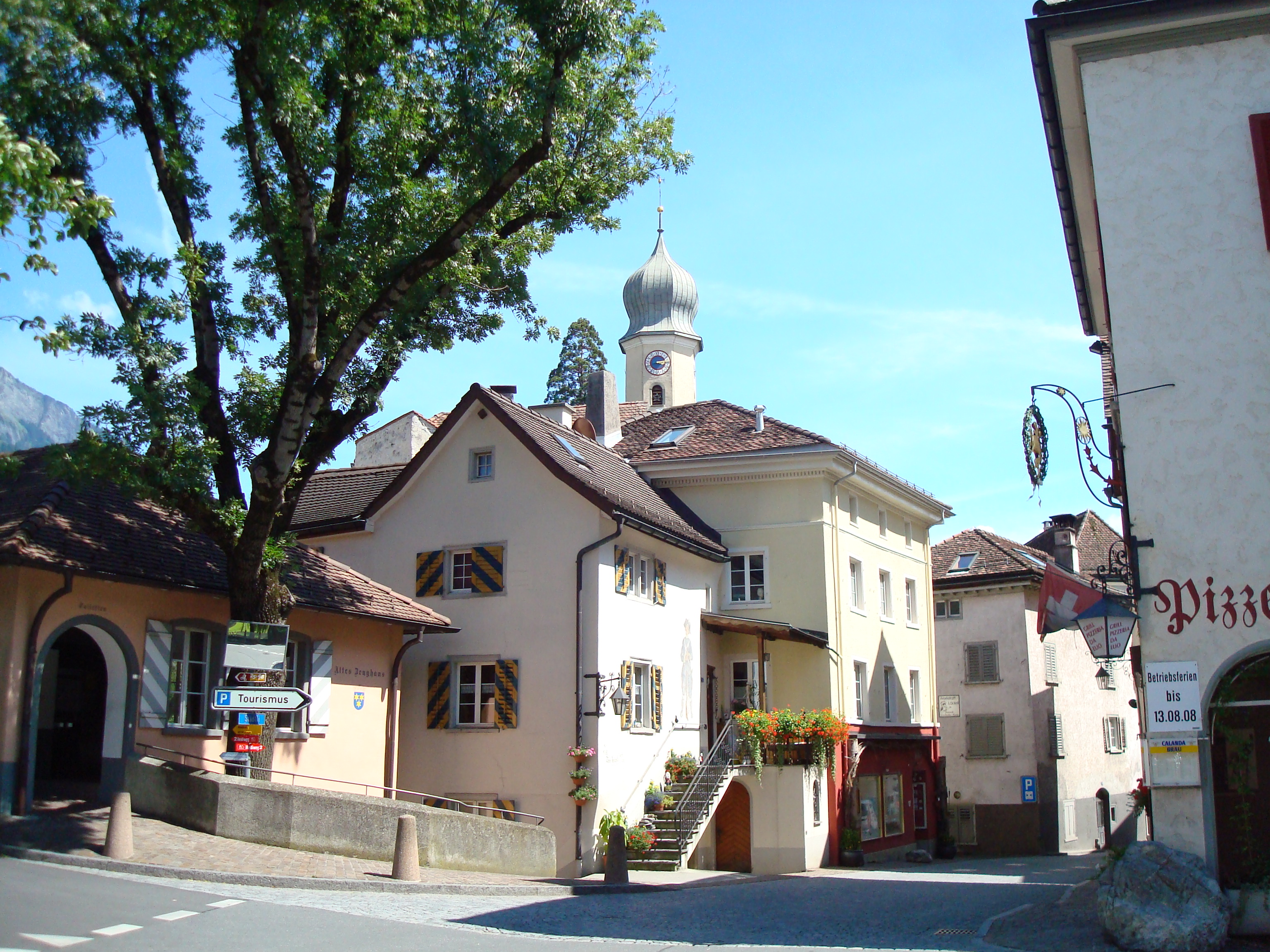
View map of Maienfeld Maienfeld is a municipality in the district of Landquart in the Swiss canton of Graubünden. It is a tourist destination in the Alps, both because of the local wine and because it was the setting of the story Heidi.
Contents
History
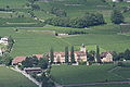
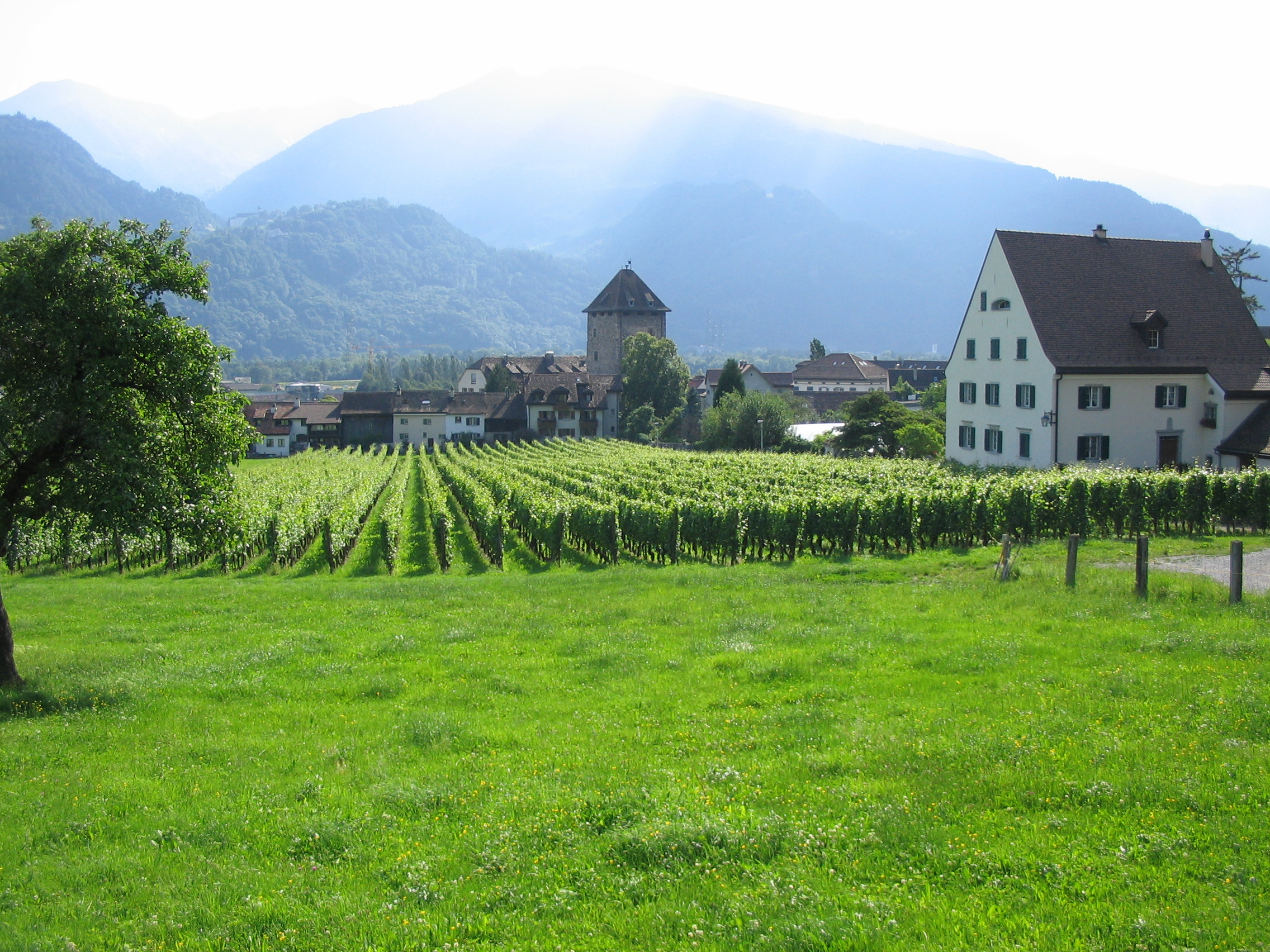
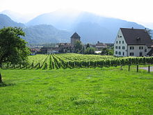 Schloss Brandis with vineyards in the foreground
Maienfeld lies along a key route through the Rhine Valley in the Alps. A settlement has existed in the Maienfeld area since at least the invasion of the Roman Empire.[2] Prehistoric Bronze work and a pre-Roman cellar have been found in the city and on St. Luzisteig hill.[3] A 3rd century Roman station or settlement has been found along the old Roman Road.[2]
The village is first mentioned in 831 and was known as Lupinis at that time. The name of the village changed several times over the following centuries and included; Magenza, Lopine, Maging and Magen zu Luppinis. Finally, in 1295 the name Maienvelt was used, which eventually became Maienfeld.[3]
From the mid 10th century until the mid 12th century, the counts of Bregenz ruled Maienfeld. Their castle at Maienfeld was destroyed in 1079 by Henry IV, HRE during the Investiture Controversy. The current Schloss Brandis was initially built in 1270–75 by the von den Aspermont family and later by Friedrich VII, count of Toggenburg. In 1465 it was rebuilt and expanded by the Baron von Brandis.
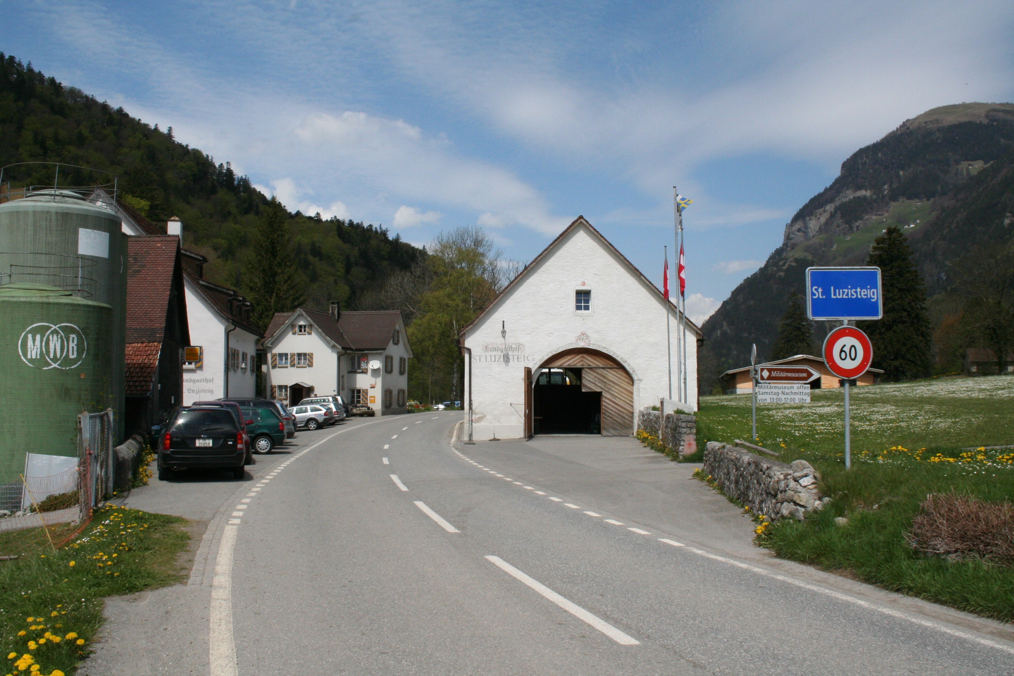
 St. Luzisteig pass
Maienfeld is first mentioned as a city in 1346, however it seems to have lacked a city government (until 1437) or guilds. In 1388 Maienfeld acquired the rights to charge a toll on the Roman Road that led from Chur over the St. Luzisteig to the north. Maienfeld also had a market, though the neighboring city of Malans had the market right. Following the death of the Toggenburger line, Maienfeld joined the League of the Ten Jurisdictions in 1436. In 1438 the city reached an agreement with the von Brandis and von Aarburg (inheritors of some Toggenburg lands) families. The agreement gave Maienfeld a set of rights and gave the city the right to Low Justice over the communities of Malans and Jenins.[2]
During the 14th century the Walser moved into the Maienfeld area and founded settlements that eventually became the Walser part of town. However, it would take several centuries until the Walser were granted full citizen rights. Maienfeld had been fully Romansh before this time, but during the Germanic-speaking Walser immigration Maienfeld became Germanized. By the 16th century the region was nearly completely Germanic.
In 1509 the Three Leagues bought Maienfeld from the von Brandis and put the city under the Protectorate of the Three Leagues. This led to an unusual situation where Maienfeld, as a voting member of the League of the Ten Jurisdictions and therefore a voting member of the Three Leagues, was also under the protection and control of the Three Leagues. Maienfeld indirectly set policy for managing Maienfeld.
Description
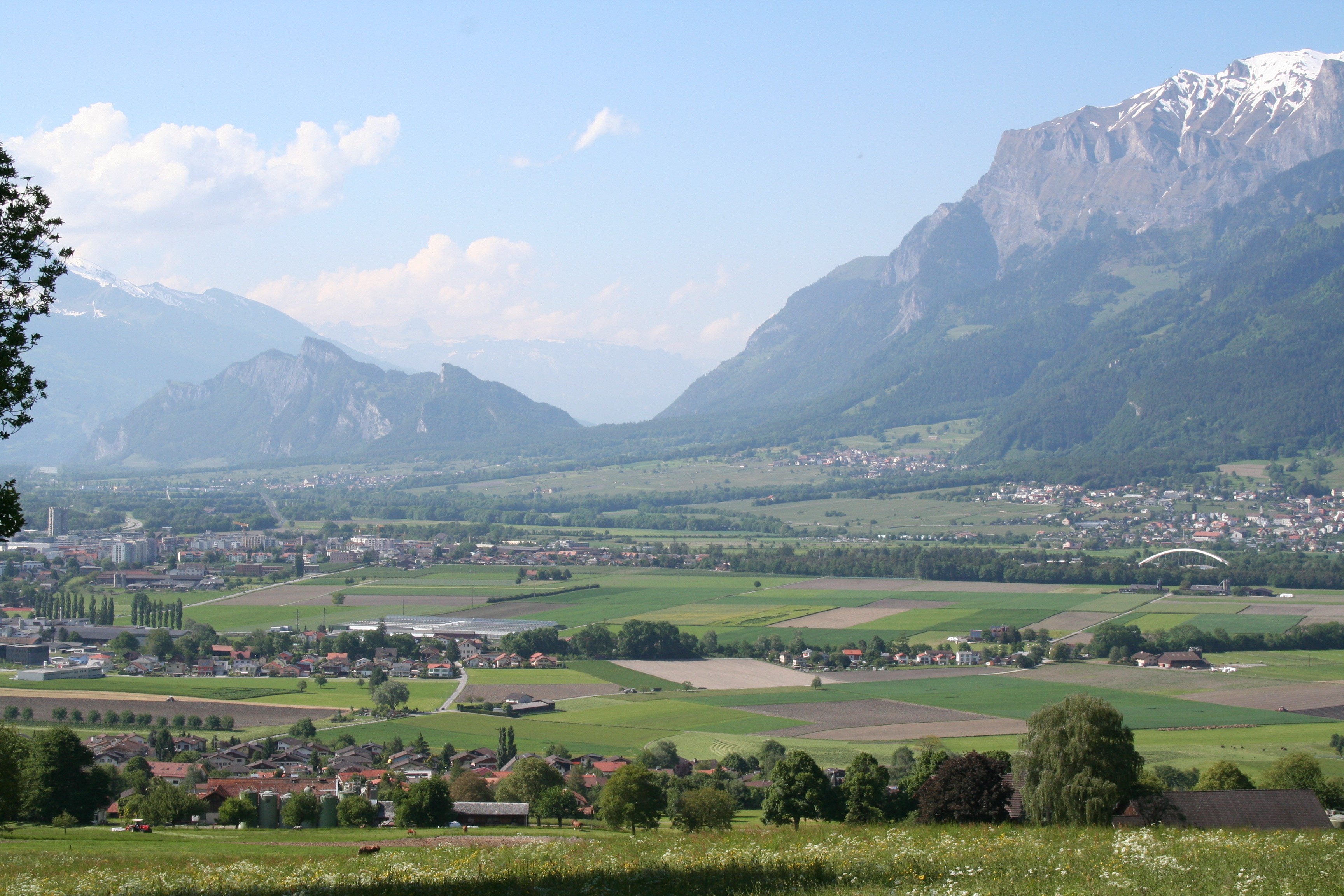
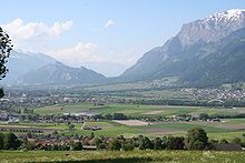 Chur Rhein valley, (l to r) Landquart, Maienfeld, Jenins and Malans.
Maienfeld is located 8 kilometers (5.0 mi) southeast of Sargans in the lower Chur Rhein valley. It is bordered on the west by Bad Ragaz, Canton of St. Gallen and on the west and north by the community of Fläsch, Canton Graubünden. To the north it is bordered by Balzers, Triesen, Schaan, the country of Liechtenstein, Nenzing and Vorarlberg, Austria. To the east is the community of Seewis im Prättigau, Canton Graubünden. To the southwest Jenins und Malans, Canton Graubünden. In the south it is bordered by Igis and Zizers, Canton Graubünden, as well as in the southwest the community of Mastrils, Canton Graubünden.
Maienfeld is located on the right side of the Rhein valley and includes the boroughs of; Bovel, Rofels und St. Luzisteig. St. Luzisteig is the site of an important alpine pass, which leads into Liechtenstein, and is guarded by an 18th-century fortress that is now barracks for the Swiss Army.
The old Walser settlement Stürfis was abandoned by 1633 and became a part of Maienfeld, when the inhabitants moved to Rofels. In contrast, the Walser settlement Guscha was occupied until 1969 when the last two families were bought out by the Swiss Army and the village became part of their training area.
The city of Maienfeld has an area, as of 2006[update], of 32.4 km2 (12.5 sq mi), of which about 6 km2 (2.3 sq mi) or about 44.3% is used for agricultural purposes and about 10.5 km2 (4.1 sq mi) or 31.9% is forested. Of the rest of the land, 5.4% is settled (buildings or roads) and the remainder (18.4%) is non-productive (rivers, glaciers or mountains).[4] The train station in the city is located at 502 m or 1,647 ft (502 m) above sea level. The highest point in the city boundaries is the Hinterer Grauspitz mountain, which is 2574 m (8445 ft) high. There are 2523 inhabitants in the city (as of November 2006).[3]
Demographics
Maienfeld has a population (as of 31 December 2009) of 2,588.[1] As of 2008[update], 11.2% of the population was made up of foreign nationals.[5] Over the last 10 years the population has grown at a rate of 14.4%. Most of the population (as of 2000[update]) speaks German (92.1%), with Portuguese being second most common ( 1.5%) and Romansh being third ( 1.4%).[4]
As of 2000[update], the gender distribution of the population was 50.1% male and 49.9% female.[6] The age distribution, as of 2000[update], in Maienfeld is; 245 children or 10.3% of the population are between 0 to 9 years old. 137 teenagers or 5.8% are 10 to 14, and 152 teenagers or 6.4% are 15 to 19. Of the adult population, 246 people or 10.4% of the population are between 20 to 29 years old. 404 people or 17.1% are 30 to 39, 351 people or 14.8% are 40 to 49, and 307 people or 13.0% are 50 to 59. The senior population distribution is 203 people or 8.6% of the population are between 60 to 69 years old, 168 people or 7.1% are 70 to 79, there are 120 people or 5.1% who are 80 to 89, there are 34 people or 1.4% who are 90 to 99, and 1 person or 0.0% who is 100 or more.[5]
In the 2007 federal election the most popular party was the SVP which received 42% of the vote. The next three most popular parties were the FDP (28.7%), the SP (20%) and the CVP (8%).[4]
The entire Swiss population is generally well educated. In Maienfeld about 79.1% of the population (between age 25–64) have completed either non-mandatory upper secondary education or additional higher education (either university or a Fachhochschule).[4]
Maienfeld has an unemployment rate of 1.23%. As of 2005[update], there were 199 people employed in the primary economic sector and about 63 businesses involved in this sector. 400 people are employed in the secondary sector and there are 45 businesses in this sector. 656 people are employed in the tertiary sector, with 111 businesses in this sector.[4]
From the 2000 census[update], 689 or 29.1% are Roman Catholic, while 1,384 or 58.4% belonged to the Swiss Reformed Church. Of the rest of the population, there are 20 individuals (or about 0.84% of the population) who belong to the Orthodox Church, and there are 32 individuals (or about 1.35% of the population) who belong to another Christian church. There are 35 (or about 1.48% of the population) who are Islamic. There are 5 individuals (or about 0.21% of the population) who belong to another church (not listed on the census), 129 (or about 5.45% of the population) belong to no church, are agnostic or atheist, and 74 individuals (or about 3.13% of the population) did not answer the question.[5]
The historical population is given in the following table:[6][7]
year population 1850 1,232 1900 1,240 1950 1,568 1960 1,488 1970 1,542 1980 1,716 1990 1,990 2000 2,368 Tourism
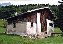 Heidihaus in Maienfeld
Johanna Spyri's classic book Heidi is largely set in Maienfeld.
Heritage sites of national significance
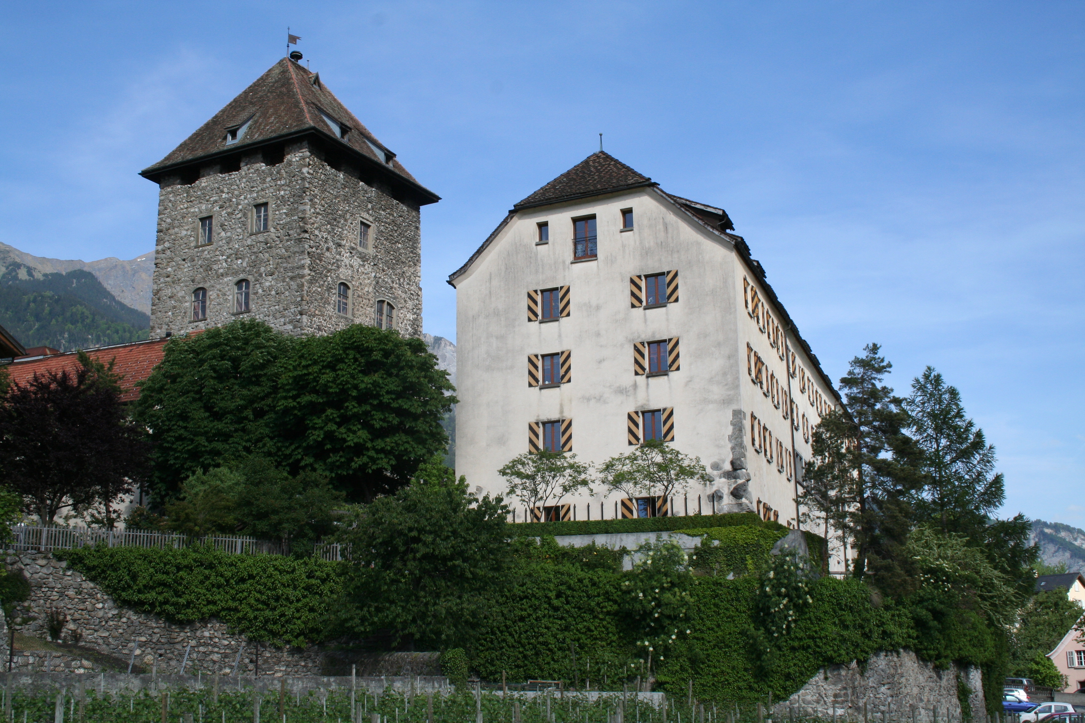
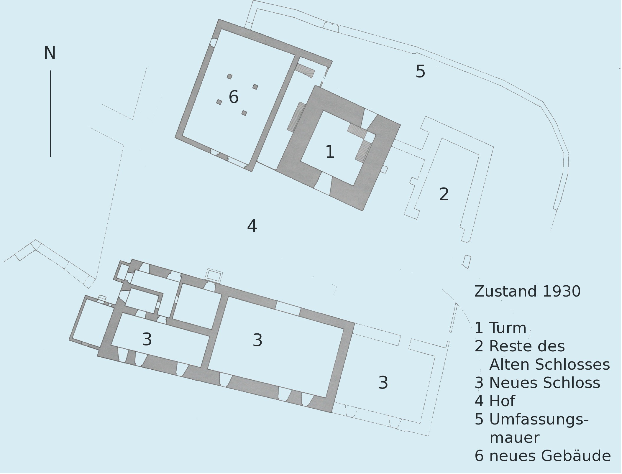
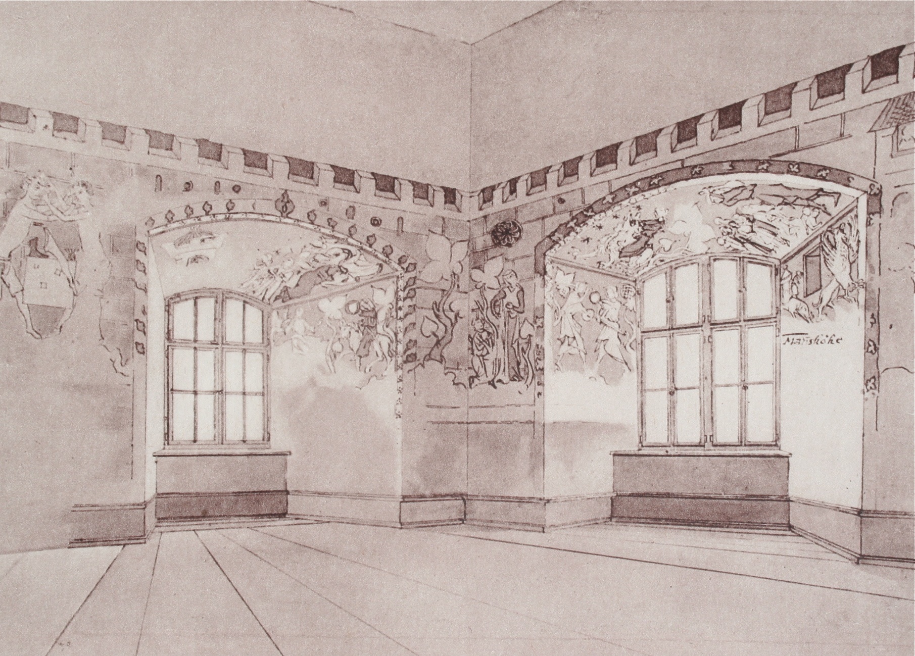
Both Brandis Castle and Salenegg Castle are listed as Swiss heritage sites of national significance.[8]
-
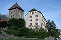
Brandis Castle
-
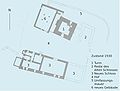
Brandis Castle floorplan
-
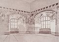
Sketch of the paintings inside Brandis Castle
-
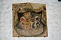
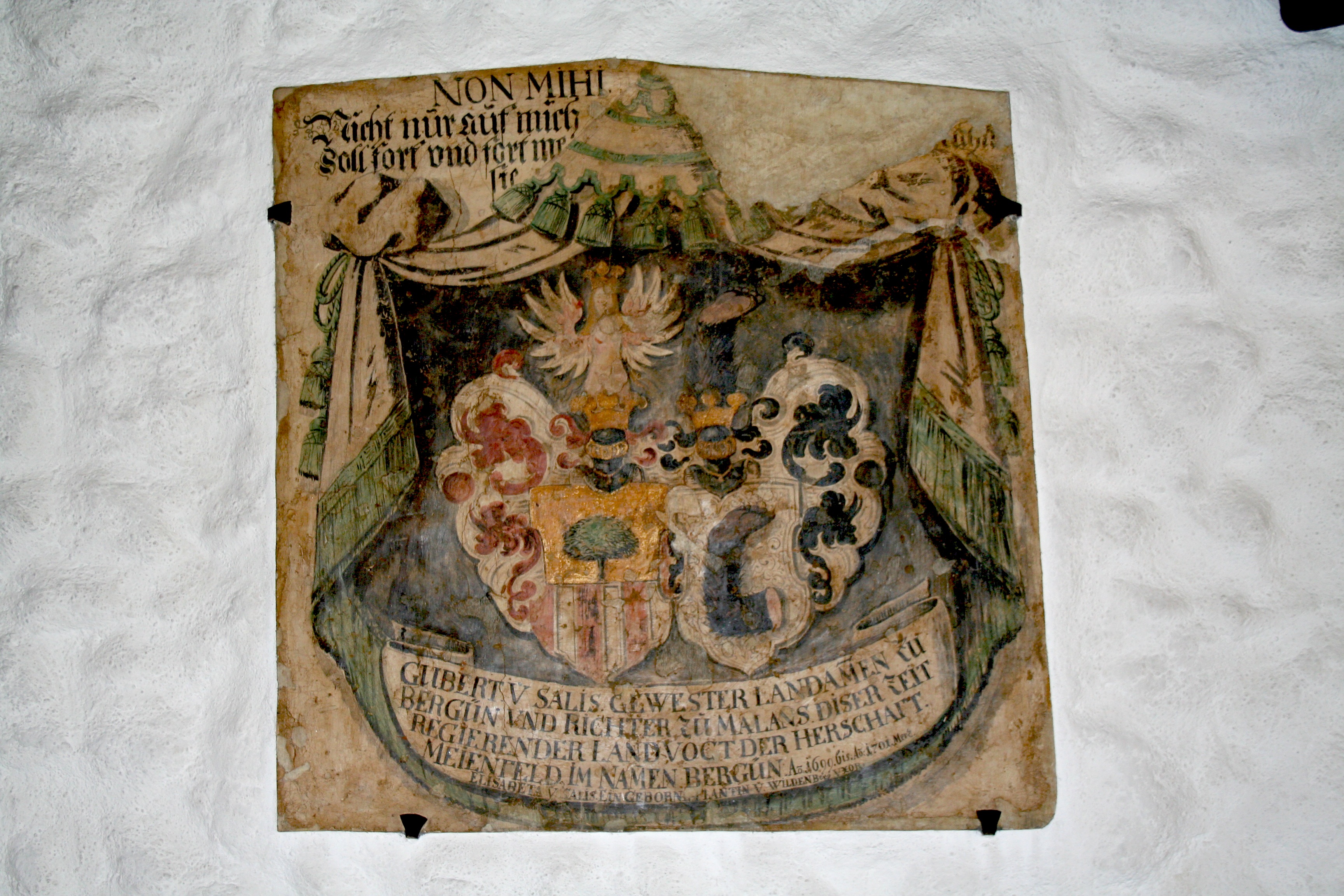
Coat of Arms at Brandis Castle
-
Salenegg Castle
References
- ^ a b Swiss Federal Statistical Office, MS Excel document – Bilanz der ständigen Wohnbevölkerung nach Kantonen, Bezirken und Gemeinden (German) accessed 25 August 2010
- ^ a b c Maienfeld in Romansh, German, French and Italian in the online Historical Dictionary of Switzerland.
- ^ a b c (German) City of Maienfeld
- ^ a b c d e Swiss Federal Statistical Office accessed 16 October 2009
- ^ a b c Graubunden Population Statistics (German) accessed 21 September 2009
- ^ a b Graubunden in Numbers (German) accessed 21 September 2009
- ^ Maienfeld in German, French and Italian in the online Historical Dictionary of Switzerland.
- ^ Swiss inventory of cultural property of national and regional significance 21 November 2008 version, (German) accessed 16 October 2009
External links
 Media related to Maienfeld at Wikimedia Commons
- Maienfeld in Romansh, German, French and Italian in the online Historical Dictionary of Switzerland.
- This article incorporates information from the revision as of 21 January 2008 of the equivalent article on the German Wikipedia.
Fläsch | Haldenstein | Igis | Jenins | Maienfeld | Malans | Mastrils | Trimmis | Untervaz | Zizers
Graubünden | Districts of Canton Graubünden | Municipalities of the canton of Graubünden
 Categories:
- Municipalities of Graubünden
- Municipalities of Switzerland
- Cities in Switzerland
- Cultural property of national significance in the canton of Graubünden
-


Wikimedia Foundation. 2010.