- Mastrils
-
Mastrils 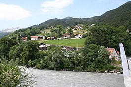
Country Switzerland 
Canton Graubünden District Landquart 46°58′N 9°32′E / 46.967°N 9.533°ECoordinates: 46°58′N 9°32′E / 46.967°N 9.533°E Population 557 (Dec 2009)[1] - Density 70 /km2 (181 /sq mi) Area 7.98 km2 (3.08 sq mi) Elevation 550 m (1,804 ft) Postal code 7303 SFOS number 3943 Surrounded by Bad Ragaz (SG), Igis, Maienfeld, Pfäfers (SG), Untervaz, Zizers Website www.mastrils.ch
SFSO statistics
 Mastrils
View map of Mastrils Mastrils is a municipality in the district of Landquart in the Swiss canton of Graubünden.
Contents
History
Mastrils is first mentioned in 1318 as Ponstrils. In 1345 it was mentioned as Bastrils.[2] In 1854 the municipality separated from Zizers to become an independent municipality.[3]
Geography
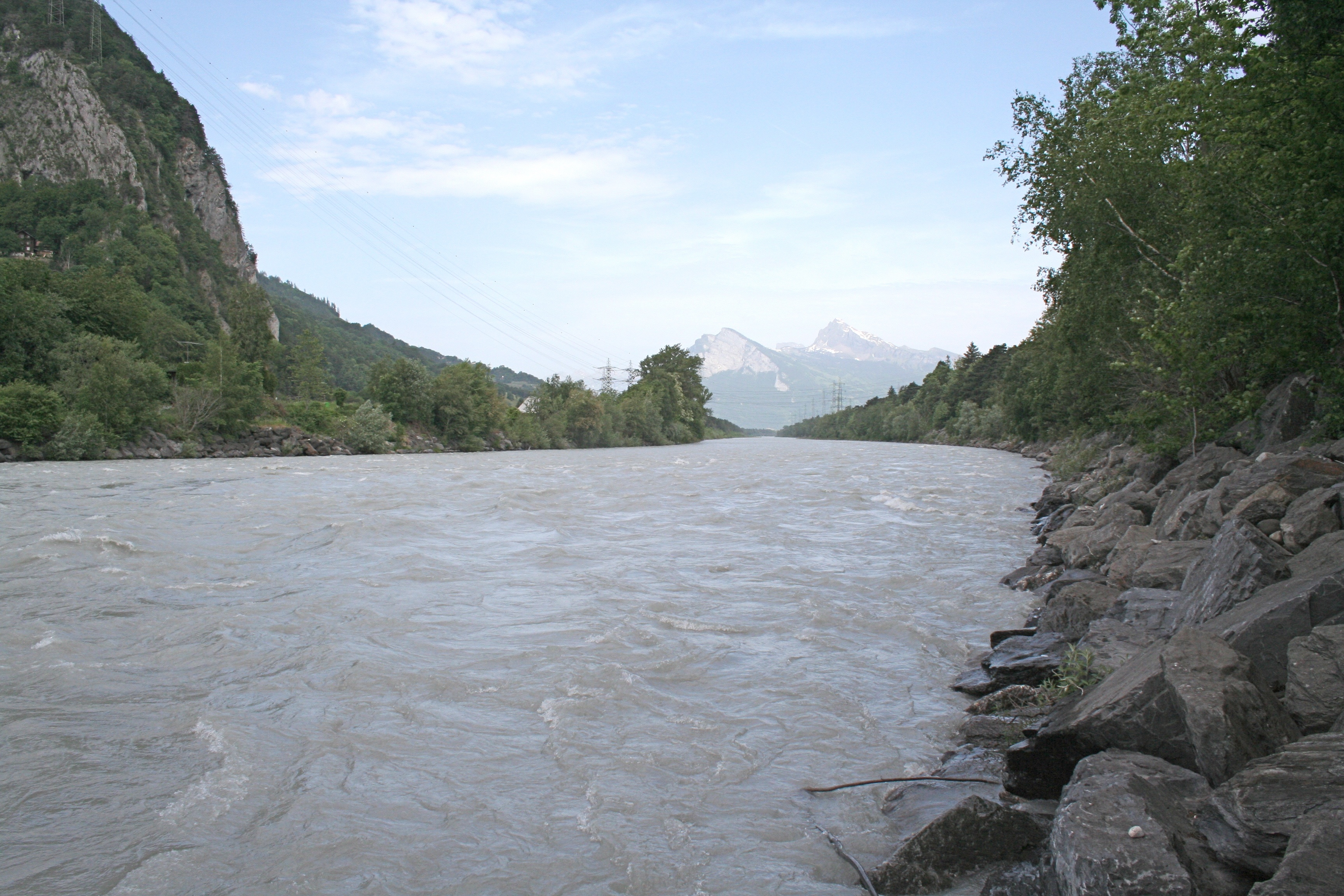
 Rhein river near Mastrils
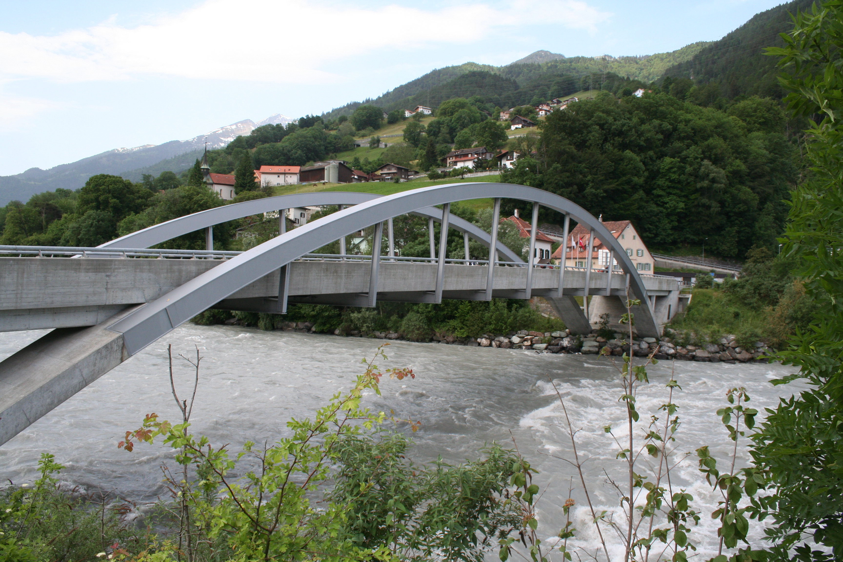
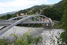 Tardisbrücke village and Tardis bridge (in German: Tardisbrücke)
Mastrils has an area, as of 2006[update], of 8 km2 (3.1 sq mi). Of this area, 23.9% is used for agricultural purposes, while 68.8% is forested. Of the rest of the land, 2.5% is settled (buildings or roads) and the remainder (4.9%) is non-productive (rivers, glaciers or mountains).[4]
The municipality is located in the Fünf Dörfer sub-district of the Landquart district. It is a widely scattered settlement on in the foothills of the Calanda mountains. It consists of the settlements of Isla, Tardisbrücke and Trätsch.
Demographics
Mastrils has a population (as of 31 December 2009) of 557.[1] As of 2008[update], 8.5% of the population was made up of foreign nationals.[5] Over the last 10 years the population has grown at a rate of 1.1%. Most of the population (as of 2000[update]) speaks German (93.0%), with Italian being second most common ( 1.9%) and Romansh being third ( 1.5%).[4]
As of 2000[update], the gender distribution of the population was 49.4% male and 50.6% female.[6] The age distribution, as of 2000[update], in Mastrils is; 54 children or 10.2% of the population are between 0 to 9 years old. 31 teenagers or 5.9% are 10 to 14, and 48 teenagers or 9.1% are 15 to 19. Of the adult population, 53 people or 10.0% of the population are between 20 to 29 years old. 88 people or 16.6% are 30 to 39, 86 people or 16.3% are 40 to 49, and 82 people or 15.5% are 50 to 59. The senior population distribution is 38 people or 7.2% of the population are between 60 to 69 years old, 38 people or 7.2% are 70 to 79, there are 10 people or 1.9% who are 80 to 89, and there are 1 people or 0.2% who are 90 to 99.[5]
In the 2007 federal election the most popular party was the SVP which received 35.8% of the vote. The next three most popular parties were the SP (29%), the CVP (14.8%) and the FDP (14.4%).[4]
The entire Swiss population is generally well educated. In Mastrils about 71.8% of the population (between age 25-64) have completed either non-mandatory upper secondary education or additional higher education (either university or a Fachhochschule).[4]
Mastrils has an unemployment rate of 1.08%. As of 2005[update], there were 36 people employed in the primary economic sector and about 16 businesses involved in this sector. 14 people are employed in the secondary sector and there are 5 businesses in this sector. 44 people are employed in the tertiary sector, with 12 businesses in this sector.[4]
The historical population is given in the following table:[2]
year population 1850 460 1900 322 1950 433 1970 464 1990 585 2000 529 References
- ^ a b Swiss Federal Statistical Office, MS Excel document – Bilanz der ständigen Wohnbevölkerung nach Kantonen, Bezirken und Gemeinden (German) accessed 25 August 2010
- ^ a b Mastrils in German, French and Italian in the online Historical Dictionary of Switzerland.
- ^ Amtliches Gemeindeverzeichnis der Schweiz published by the Swiss Federal Statistical Office (German) accessed 23 September 2009
- ^ a b c d e Swiss Federal Statistical Office accessed 15-Oct-2009
- ^ a b Graubunden Population Statistics (German) accessed 21 September 2009
- ^ Graubunden in Numbers (German) accessed 21 September 2009
External links
Fläsch | Haldenstein | Igis | Jenins | Maienfeld | Malans | Mastrils | Trimmis | Untervaz | Zizers
Graubünden | Districts of Canton Graubünden | Municipalities of the canton of Graubünden
 Categories:
- Municipalities of Graubünden
- Municipalities of Switzerland


Wikimedia Foundation. 2010.