Rätikon

Rätikon

Geobox|Range
name=Rätikon


image_caption=Schesaplana
country=Austria| country1 = Switzerland| country2=Liechtenstein
state= Vorarlberg| state1=Graubünden| state2=
parent=Central Eastern Alps
border=Silvretta| border1=Verwall Alps| border2=Plessur Range
highest=Schesaplana
highest_elevation=2964
highest_lat_d=47|highest_lat_m=3|highest_lat_s=14|highest_lat_NS=N
highest_long_d=9|highest_long_m=42|highest_long_s=46|highest_long_EW=E
geology= | period= |orogeny=
area= | length= | length_orientation=
width= | width_orientation=


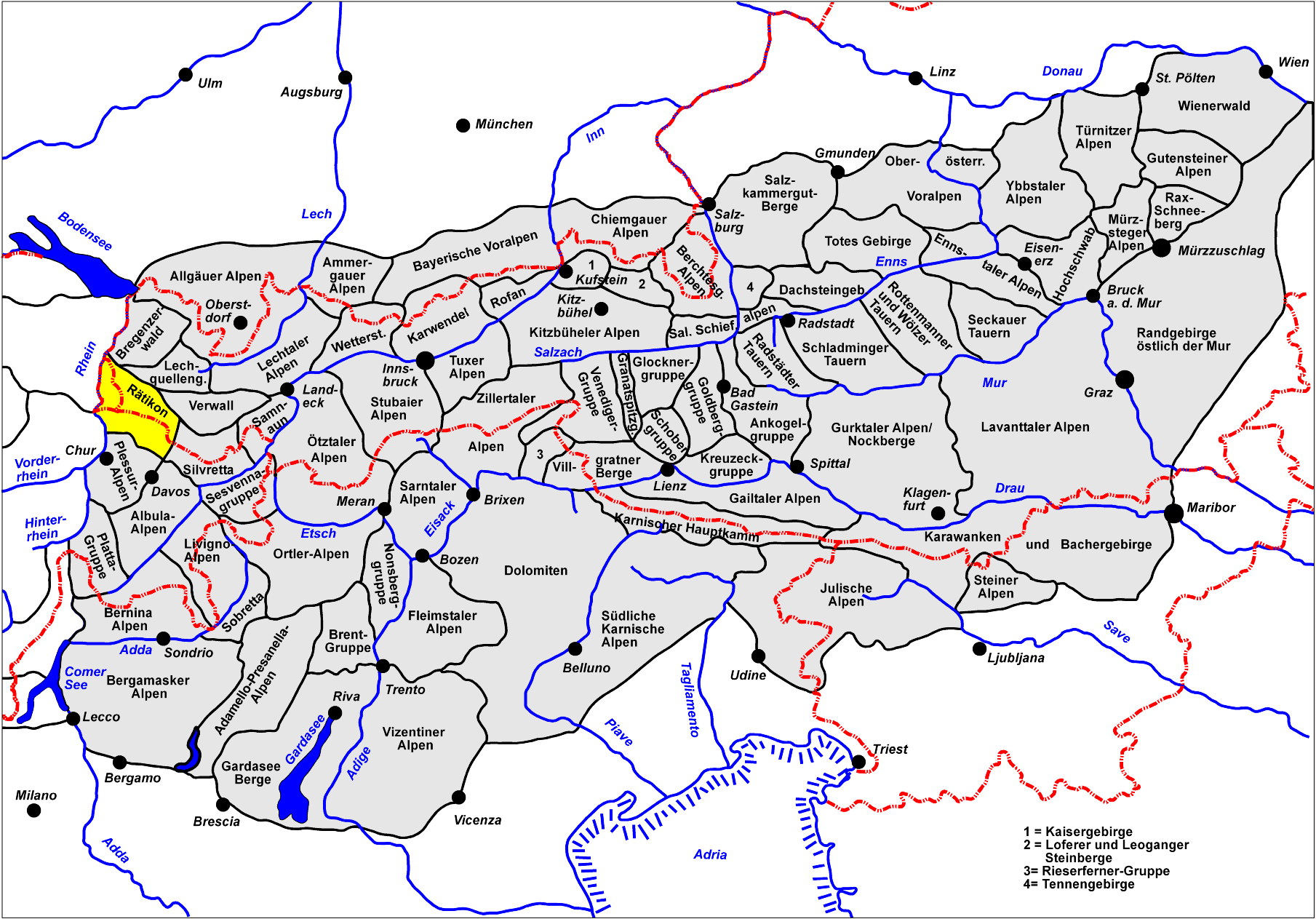
map_caption=Location of the Rätikon range

The Rätikon is a mountain range of the Central Eastern Alps located at the border between Vorarlberg, Liechtenstein and Graubünden. It is the geological border between the Eastern and Western Alps and stretches from the Montafon as far as the Rhine. In the south, the Prättigau is its limit, in the north the Walgau. In the east, it borders the Silvretta groups.

Its chief peaks are:
*Schesaplana 2964 m (9725 ft)
*Schiltfluh 2890 m (9482 ft)
*Panüeler 2859 m (9380 ft)
*Drusenfluh 2829 m (9282 ft)
*Madrisahorn 2830 m (9285 ft)
*Sulzfluh 2820 m (9252 ft)
*Zimbaspitze 2643 m (8678 ft)
*Vorder Grauspitz 2599 m (8528 ft)
*Falknis 2566 m (8419 ft)
*Naafkopf 2571 m (8445 ft)
*Hornspitze 2537 m (8323 ft)
*Vilan 2376 m (7795 ft)
*Sassauna 2308 m (7572 ft)

For a list of passes see Passes of the Silvretta and Rätikon Ranges.

ee also

Swiss Alps


Wikimedia Foundation. 2010.

Игры ⚽ Поможем решить контрольную работу

Look at other dictionaries:

  • Rätikon — Lage des Rätikons innerhalb der Ostalpen …   Deutsch Wikipedia

  • Ratikon — Rätikon Rätikon Carte de localisation du Rätikon. Géographie Altitude 2 964 m, Schesaplana …   Wikipédia en Français

  • Rätĭkon — Rätĭkon, Gebirgskette, welche den Schweizercanton Graubündten von Lichtenstein u. dem tyroler Kreise Vorarlberg trennt u. in der höchsten Spitze Scesaplana eine Höhe von 9136 Fuß erreicht …   Pierer's Universal-Lexikon

  • Rätĭkon — Rätĭkon, Gebirgszug der Algäuer Alpen (s. Karte »Tirol«), hängt durch das Schlapiner Joch mit den Silvrettaalpen zusammen und erstreckt sich an der Grenze von Vorarlberg und der Schweiz zwischen den Tälern der Landquart und Ill nordwestlich bis… …   Meyers Großes Konversations-Lexikon

  • Rätikon — 47° 03′ 14″ N 9° 42′ 26″ E / 47.0539, 9.70722 …   Wikipédia en Français

  • Rätikon — Rä|ti|kon, das; s, auch: der; [s]: Teil der Ostalpen an der österreichisch schweizerischen Grenze. * * * Rätikon   der, früher Rhätikon, südwestlichster Teil der Nördlichen Kalkalpen (südlich der Ill), über dessen Hauptkamm die Grenze zwischen… …   Universal-Lexikon

  • Rätikon — Sp Rètikonas Ap Rätikon Ap Rhätikon senoviškai L Klintinių Alpių Š dalis, Šveicarija …   Pasaulio vietovardžiai. Internetinė duomenų bazė

  • Rätikon — D✓Rä|ti|kon, Rhä|ti|kon, das; s, auch der; [s] (Teil der Ostalpen an der österreichisch schweizerischen Grenze) …   Die deutsche Rechtschreibung

  • Passes of the Silvretta and Rätikon Ranges — This article lists mountain passes of the Silvretta, Rätikon, Verwall and Samnaun Ranges of the Alps. They should be incorporated into the pages of those individual ranges to which they belong. The chief passes of the Silvretta and Rhatikon… …   Wikipedia

  • Ретикон — (Rätikon) см. Альпы …   Энциклопедический словарь Ф.А. Брокгауза и И.А. Ефрона

Share the article and excerpts

Direct link
Do a right-click on the link above
and select “Copy Link”