- Hīt
-
Hīt
Arabic: هيتCoordinates: 33°38′N 42°49′E / 33.633°N 42.817°ECoordinates: 33°38′N 42°49′E / 33.633°N 42.817°E Country  Iraq
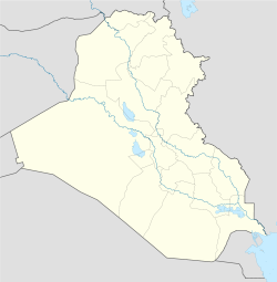
IraqProvince Al-Anbar Population (2003) – Total 105,825 Time zone GMT+3 (UTC+3) Hīt (Arabic: هيت) is an Iraqi city in Al-Anbar province. Hīt lies northwest of Ramadi, the provincial capital.
On the Euphrates River, Hīt is a small walled town built on two mounds on the site of the ancient city of Is; bitumen wells in the vicinity have been utilized for at least 3,000 years and were used in the building of Babylon. Hīt is a marketplace for agricultural produce and oil pipelines to the Mediterranean Sea cross the Euphrates there. It was regarded as the head of navigation on the river before the decline in river traffic.[1]
References
- ^ "Hīt". The New Encyclopædia Britannica. V. Chicago: Encyclopædia Britannica, Inc. 1980. p. 66.
Cities of Al Anbar in Iraq Ar Ramadi · Al Fallujah · Al Khaldiya · Hit · Haditha · Al Haqlaniyah · Habbaniyah · Ar Rutba · Husaybah · Nukhayb · Anah · Rawah · Al Karmah · Kabisa · Al Amiriyah · Al Waleed · Akashat · Tarbil · Khan al Baghdadi · Barwanah · Al Rahaliyah · Saqlawiyah · Husaibah Al Sharqiah · Al Karblah · Al Ubaidi · Al Qaim
Districts of Iraq and capitals Al Anbar Governorate Al Muthanna Governorate Al-Khidhir District (Al-Khidhir) • Al-Rumaitha District (Al-Rumaitha) • Al-Salman District (Al-Salman) • Al-Samawa District (Samawa)Al-Qādisiyyah Governorate Afaq District (Afaq) • Al-Shamiya District (Al-Shamiya) • Diwaniya District (Diwaniya) • Hamza District (Hamza)Babil Governorate Al-Mahawil District (Al-Mahawil) • Al-Musayab District (Al-Musayab) • Hashimiya District (Hashimiya) • Hilla District (Hilla)Baghdad Governorate Basra Governorate Abu Al-Khaseeb District (Abu Al-Khaseeb) • Al-Midaina District (Al-Midaina) • Al-Qurna District (Al-Qurna) • Al-Zubair District (Al-Zubair) •
Basrah District (Basrah) • al-Faw District (al-Faw) • Shatt Al-Arab District (Shatt Al-Arab)Dhi Qar Governorate Al-Chibayish District (Al-Chibayish) • Al-Rifa'i District (Al-Rifa'i) • Al-Shatra District (Al-Shatra) • Nassriya District (Nassriya) • Suq Al-Shoyokh District (Suq Al-Shoyokh)Diyala Governorate Dohuk Governorate Amadiya District (Amadiya) • Dohuk District (Dohuk)• Sumel District (Sumel) • Zakho District (Zakho)Arbil Governorate Makhmur District (Makhmur) • Arbil • Koisanjaq District (Koisanja) • Shaqlawa District (Shaqlawa)• Soran District • Mergasur District • Choman DistrictKarbala Governorate Ain Al-Tamur District (Ain Al-Tamur) • Al-Hindiya District (Al-Hindiya) • Kerbala District (Kerbala)Kirkuk Governorate Maysan Governorate Ali Al-Gharbi District (Ali Al-Gharbi) • Al-Kahla District (Al-Kahla) • Al-Maimouna District (Al-Maimouna) • Al-Mejar Al-Kabi District (Al-Mejar Al-Kabi) • Amara District (Amarah) • Qal'at Saleh District (Qal'at Saleh)Najaf Governorate Ninawa Governorate Aqrah District (Aqrah) • Al-Ba'aj District (Al-Ba'aj) • Al-Hamdaniya District (Bakhdida) • Hatra District (Hatra) •Mosul District (Mosul) • Shekhan District (Ain Sifni) • Sinjar District (Sinjar) • Tel Afar District (Tel Afar) • Tel Keppe District (Tel Keppe)Salah ad Din Governorate Al-Daur District (Al-Daur) • Al-Shirqat District (Al-Shirqat) • Baiji District (Baiji) • Balad District (Balad) • Samarra District (Samarra) • Tikrit District (Tikrit) • Tooz District (Tooz)Sulaymaniyah Governorate Chamchamal District (Chamchamal) • Darbandokeh District (Darbandokeh) • Dokan District (Dokan) • Halabja District (Halabja) • Kalar District (Kalar) • Penjwin District (Penjwin) • Pshdar District (Pshdar) • Ranya District (Ranya) • Sharbazher District (Sharbazher) • Sulaymaniya District (Sulaymaniya)Wasit Governorate Al-Hai District (Al-Hai) • Al-Na'maniya District (Al-Na'maniya) • Al-Suwaira District (Al-Suwaira) • Badra District (Badra) • Kut District (Kut)Categories:- Populated places in Al Anbar Governorate
- Populated places on the Euphrates River
- District capitals of Iraq
- Cities in Iraq
- Iraq geography stubs
Wikimedia Foundation. 2010.

