- Chao Phraya River
-
Chao Phraya River River 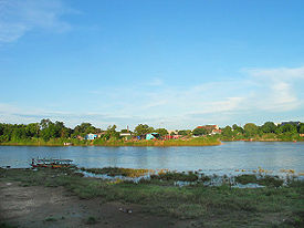 Origin of the Chao Phraya River in Nakhon Sawan
Tributaries - left Pa Sak River - right Sakae Krang River Source Confluence of Ping River and Nan River - location Pak Nam Pho, Nakhon Sawan province - elevation 25 m (82 ft) Mouth - location Gulf of Thailand, Samut Prakan Province - elevation 0 m (0 ft) Length 372 km (231 mi) Basin 160,400 km2 (61,931 sq mi) Discharge for Nakhon Sawan - average 718 m3/s (25,356 cu ft/s) - max 5,960 m3/s (210,475 cu ft/s)  Map of the Chao Phraya River drainage basin
The Chao Phraya (Thai: แม่น้ำเจ้าพระยา, RTGS: Maenam Chao Phraya, pronounced [mɛ̂ːnáːm tɕâːw pʰráʔ.jaː] or [tɕâːw pʰra.jaː], listen) is a major river in Thailand, with its low alluvial plain forming the centre of the country. It runs through Bangkok, the capital city, and then empties into the Gulf of Thailand.
Contents
Etymology
On many old European maps, the river is named Menam or Mae Nam (Thai: แม่น้ำ), Thai for "river". Englishman H. Warington Smyth, who served as Director of the Department of Mines in Siam from 1891-1896[1], refers to it in his book first published in 1898 as "the Me Nam Chao Phraya." [2] Thai royal and noble title Chao Phraya may be translated as "Grand Duke". In the English-language media in Thailand, the name is often translated as River of Kings.[3]
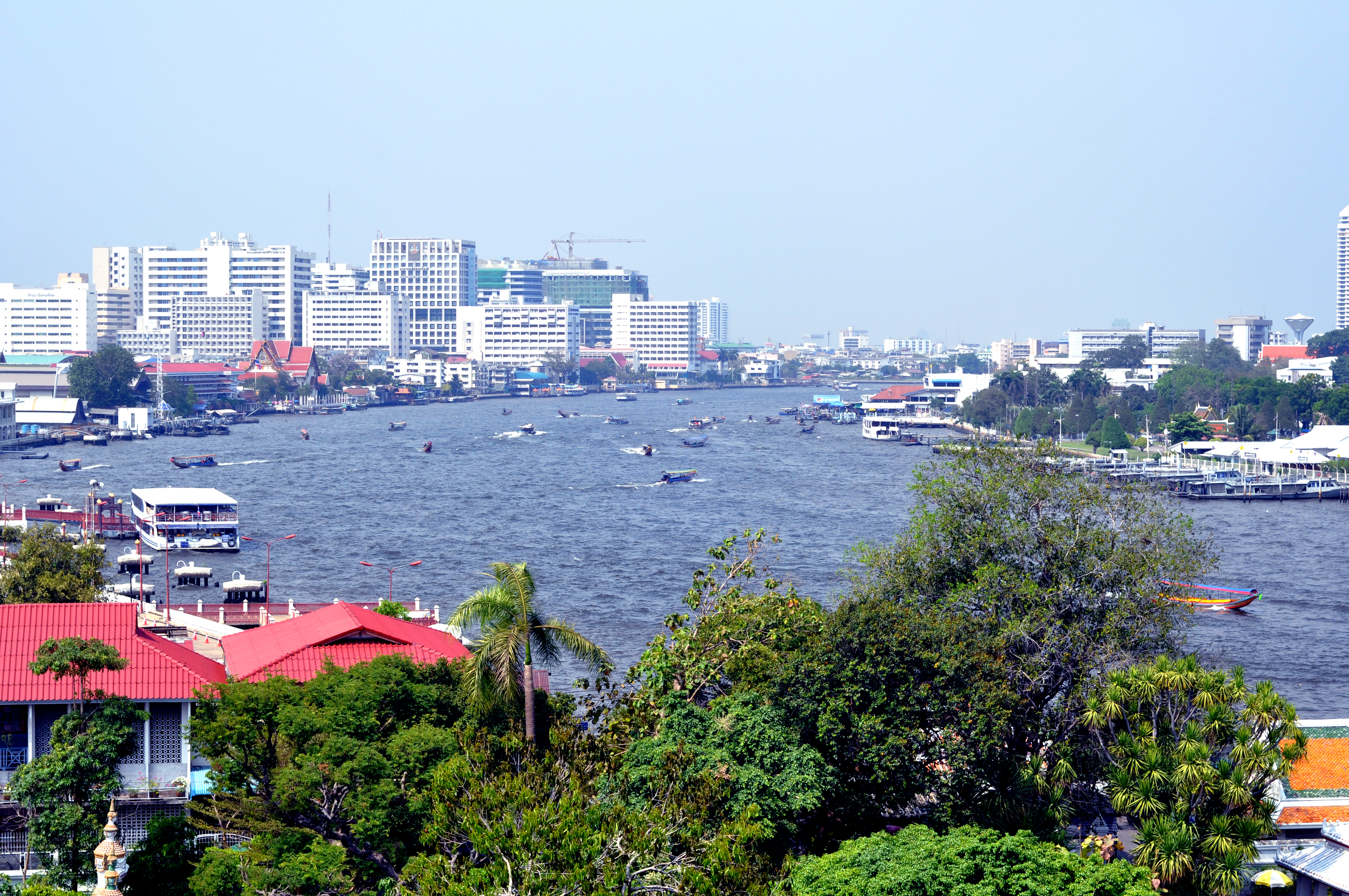
 A view of the Chao Phraya River in the city of Bangkok.
Geography
The Chao Phraya begins at the confluence of the Ping and Nan rivers at Nakhon Sawan (also called Pak Nam Pho) in Nakhon Sawan province. It then flows south for 372 kilometres (231 mi) from the central plains to Bangkok and the Gulf of Thailand. In Chainat, the river splits into the main course and the Tha Chin river, which then flows parallel to the main river and exits in the Gulf of Thailand about 35 kilometres (22 mi) west of Bangkok in Samut Sakhon. In the low alluvial plain which begins below the Chainat dam, many small canals (khlong) split off from the main river. The khlong are used for the irrigation of the region's rice paddies.
The rough co-ordinates of the river are 13 N, 100 E. This area has a wet monsoon climate, with over 1,400 mm of rainfall per year, and temperatures range from 24°C to 33°C in Bangkok.
River settlements
Cities along the Chao Phraya include Nakhon Sawan, Uthai Thani, Chainat, Singburi, Ang Thong, Ayutthaya, Pathum Thani, Nonthaburi, Bangkok and Samut Prakan, listed from north to south. These cities are among the most historically significant and densely populated settlements of Thailand precisely because of their access to the waterway, with Bangkok alone having a population of over 12 million.
Transportation
The major bridges that cross the Chao Phraya are in the province of Bangkok: the Rama VI rail-road bridge; Phra Pin-klao near the Grand Palace; Rama VIII, a single tower asymmetrical cable-stayed bridge; Rama IX, a semi-symmetric cable-stayed bridge; and Mega Bridge, part of the Industrial Ring Road.
In Bangkok, the Chao Phraya is a major transportation artery for a vast network of river buses, cross-river ferries and water taxis, also known as longtails. More than 15 boat lines operate on the rivers and canals of the city, including commuter lines.
See also: List of crossings of the Chao Phraya River, Chao Phraya Express Boat, Bangkok Boat Express Lines, and Sathon-Klong Toei Express BoatTributaries
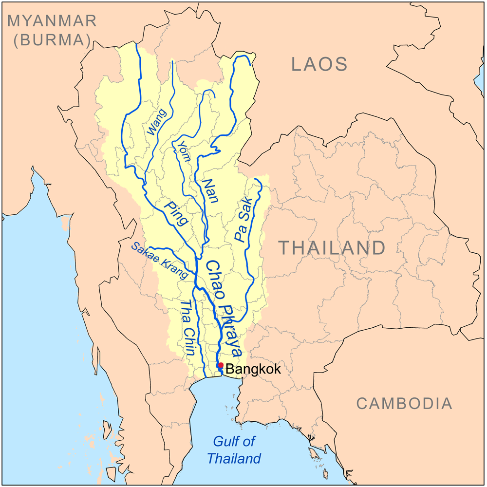
The principal tributaries of the Chao Phraya River are the Pa Sak River, the Sakae Krang River, the Nan River (along with its principal confluent the Yom River), the Ping River (with its principal confluent the Wang River), and the Tha Chin River.[4][5][6] Each of these tributaries (and the Chao Phraya itself) is further tributed by additional minor tributaries often referred to as khwae. All of the tributaries, including the lesser khwae, form an extensive tree-like pattern, with branches flowing through nearly every province in central and northern Thailand.[4] None of the tributaries of the Chao Phraya extend beyond the nation's borders.[7] The Nan and the Yom River flow nearly parallel from Phitsanulok to Chumsaeng in the north of Nakhon Sawan province. The Wang River enters the Ping River near Sam Ngao district in Tak province.
Chao Phraya watershed

The expanse of the Chao Phraya River and its tributaries, i.e. the Chao Phraya river system, together with the land upon which falling rain drains into these bodies of water, form the Chao Phraya watershed.[8] The Chao Phraya watershed is the largest watershed in Thailand, covering approximately 35% of the nation's land, and draining an area of 157,924 square kilometres (60,975 sq mi).[9] The watershed is divided into the following basins:
- Pa Sak Basin
- Sakae Krang Basin
- Greater Nan Basin (comprising the Nan Basin and the Yom Basin, and usually divided as such in drainage analyses)
- Greater Ping Basin (comprising the Ping Basin and the Wang Basin, and usually divided as such in drainage analyses)
- Tha Chin Basin (the basin of the Chao Phraya's most significant distributaries)
- Finally the Chao Phraya Basin itself is defined as the portion of the Chao Phraya Watershed drained by the Chao Phraya River itself, and not by its major tributaries or distributaries. As such, the Chao Phraya Basin drains 20,126 square kilometres (7,771 sq mi) of land.[9]
Meanwhile to the west the central plain of Thailand is drained by the Mae Klong and the east by the Bang Pakong Rivers which are not part of the Chao Praya system.
The landscape of the river basins is a very wide, flat, well-watered plain continuously refreshed with soil and sediment brought down by the rivers. The Lower Central plain from the delta north to Ang Thong Province is a flat, low area with an average of 2m above sea level. Further north and into the plains of the Ping and the Nan the elevation is over 20m. Then the mountains that are the natural boundary of the Chao Praya watershed form a divide, which has, to some degree, historically isolated Thailand from other Southeast Asian civilizations.
In fact in northern Thailand the divide roughly corresponds to a long section of the political border of the country today. Southern portions of the divide's boundary correspond less to the nation's political border, because isolation in this area was prevented by the ease of transportation along the lowlands surrounding the Gulf of Thailand, allowing a unified Thai civilization to extend beyond the watershed without issue. The slightly higher northern plains have been farmed for centuries and saw a major change from the 13th century onwards during the Sukhothai Kingdom in the 13th and 14th centuries and the Ayutthaya Kingdom that succeeded it when rice-growing intensified with the introduction of floating rice, a much faster-growing strain of rice from Bengal. The southern swamps meanwhile changed radically from the 18th century when King Buddha Yodfa Chulaloke moved the capital of Siam to Bangkok, and a process of canalisation and cultivation began, especially as Thailand began to export rice from 1855 onwards.
Delta
The Tha Chin River is the major distributary of the Chao Phraya River. The expanse of the Chao Phraya and Tha Chin Rivers and their distributaries, starting at the point at which the distributaries diverge, together with the land amid the triangle formed by the outermost and innermost distributary, form the Chao Phraya Delta. The many distributaries of the Chao Phraya delta are interconnected by canals that serve both for irrigation and for transportation.
Ecology
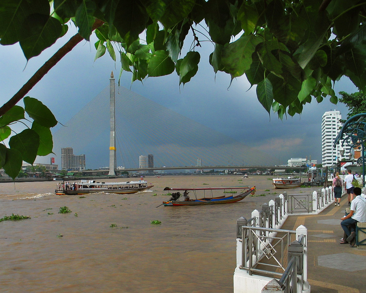
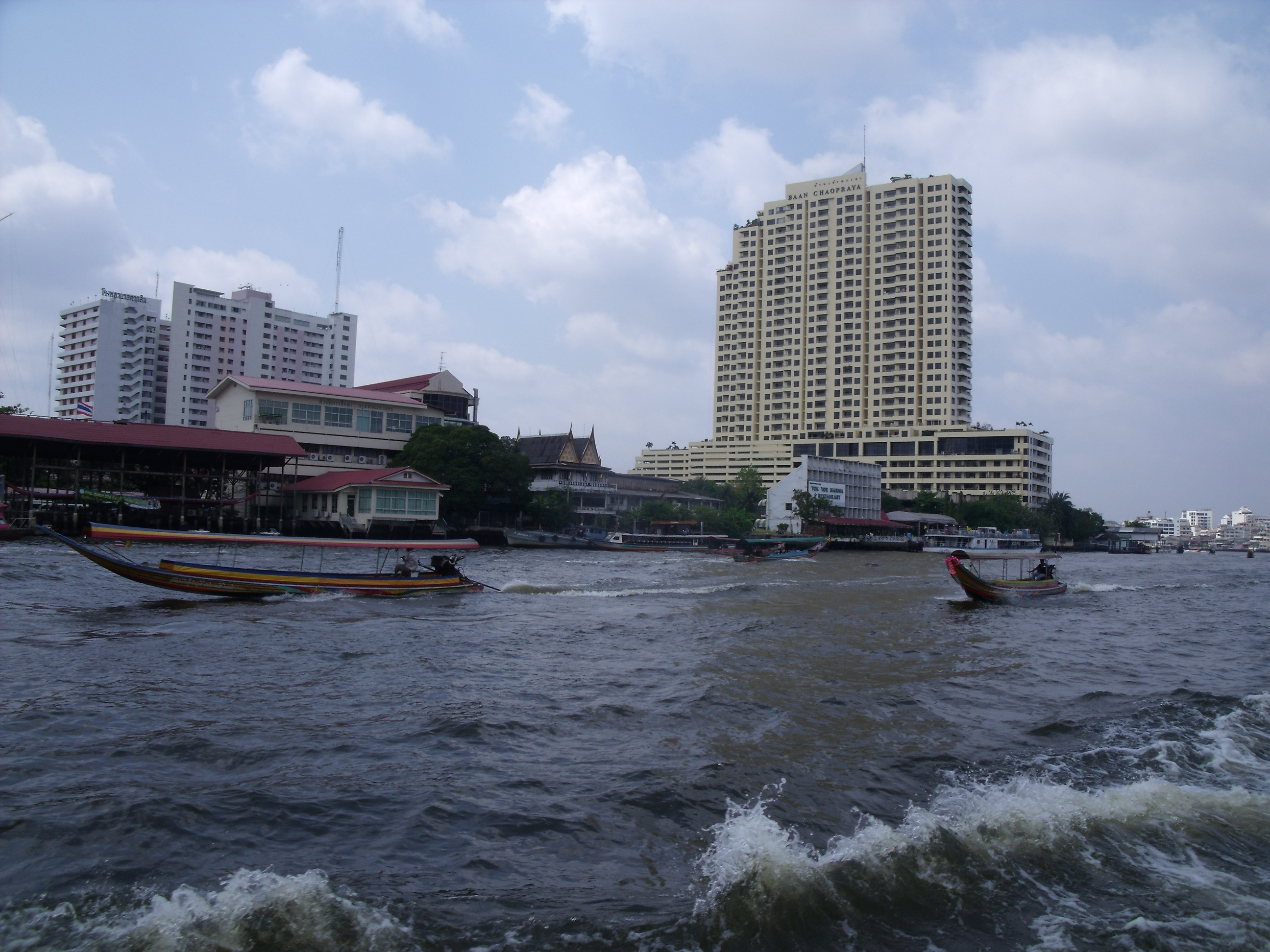
 View of the river from a boat ride.
The lowland areas of the Chao Phraya watershed in central Thailand have been designated as the Chao Phraya freshwater swamp forests, a tropical and subtropical moist broadleaf forests ecoregion,[10] an area about 400 km north to south and 180 km wide.
The original swamp forests have almost entirely been removed as the plain has been converted to rice paddies, other agriculture, and urban areas like the massive Bangkok, and much of the wildlife that once inhabited these plains has disappeared including a large number of fish in the river systems, birds such as vultures, the Oriental Darter, White-eyed River Martin (Pseudochelidon sirintarae) and the Sarus Crane [11] and animals such as tigers, Asian elephants, Javan Rhinoceroses and the much-hunted Schomburgk's Deer.[12] Today we can only estimate a description of the original habitat and wildlife by comparing with that of neighbouring countries and it is believed that it would have consisted of freshwater swamps inland and salty mangroves on the coast and the river estuaries. The swamp would have been covered in Phragmites marsh grasses and today there is a small area of this remaining in Khao Sam Roi Yot National Park, a relic of the original landscape.
As so much has been cleared or altered the potential for creating large protected areas to preserve original habitat no longer exists. However much wildlife does remain in the rice fields and steps may be taken to preserve these as urban and industrial development on the plains is ongoing and the Industrial Estate Authority of Thailand has very little control or planning over this. Particular threats come from the conversion of rice paddies to large-scale production of prawns by pumping in seawater, and the use of pesticides to eliminate the introduced snail Pomacea canaliculata, which damages rice plants.
There are for example populations of threatened birds, including colonies of breeding water birds such as the world's largest populations of the near-threatened Asian Openbill (Anastomus oscitans), and other birds such as the wintering Black Kite (Milvus migrans). Endemic mammals that remain are the Limestone Rat (Niviventer hinpoon), Neill's Long-tailed Giant Rat (Leopoldamys neilli) and the near-endemic Thailand Roundleaf Bat (Hipposideros halophyllus). In 2011, the IUCN Red List of Threatened Species declared the endemic catfish species Platytropius siamensis extinct[13]. There are few areas of wetland protected as national park and these are mostly very small.
See also
- River Systems of Thailand
- Giant freshwater stingray (Himantura chaophraya)
References
- ^ Tamara Loos (1 December 2002). "Introduction to Five Years in Siam". 1994 reprint. Pine Tree Web. http://www.pinetreeweb.com/hw-smyth-five-years-00.htm. Retrieved 1 March 2011. "At the time of writing the "Introduction" to the 1994 reprint of Five Years in Siam, she was a Ph.D. candidate in the Department of History at Cornell University."
- ^ Smyth, H. Warington (1994) [1898]. "I. The river and port of Bangkok". Five Years in Siam : from 1891-1896. Bangkok: White Lotus. ISBN 9748495981. http://www.pinetreeweb.com/hw-smyth-five-years-01.htm. Retrieved 1 March 2011.
- ^ "The River of Kings II : City of Angels". Thai Stories. http://www.speakingthai.com/stories/river%20king.htm. Retrieved 3 March 2011. ""The River of Kings II - City of Angels", a light and sound musical"
- ^ a b "Royal Irrigation Department River Gauges Report". RID Stations. 2002. http://157.82.150.160/GAME-T/GAIN-T/routine/rid-river/RIDstations.html. Retrieved 2008-07-20.
- ^ "Chao Phraya River Basin (Thailand)". World Water Assessment Programme. http://www.unesco.org/water/wwap/case_studies/chao_phraya/index.shtml. Retrieved 2008-07-20.
- ^ "Detailed Map of the Chao Phraya River Basin (Thailand)". World Water Assessment Programme. http://www.unesco.org/water/wwap/case_studies/chao_phraya/detailed_view.shtml. Retrieved 2008-07-20.
- ^ Google Earth
- ^ River and Watershed Facts on the Chao Phraya
- ^ a b Basins of Thailand
- ^ http://www.worldwildlife.org/wildworld/profiles/terrestrial/im/im0107_full.html
- ^ Madoc, G. 1950. Field Notes on some Siamese Birds. Bull. Raffles Mus. 23: 129-190.
- ^ IUCN 1991. The Conservation Atlas of Tropical Forests: Asia and the Pacific. London and Basingstoke: Macmillan Press Ltd.
- ^ Ng, H.H. (2011). Platytropius siamensis. In: IUCN (2011). IUCN Red List of Threatened Species. Version 2011.1. <www.iucnredlist.org>. Downloaded on 25 June 2011.
- Bangkok Waterways, William Warren and R. Ian Lloyd, Asia Books, ISBN 981-00-1011-7.
External links
Categories:- Chao Phraya River
- Rivers of Thailand
- Tropical and subtropical moist broadleaf forests

Wikimedia Foundation. 2010.