- Nechells
-
Coordinates: 52°30′04″N 1°51′36″W / 52.501°N 1.860°W
Nechells 
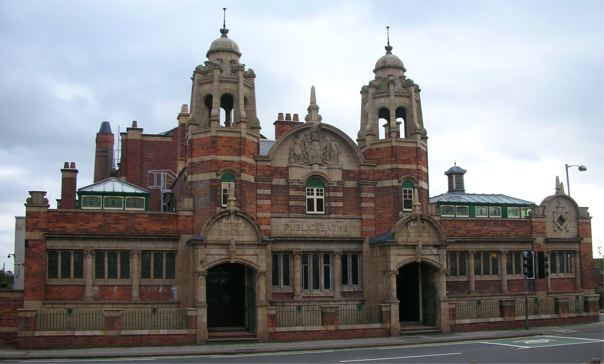
The grade II listed public baths, opened June 22, 1910, on Nechells Park Road.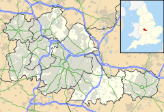
 Nechells
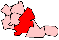
Nechells shown within the West MidlandsPopulation 27,969 (2001 Population Census) - Density 25.8 per ha OS grid reference SP095895 Metropolitan borough Birmingham Metropolitan county West Midlands Region West Midlands Country England Sovereign state United Kingdom Post town BIRMINGHAM Postcode district B7 Dialling code 0121 Police West Midlands Fire West Midlands Ambulance West Midlands EU Parliament West Midlands UK Parliament Birmingham Ladywood List of places: UK • England • West Midlands Nechells is an area in inner-city Birmingham, England, with a population of 27,969 (as of 2001). It is also a ward within the formal district of Ladywood. Nechells local government ward includes areas, for example parts of Birmingham city centre, which are not part of the historic district of Nechells as such. It is adjacent to Saltley
Contents
Origins of the name
The first recorded use of the name "Nechells" is in a land transfer deed of 1339. Earlier sources mention the name "atten Eccheles", "the land belonging to Eccheles". In the Middle English period, following the process of language change known as metanalysis,only the "n" in "atten" remained in oral usage and became assimilated to "Eccheles". So, n+Eccheles became the "Nechells" (pronunciation [niːt͡ʃl̩z]) of modern usage. However, the pronunciation [net͡ʃl̩z] was also to be heard in the 20th century amongst some older inhabitants of the area.[1]
History
The Nineteenth Century
Nechells became a densely populated area during the 19th century, with mass development of houses and factories taking place. Mass immigration occurred from Ireland. In 1868 it was described thus:
- ...a hamlet in the parish of Aston and borough of Birmingham, county Warwick. It is united with Duddeston, and forms a populous suburb of Birmingham. Here are extensive workshops for building railway carriages, also a lunatic asylum. The living (i.e. the position of vicar of the parish) is a perpetual curacy in the diocese of Worcester, value £59. The church is dedicated to St. Clement.[2]
Developments in the Victorian era include the opening of the aforementioned St Clement's Church, designed by J.A. Chatwin, in 1859;[3] St Joseph's Roman Catholic Church in 1872 (incorporating the former chapel of the Roman Catholic cemetery, designed by A.W Pugin and opened in 1850). The later church was designed by Pugin's son, E.W. Pugin;[4] a board school situated in Hutton (later Eliot) Street in 1879;[5] the building of almshouses adjacent to St. Clement's church to accommodate "31 inmates, widows, single women, and married couples - whose age is above 60"[6] and Bloomsbury Library of 1892 on Nechells Parkway, described as "a typical vigorous example of the red brick and terracotta school for municipal building at the end of the nineteenth century."[7]
The London and North Western Railway's line from Stechford to Aston cut across Nechells Park Road and neighbouring streets when it opened in 1880,[8] as had the Grand Junction Railway from Liverpool and Manchester to Birmingham in order to reach its temporary terminus at Vauxhall in 1837.[9][10]
The Twentieth Century and Later
After World War II, further immigration occurred from parts of the Commonwealth, mostly the Caribbean and the Indian Sub Continent.
By the 1950s, however, many of the homes in Nechells had been reduced to "slums" and were unfit for human habitation. People were living in homes without electricity, running water, bathrooms or indoor toilets. The Gas Works caused a continuous unpleasant smell. The bulk of the area had been designated as a redevelpment area in 1937, but its regeneration was put off by some 20 years due to World War II.[11]
The face of Nechells changed dramatically during the 1960s, with the decaying Victorian terraces being cleared and the area redeveloped with new houses and tower blocks. Some families remained in the new homes that had been built around Nechells, but there were insufficient new homes to rehouse all of the area's original residents, and as a result some families moved to new housing estates like Castle Vale and Chelmsley Wood. The new homes were certainly a big improvement on their predecessors, but the area still suffered from rising unemployment and crime.
The development of high rise flats in Nechells had actually started in the 1950s, and it was the home of Birmingham's very first tower block - Queens Tower, on Great Francis Street[12]. - which was completed in 1954 and is still standing today.[13] However, many of the tower blocks in the Nechells area were demolished in the 1990s to make way for new low rise private and rented housing.[2]
Industrial and Commercial Development
Two notable features of the commercial life of present-day Nechells are the headquarters of the Wing Yip Chinese food and restaurant business which occupies a site at Nechells Green bounded by Rocky Lane, Nechells Park Road and Railway Terrace.This site opened in 1992, was expanded considerably in 1996 and now includes a business centre serving the Chinese community and a food superstore.[14]
On Thimble Mill Lane, the Aston Manor Brewery started production in 1993 and produces beer, cider and perry. It is capable of producing 24,000 bottles per hour.[15]
Demographics and Health
The 2001 Population Census found that 27,969 people lived in the ward with a population density of 3,015 people per km² compared with 3,649 people per km² for Birmingham. 62.6% (17,142) of the ward's population consists of ethnic minorities compared with 29.6% for Birmingham.
Whilst it is notable in Birmingham for being the area with the highest rate of unemployment, crime and poverty, it has been the focus of a great deal of urban regeneration by Birmingham City Council and the former Birmingham Heartlands Development Corporation.
However, a report published in 2010 by the Birmingham Public Health Information Team concluded that:
- North Nechells, Bloomsbury and Duddeston has a young population compared with Birmingham overall
- The area is made up of multicultural, mixed communities with crime and health problems
- Life expectancy is much worse than the Birmingham average, along with self reported health status and long term limiting illnesses
- More people die young in North Nechells, Bloomsbury and Duddeston than Birmingham on average, mostly from: chronic liver disease including cirrhosis, suicide, injury undetermined and stroke
- Mortality rates and admission rates (to hospital) are higher than the Birmingham average.[16]
- Ethnicity
- White - 10,284 (37.42%)
- Black - 2,644 (9.65%)
- Asian - 12,700 (46.38%)
- Chinese or Other - 539 (1.97%)
- Mixed Race - 1,018 (4.60%)
Transport
Nechells is served by Duddeston railway station and Aston railway station. From 1856-1869, a station named "Bloomsbury and Nechells " was situated slightly to the north of the present Duddeston station.[17]
The main bus services serving Nechells are the West Midlands bus routes 66 and 66A from Birmingham city centre to Sutton Coldfield via Erdington.These routes are the successors of trolleybus route 7, which ran from the city centre to Nechells from 1922–1940 and the motorbus route 43 which replaced it in 1940.[18] The West Midlands bus route 8, the "Inner Circle", also serves the western part of the area.[19].
Places of interest
Nechells is home to Star City - a vast entertainment complex that houses shops, restaurants, a 22-lane bowling centre (Tenpin, formerly Megabowl), a casino and Vue Cinema which, with thirty screens, is one of the largest multiplexes in Europe.
As well as Bloomsbury library, other community facilities include Nechells Play Centre and the Nechells Green Community Centre. Sports facilities are provided at the Heartlands High Community Leisure Centre and the Nechells Community Sports Centre.
Nechells Baths on Nechells Park Road is a Grade II listed building. Plans for baths to be constructed in the Nechells ward came about in 1900 when representatives from the ward pressured the council into providing public baths for the ward. However, the Birmingham Baths Committee were already committed to other projects in the city and were unable to immediately attend the matter.
In 1903, a site at the corner of Nechells Park Road and Aston Church Road was acquired and in 1908, approval was given for the construction of baths on the site. Construction commenced that year and the baths were opened June 22, 1910. Facilities provided included a large swimming bath with a spectators' gallery and suites of private baths for men and women. The baths were immediately popular among the locals.
Refurbishment work to the baths was completed in May 2007 by Welconstruct. It cost £5.5 million, with funding from Advantage West Midlands, the Heritage Lottery Fund and ERDF.[20]
Politics
Nechells ward is served by three Labour councillors; Tahir Ali, Rashid Chauhdry and Yvonne Mosquito.[21]
Nechells has adopted a Ward Support Officer with the current holder of the title being Maz Dad.
References
- ^ Chinn, C. One Thousand Years of Brum. Birmingham: Birmingham Evening Mail, 1999, p. 103.
- ^ The National Gazetteer of Great Britain and Ireland. London: James S. Virtue, 1868.
- ^ Dent, R.K. Old and New Birmingham. Birmingham: Houghton and Hammond 1880, P. 578
- ^ Victoria History of the County of Warwick, Vol. VII. London: Oxford University Press, 1964
- ^ Victoria History of the County of Warwick, Vol. VII. London: Oxford University Press, 1964
- ^ Dent,R.K. Old and New Birmingham. Birmingham: Houghton and Hammond 1880
- ^ Pevsner, N. and Wedgwood, A. The Buildings of England: Warwickshire. London: Penguin, 1966.
- ^ Clinker, C.R. Railways of the West Midlands: A Chronology. London: Stephenson Locomotive Society. 1954
- ^ Clinker, C.R. Railways of the West Midlands: A Chronology. London: Stephenson Locomotive Society. 1954
- ^ Victoria History of the County of Warwick, Vol. VII. London: Oxford University Press, 1964
- ^ [1]
- ^ Bartlam, N. The Litttle Book of Brum. Stroud: The History Press, 2011, p.108.
- ^ Jones, P. "The suburban high flat in the post-war reconstruction of Birmingham, 1945–71". Urban History (32), pp.308-326 (2005).
- ^ http://wingyip.com/page-531.html
- ^ http://astonmanor.co.uk/about-us/history/
- ^ http://www.bhwp.nhs.uk/Files/Content/L/339/Priority%20Neighbourhood%20Health%20Profiles%202010%20-%20North%20Nechells,%20Bloomsbury%20and%20Duddeston.pdf
- ^ Quick, M. Passenger Railway Stations in Great Britain: A Chronology. Oxford: Railway and Canal Historical Society, 2009
- ^ Keeley, M., Russell, M. and Gray, P. Birmingham City Transport. Glossop: The Transport Publishing Company, 1977
- ^ Hanson, M., Harvey, D. and Drake, P. The Inner Circle - Birmingham's No. 8 Bus Route. Stroud: Tempus, 2002.
- ^ "Makeover is complete for Nechells Baths". Birmingham Post. 2007-05-10. http://icbirmingham.icnetwork.co.uk/birminghampost/news/tm_headline=makeover-is-complete-for-nechells-baths%26method=full%26objectid=19078215%26siteid=50002-name_page.html. Retrieved 2007-05-11.
- ^ "Councillors' Advice Bureaux - Nechells Ward". Birmingham City Council. Archived from the original on 2008-05-10. http://web.archive.org/web/20080510085458/http://www.birmingham.gov.uk/GenerateContent?CONTENT_ITEM_ID=6187&CONTENT_ITEM_TYPE=0&MENU_ID=11746&EXPAND=5461. Retrieved 2008-05-30.
Further reading
- Chinn, Carl The Streets of Brum, vols 1-4. Studley: Brewin Books 2003-2007.
- Frostick, E. and Harland, L. Take Heart: people, history and change in Birmingham's Heartlands. Beverley: Hutton Press, 1993.
- Moth, J. The City of Birmingham Baths Department 1851 - 1951. Birmingham: Birmingham Corporation, 1951.
- Pevsner, N. and Wedgwood, A. The Buildings of England - Warwickshire. London: Penguin 1966.
- Thomson, N. Where I live - Inner City: Neil Thomson meets Desrene Gentles. London: Watts Books, 1993.
- Twist, Maria Saltley, Duddeston and Nechells. Stroud: Tempus 2001
External links
- A brief history of Nechells
- Millennium Point
- Aston University
- Birmingham City Council: Nechells Ward
 Areas of Birmingham, West Midlands
Suburbs Acocks Green • Alum Rock • Ashted • Aston • Austin Village • Balsall Heath • Bartley Green • Bearwood • Beech Lanes • Billesley • Birches Green • Birchfield • Bordesley Green • Bournbrook • Bournville • Bromford • California • Cotteridge • Digbeth • Druids Heath • Edgbaston • Erdington • Frankley • Gosta Green • Great Barr • Hall Green • Handsworth • Handsworth Wood • Harborne • Highgate • Kings Heath • Kings Norton • Kingstanding • Kitts Green • Ladywood • Longbridge • Lozells • Minworth • Moseley • New Oscott • Northfield • Perry Barr • Oscott • Quinton • Rednal • Roughley • Rubery • Saltley • Selly Oak • Selly Park • Shard End • Sheldon • Small Heath • Sparkbrook • Sparkhill • Stechford • Stirchley • Sutton Coldfield • Tyseley • Ward End • Washwood Heath • Weoley Castle • West Heath • Witton • Woodgate • Yardley • Yardley Wood
 Government of Birmingham
Edgbaston - Bartley Green
- Edgbaston
- Harborne
- Quinton

Erdington Hall Green Hodge Hill Ladywood - Aston
- Ladywood
- Nechells
- Soho
Northfield - Kings Norton
- Longbridge
- Northfield
- Weoley
Perry Barr Selly Oak - Billesley
- Bournville
- Brandwood
- Selly Oak
Sutton Coldfield - Sutton Four Oaks
- Sutton New Hall
- Sutton Trinity
- Sutton Vesey
Yardley - Acocks Green
- Sheldon
- South Yardley
- Stechford and Yardley North
Categories:- Areas of Birmingham, West Midlands
- Wards of Birmingham, West Midlands
- UK locations with ethnic minority-majority populations

Wikimedia Foundation. 2010.