- Chelmsley Wood
-
Coordinates: 52°28′34″N 1°43′45″W / 52.47612°N 1.72906°W
Chelmsley Wood 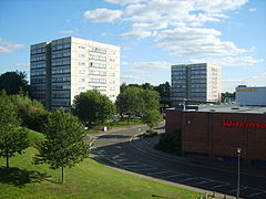
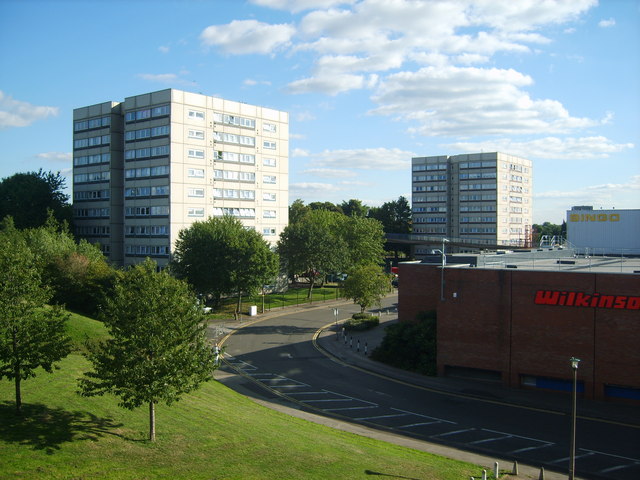
Blocks of flats on the edge of Chelmsley Wood shopping centre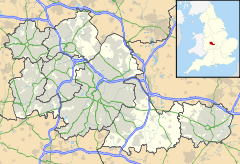
 Chelmsley Wood
Chelmsley Wood shown within the West MidlandsPopulation 13,010 (2001) OS grid reference SP1886 Parish Chelmsley Wood Metropolitan borough Solihull Metropolitan county West Midlands Region West Midlands Country England Sovereign state United Kingdom Post town Birmingham Postcode district B37 Dialling code 0121 Police West Midlands Fire West Midlands Ambulance West Midlands EU Parliament West Midlands UK Parliament Meriden List of places: UK • England • West Midlands Chelmsley Wood is a neighbourhood, civil parish and large housing estate in the Metropolitan Borough of Solihull, England, with a population of 13,010.[1] It is located near Birmingham International Airport and the National Exhibition Centre. It lies adjacent to Birmingham. There are several bus routes linking the town to Birmingham city centre, about 8 miles (13 km) away, and to Solihull town centre.
Contents
History
Chelmsley Wood is a relatively new area, which was built by Birmingham City Council in the 1960s on ancient woodland (part of the Forest of Arden) as an overspill town for Birmingham. Permission for the construction of the overspill estate on green belt land was granted by Richard Crossman as Minister of Housing and Local Government.[2] A shopping centre (which opened on 7 April 1970), a library (completed in 1970 at £240,000),[3] hall and a few public houses. With the adjoining neighbourhoods of Fordbridge and Smith's Wood it became part of Metropolitan Borough of Solihull in 1974.
Recent development
Plans are currently under way to carry out the largest renovation of older parts of the area since the demolition of many high-rise blocks of flats in the early 1990s. The current plans propose changes to the central shopping centre area. A new supermarket was opened in the Town Centre in June 2009. There is also proposed modernisation of housing and commercial buildings in the Craig Croft area. In addition, there will be the renovation of the library and surrounding buildings.
Demographics
Chelmsley Wood's comprehensive school, Whitesmore School, was demolished and replaced by Grace Academy at a cost of £32 million.[4]
Chelmsley Wood is part of the Regeneration of North Solihull, a partnership between Solihull Metropolitan Borough Council and the private sector. An estimated £1.8 billion will be invested over the next fifteen years.[citation needed]
Politically, Chelmsley Wood voters have been known for their strong support of Labour candidates at both local and national elections. However, in the 2006 election, the Chelmsley Wood ward of Solihull Metropolitan Borough Council elected a candidate from the British National Party, the first in Solihull's history. The elected candidate, George Morgan, won by a margin of 19 votes. In the 2010 election the seat went to Labour after George Morgan stood down with the BNP vote falling dramatically and the Green Party finishing second to Labour by 22 votes.[5]
References
- ^ Office for National Statistics : Census 2001 : Parish Headcounts : Solihull Retrieved 2009-11-22
- ^ Stephen Victor Ward (1994). Planning and Urban Change. Sage Publications. ISBN 185396218X.
- ^ Thomas Greenwood (1971). The Libraries, Museums and Art Galleries Year Book. New York: J. Clarke.
- ^ Grace Academy (Solihull)
- ^ "Local Election Results 2010". Solihull Council. http://www.solihull.gov.uk/democracy/22041.htm. Retrieved 2010-09-16.
External links
Categories:- Areas of the West Midlands (county)
- Solihull

Wikimedia Foundation. 2010.