- Brunswick House First Nation
-
Brunswick House First Nation is an Ojibway-Cree First Nation in the Canadian province of Ontario, located in the Sudbury District, 157 kilometres (97.6 mi) northeast of Sault Ste Marie, Ontario. The First Nation have reserved for themselves the 9,054.2 hectares (22,373.4 acres) Mountbatten 76A Indian Reserve and the 259.8 hectares (642.0 acres) Duck Lake 76B Indian Reserve. As of June, 2008, it had a registered population of 639 people, of which their on-Reserve population was 171 people.
Brunswick House is policed by the Nishnawbe-Aski Police Service, an Aboriginal based service.
Background
Originally known as the New Brunswick House Band of Ojibway, the Ojibway people who during the fur trade era traded primarily at the New Brunswick House posts at Brunswick Lake and Missinaibi Lake became a signatory to Treaty 9. Originally, the Band had reserved for themselves the 17,280 acres (6,993.0 ha) New Brunswick House 76 Indian Reserve, but on June 1, 1925, the Ontario government established the Chapleau Game Preserve which surrounded (and did not explicitly exclude) the New Brunswick House reserve and was closed to all hunting and trapping. The Ontario government subsequently purchased reserve land from the federal government in 1928. In 1947, the federal government purchased a tract of land in Mountbatten Township from the Ontario government and established the Mountbatten 76A Indian Reserve. The Band moved to its present reserve at Duck Lake 76B Indian Reserve after 642 acres (259.8 ha) of the Mountbatten 76A were exchanged in 1973 for an equivalent area of land closer to Chapleau, Ontario.
Governance
Brunswick House First Nation elects their leaders through the Act Electoral System, consisting of a Chief and three Councillors. The current Chief is Rene Ojeebah. Together with Councillors Charmine Saunders, Majorie Tangie and Irene Redbreast, their current term ends on August 10, 2009.
Brunswick House First Nation is a member of the Wabun Tribal Council, a Regional Chiefs' Council, which in turn is member of the Nishnawbe Aski Nation, a Tribal Political Organization.
External links
Nishnawbe Aski Nation Independent First Nations Alliance Keewaytinook Okimakanak Council Matawa First Nations Aroland • Constance Lake • Eabametoong • Ginoogaming • Hornepayne • Long Lake 58 • Marten Falls • Neskantaga • Nibinamik • Webequie
Mushkegowuk Council Attawapiskat • Chapleau Cree • Fort Albany • Kashechewan • Missanabie Cree • Moose Cree • Taykwa Tagamou • Weenusk
Shibogama First Nations Council Wabun Tribal Council Beaverhouse • Brunswick House • Chapleau Ojibway • Flying Post • Matachewan • Mattagami • Wahgoshig
Windigo First Nations Council Bearskin Lake • Cat Lake • Koocheching • North Caribou Lake (Weagamow Lake) • Sachigo Lake • Slate Falls • Whitewater
independent NAN communities Mishkeegogamang • Mocreebec Council • Sandy Lake
Towns 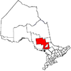
Townships First Nations Indian Reserves Chapleau 61A • Chapleau 74 • Chapleau 74A • Chapleau 75 • Duck Lake • Mattagami • Mountbatten • Whitefish Lake • Whitefish RiverUnorganized area Unorganized North PartSee also: Communities in Sudbury District • Census divisions of OntarioCoordinates: 47°49′59″N 83°19′52″W / 47.83306°N 83.33111°W
Categories:- Nishnawbe Aski Nation
- Anishinaabe reserves in Ontario
- Communities in Sudbury District, Ontario
- Hudson's Bay Company trading posts
- Northern Ontario geography stubs

Wikimedia Foundation. 2010.