- Killarney, Ontario
Infobox City
official_name = Municipality of Killarney
other_name =
native_name =
nickname =
motto =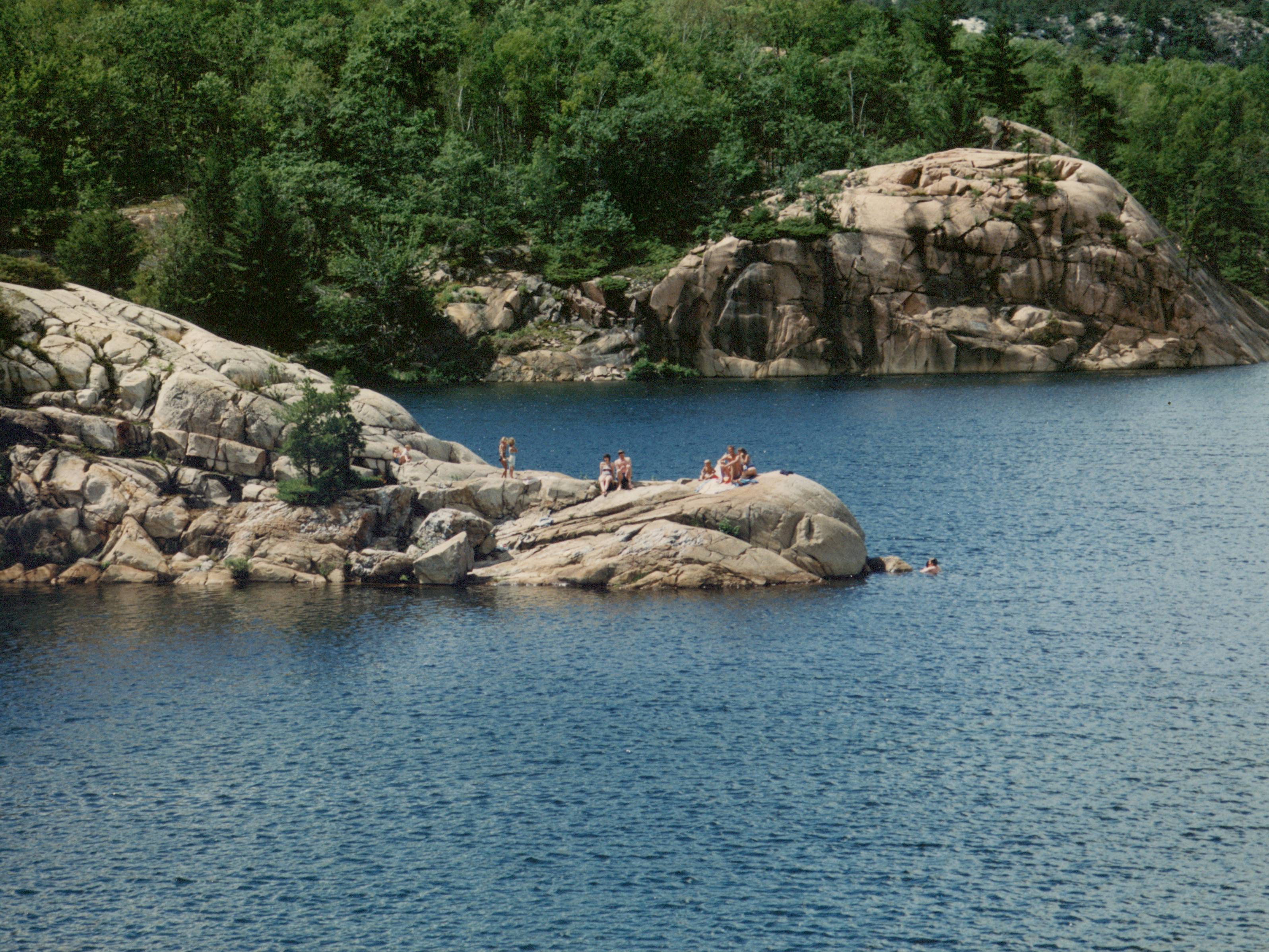
imagesize =
image_caption = George Lake in Killarney
flag_size =
image_
seal_size =
image_shield =
shield_size =
image_blank_emblem =
blank_emblem_size =
mapsize =
map_caption =
pushpin_
pushpin_label_position =
subdivision_type = Country
subdivision_name =Canada
subdivision_type1 = Province
subdivision_name1 =Ontario
subdivision_type2 = District
subdivision_name2 = Sudbury
subdivision_type3 =
subdivision_name3 =
subdivision_type4 =
subdivision_name4 =
government_type = Town
leader_title = Mayor
leader_name = Morgan Pitfield
leader_title1 = Governing Body
leader_name1 = Killarney Municipal Council
leader_title2 =MP
leader_name2 =Ray Bonin (LPC)
leader_title3 =MPP
leader_name3 =France Gélinas (NDP)
leader_title4 =
leader_name4 =
established_title = Incorporated
established_date =January 1 ,1999
established_title2 =
established_date2 =
established_title3 =
established_date3 =
area_magnitude =
unit_pref =
area_footnotes =
area_total_km2 = 1513.58
area_land_km2 =
area_water_km2 =
area_total_sq_mi =
area_land_sq_mi =
area_water_sq_mi =
area_water_percent =
area_urban_km2 =
area_urban_sq_mi =
area_metro_km2 =
area_metro_sq_mi =
population_as_of = 2006
population_footnotes =ref label|Stats_Canada|1|1(sc)
population_note =
settlement_type = Township
population_total = 454
population_density_km2 = 0.3
population_density_sq_mi =
population_metro =
population_density_metro_km2 =
population_density_metro_sq_mi =
population_urban =
population_density_urban_km2 =
population_density_urban_mi2 =
timezone = EST
utc_offset = -5
timezone_DST = EDT
utc_offset_DST = -4
latd=
longd=
elevation_footnotes =
elevation_m =
elevation_ft =
postal_code_type =
postal_code =
area_code =705
website = [http://www.municipality.killarney.on.ca/index.html Municipality of Killarney]
footnotes =Killarney is a municipality located on the northern shore of
Georgian Bay in the Sudbury District ofOntario . It is also the name of the largest community within the municipality. Killarney is commonly associated withKillarney Provincial Park , which is a large wilderness park located to the east of the townsite which occupies much of the municipality's expanded boundary.The eastern end of the La Cloche Mountain Range is also located within the municipality of Killarney.
History
The area was first settled in 1820 by
French Canadian fur trader Étienne Augustin de Lamorandière and hisAnishinaabe wife Josephte Saisaigonokwe, who established atrading post named Shebahonaning (canoe passage) at the townsite.Highway 637, connecting Killarney to Highway 69, was constructed in 1962. [ [http://www.rainbowcountry.com/regions/manitoulin/mnc_region.html Rainbow Country Travel Association] ] Prior to its construction, the community relied primarily on water transport via
Georgian Bay and the North Channel.The current municipality was incorporated on
January 1 ,1999 , when the Ontario provincial government expanded the boundaries of the township of Rutherford and George Island, the former governing body of the community of Killarney. The municipality was also transferred from the Manitoulin District to the Sudbury District at that time.The larger municipality of Killarney now encompasses virtually all of Killarney Provincial Park and the French River delta, and in fact extends all the way to Highway 69, over 70
kilometre s from the townsite. Despite the municipality's geographic size, however, most of its population continues to reside in the community of Killarney itself, although smaller settlements also exist at Hartley Bay and Bigwood.The ghost towns of French River and Key Harbour are also located within the municipal boundaries of Killarney.
Townships
The municipal boundaries of Killarney encompass the geographic townships of Rutherford and George Island, Hansen, Goschen, Sale, Attlee, Kilpatrick, Travers, Struthers, Allen and Bigwood in the District of Sudbury, Killarney and part of Carlyle in Manitoulin District and the northern part of Henvey in Parry Sound
The township of Hansen was originally named Stalin after
Joseph Stalin , but was renamed in 1986 when MPPYuri Shymko successfully had aprivate member's bill passed through theLegislative Assembly of Ontario , renaming the township in honour of athleteRick Hansen .Economy
The Killarney area's economy is based primarily on
tourism , consisting mainly of wilderness lodges, campgrounds and retail services geared toward campers and other visitors to Killarney Provincial Park.A community museum, the Killarney Centennial Museum, is located in Killarney adjacent to the municipal government offices.
Although not officially part of the
Sudbury East region, Killarney participates in the regional Sudbury East Planning Board with the municipalities of French River, St. Charles and Markstay-Warren.Transportation
The primary road access to Killarney is via Highway 637. The town is also served by the small
Killarney Airport .References
External links
* [http://www.municipality.killarney.on.ca/index.html Municipality of Killarney]
Geographic Location (8-way)
Centre = Killarney
North =Greater Sudbury , Unorganized North Sudbury District
Northeast = French River
East = Unorganized Centre Parry Sound District
Southeast = Henvey Inlet 2
South = "Georgian Bay "
Southwest =
West = Northeastern Manitoulin and the Islands
Northwest = Unorganized North Sudbury District
Wikimedia Foundation. 2010.