- Ditton, Cheshire
-
Coordinates: 53°21′51″N 2°46′15″W / 53.36428°N 2.77082°W
Ditton 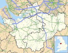
 Ditton
Ditton shown within CheshirePopulation 6,249
(2001 Census)OS grid reference SJ488855 Unitary authority Halton Ceremonial county Cheshire Region North West Country England Sovereign state United Kingdom Post town WIDNES Postcode district WA8 Dialling code 0151 Police Cheshire Fire Cheshire Ambulance North West EU Parliament North West England UK Parliament Halton List of places: UK • England • Cheshire Ditton is a residential area of Widnes, in the borough of Halton, England. It borders Halebank to the south and west, Hough Green to the north and north west and an area just outside of Widnes town centre (the Ball o'Ditton) to the east. Ditton is a local government ward, with a population of 6,249 at the time of the 2001 Census.[1]
It has three small areas of shops ("Alexander Drive", "St Michaels" and "Queens Avenue") and the Roman Catholic St Michael's Church - a local example of Gothic Revival architecture. The area also houses two medium-sized industrial estates. There are three public-houses in Ditton; the Blundell Arms, the Yew Tree and the New Inn.
To the south east of Ditton runs Ditton Road, which connects the A562 Ashley Way Central Widnes By-pass to the Halebank area of the town. This an industrial stretch of road containing remnants of Widnes' manufacturing and trade, including a chemical plant and large timber yard which sit on an expanse of land which leads to the River Mersey. The area also once contained a popular golf course - St Michaels Municipal, however it closed due to arsenic contamination, which is a reminder of the industrial waste that lies beneath. Ditton railway station, situated on Hale Road between Ditton and Halebank, closed to passengers on 27 May 1994. The site is now a railway junction with concrete remnants of platforms. Near to the former station is Ditton Brook, which runs from the eastern part of Liverpool to Ditton, where it flows into the River Mersey.
Until the early 1990s, Ditton was the site of a large Golden Wonder factory, where their crisps and Pot Noodle snacks were produced. The workforce were primarily Ditton-based, so the decline of the factory exacerbated the problem of unemployment for unskilled and semi-skilled workers in the area. The site of the factory was used as the police station in the BBC TV drama Merseybeat, which was filmed on location in Ditton.
The area has recently benefited from new-build housing developments (such as Redrow's Chapel Gate development) with units primarily being purchased by first time buyer owner-occupiers, many of whom are indigenous to the area.[citation needed]
References
- ^ "2001 Census: Ditton (Ward)". Office for National Statistics. http://neighbourhood.statistics.gov.uk/dissemination/LeadKeyFigures.do?a=7&b=5940759&c=ditton&d=14&e=16&g=387743&i=1001x1003x1004&m=0&r=1&s=1201446260171&enc=1. Retrieved 27 January 2008.
Borough of Halton, Cheshire Principal Settlements Civil Parishes Unparished Areas Ceremonial county of Cheshire Unitary authorities Major settlements Rivers Topics - History
- Museums
Categories:- Villages in Cheshire

Wikimedia Foundation. 2010.