- Mount Eniwa
-
Mount Eniwa 恵庭岳 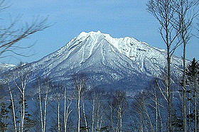
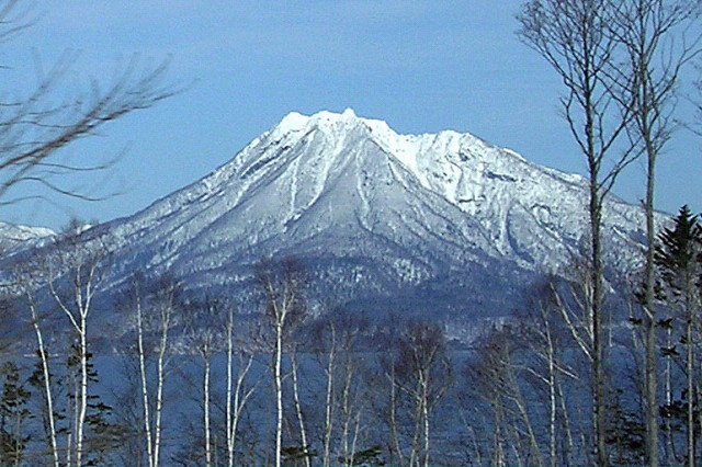
Mount Eniwa from the shores of Lake Shikostu, March 2007Elevation 1,320 m (4,331 ft) [1] Listing List of mountains and hills of Japan by height Location Location Hokkaidō, Japan Range Nasu Volcanic Zone Coordinates 42°47′36″N 141°17′8″E / 42.79333°N 141.28556°ECoordinates: 42°47′36″N 141°17′8″E / 42.79333°N 141.28556°E Topo map Geographical Survey Institute (国土地理院 Kokudochiriin) 25000:1 恵庭岳, 50000:1 樽前山 Geology Type Stratovolcano Age of rock Holocene Volcanic arc/belt Northeastern Japan Arc Last eruption 1707 ± 30[2] Climbing Easiest route Hike Mount Eniwa (恵庭岳 Eniwa-dake) is an active[3] volcano located in Shikotsu-Toya National Park in Hokkaidō, Japan. It sits opposite Mount Tarumae and Mount Fuppushi on the shores of Lake Shikotsu, the caldera lake that spawned the volcanoes. Mount Eniwa is the tallest of the three volcanoes.
Contents
Eruptions
The last eruption occurred around the start of the 18th century (circa 1700 ±30 years). There are no historical records of this, but tephrochronology indicates phreatic explosions with mudflows from crater 3. Two centuries before this eruption (circa 1550 ±75 years), radiocarbon dating indicates a similar eruption from crater 2. Around the same time (circa 1500 ±150 years), radiocarbon dating indicates another eruption, but from crater 1. This eruption included debris avalanches instead of mudflows. The oldest eruption that has been dated is an explosive eruption from the east side of the summit around 100 BCE ± 100 years according to radiocarbon dating. All these events were central vent eruptions with a volcanic explosivity index (VEI) of 2.[2]
Climbing Route
A single trail climbs the eastern side of the mountain. It gets progressively steeper as you climb. The trail starts in a forest about one 1 kilometre (0.6 mi) from Poropinai. The treeline is at about 800 metres (2,600 ft). From there the terrain is rocky and alpine. The climb takes 3-3.5 hours.[4][5]
1972 Winter Olympics
In the 1972 Winter Olympics, Mount Eniwa was the site of the men's and women's downhill ski races.[6] The course started at the summit and finished on the southwest slope.[7]
References
- ^ Geological Survey of Japan website data from ASTER
- ^ a b "Shikotsu: Eruptive History". Global Volcanism Program, Smithsonian Institution. http://www.volcano.si.edu/world/volcano.cfm?vnum=0805-04=&volpage=erupt. Retrieved 2008-04-24.
- ^ Paul Hunt, Hiking in Japan: An Adventurer's Guide to the Mountain Trails, pg. 179
- ^ Paul Hunt, Hiking in Japan: An Adventurer's Guide to the Mountain Trails, pg. 181
- ^ Robert Storey, North-East Asia on a Shoestring, pg. 327
- ^ "SHIKOTSU-KO". World Lakes Database. International Lake Environment Committee. http://www.ilec.or.jp/database/asi/asi-16.html. Retrieved 2008-12-02.
- ^ 1972 Winter Olympics official report. pp. 281-4.
- Geographical Survey Institute
- Paul Hunt, Hiking in Japan: An Adventurer's Guide to the Mountain Trails, Tokyo, Kodansha International Ltd., 1988. ISBN 0-87011-893-5 and ISBN4-7700-1393-0 C0075
- Robert Storey, North-East Asia on a Shoestring, Singapore, Lonely Planet Publications, 3rd Edition March 1992. ISBN 0-86442-135-4
Venues of the 1972 Winter Olympics City venues Mountain venues Miyanomori Jumping Hill • Mount Eniwa Downhill Course • Mt. Teine Alpine Skiing courses • Mt. Teine Bobsleigh Course • Mt. Teine Luge Course • Okurayama Jumping Hill1936: Gudiberg, Kreuzjoch, Kreuzeck • 1948: Piz Nair • 1952: Norefjell, Rødkleiva • 1956: Mount Faloria, Mount Tofana • 1960: Squaw Valley Ski Resort • 1964: Axamer Lizum, Patscherkofel • 1968: Chamrousse, Recoin de Chamrousse • 1972: Mount Eniwa Downhill Course, Mt. Teine Alpine Skiing courses • 1976: Axamer Lizum, Patscherkofel • 1980: Whiteface Mountain • 1984: Bjelašnica, Jahorina • 1988: Nakiska • 1992: Les Ménuires, Méribel, Val-d'Isère • 1994: Lillehammer Olympic Alpine Centre Hafjell, Lillehammer Olympic Alpine Centre Kvitfjell • 1998: Happōone Resort, Mount Higashidate, Mount Yakebitai • 2002: Deer Valley, Park City Mountain Resort, Snowbasin • 2006: San Sicario Fraiteve, Sestiere Borgata, Sestiere Colle • 2010: Whistler Creekside • 2014: Rosa Khutor Alpine Resort • 2018: Jungbong, Yongpyong Ski Resort Categories:
- 1972 Winter Olympics venues
- Olympic alpine skiing venues
- Volcanoes of Hokkaidō
- Active volcanoes
- Mountains of Hokkaidō
- Stratovolcanoes
- Shikotsu-Tōya National Park
- Hokkaidō geography stubs
- Japan protected area stubs

Wikimedia Foundation. 2010.