- Mount Tarumae
-
Mount Tarumae 樽前山 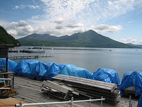
Mt. Tarumae as seen from Lake Shikotsu, (June 2006)Elevation 1,041 m (3,415 ft) [1] Listing List of mountains and hills of Japan by height
List of volcanoes in JapanLocation Location Hokkaidō, Japan Range Nasu Volcanic Zone Coordinates 42°41′24″N 141°22′41″E / 42.69°N 141.37806°ECoordinates: 42°41′24″N 141°22′41″E / 42.69°N 141.37806°E[2] Topo map Geographical Survey Institute (国土地理院 Kokudochiriin) 50000:1 樽前山, 25000:1 樽前山, 25000:1 風不死岳 Geology Type Caldera Volcanic arc/belt Northeastern Japan Arc Last eruption 1982 Climbing Easiest route Hike Mount Tarumae (樽前山 Tarumae-zan) is located in the Shikotsu-Toya National Park in Hokkaidō, Japan. It is located near both Tomakomai and Chitose towns and can be seen clearly from both. It is on the shores of Lake Shikotsu, a caldera lake. Tarumae is a 1,041 metre active andesitic stratovolcano, with a lava dome.
Contents
Eruptions
The most recent eruption, in 1982, was a phreatic eruption[3]. Previous major eruptions have occurred in 1667, 1739, (plinian eruption of VEI 5[4]) and 1909. The 1667 and 1739 eruptions were responsible for its present shape. Other eruptions were in 1919–21, 1923, 1926, 1933, 1936, 1944, 1951, 1953–55, and 1978.[5] Tarumae is an 'A' rank volcano — most likely to erupt in the relatively near future.[3]
Hokkaido Natural Monument
Designated as a Hokkaido Natural Monument, it is popular as an easy climb for hikers who may start at the seventh station and then take an hour to reach the crater.
At the foot of Tarumae on the north-west side one can find an impressive moss-covered cavern (Koke-no-domon).
References
- ^ Geographical Survey Institute
- ^ Mt. Tarumae
- ^ a b "Volcano Field Trip". http://www.ricen.hokkaido-c.ed.jp/e220field_trips/volcano-haz.htm. Retrieved 2007-10-02.
- ^ "Enlightenment activities for improvement on disasters from Tarumae Volcano, Japan" (doc). Cities on Volcanoes. January 2006. pp. 4, 23–27. http://www.citiesonvolcanoes4.com/abstracts/numerados/171.doc.
- ^ "GEOPHYSICAL OBSERVATIONS IN TARUMAI VOLCANO, HOKKAIDO, JAPAN" (doc). Makoto Tamura Geological Survey of Hokkaido. http://www.kscnet.ru/ivs/conferences/kasp/tez/ab39en.doc.
External links
- "Tarumae-san, Japan". Peakbagger.com. http://peakbagger.com/peak.aspx?pid=10784. Retrieved 2007-10-02.
Categories:- Volcanic calderas of Japan
- Active volcanoes
- Stratovolcanoes
- Lava domes
- Volcanoes of Hokkaidō
- Mountains of Hokkaidō
- Shikotsu-Tōya National Park
- Hokkaidō geography stubs
- Japan protected area stubs

Wikimedia Foundation. 2010.