- Danciger, Texas
-
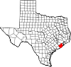
Danciger — Unincorporated area — Location within the state of Texas
 Danciger
Coordinates: 29°10′18″N 95°49′08″W / 29.17167°N 95.81889°WCoordinates: 29°10′18″N 95°49′08″W / 29.17167°N 95.81889°W Country United States State Texas County Brazoria Time zone Central (CST) (UTC-6) - Summer (DST) CDT (UTC-5) ZIP codes FIPS code GNIS feature ID Danciger is an unincorporated area in Brazoria County, Texas, United States.
Contents
Government and infrastructure
The United States Postal Service operates the Danciger Post Office on Farm to Market Road 1301.[1] In July 2011 the USPS announced that it may close the post office. Joe King, the Brazoria County Judge, said in 2011 that he was not surprised that the postal agency targeted the post office for closure and that "[f]or years, when I drove by, I wondered how many people it served. There's nothing there — just this tiny house about the size of my office, sitting in the yard of another house. There's nothing else out there."[2]
Education
Columbia-Brazoria Independent School District operates schools in the area.
References
- ^ "Post Office™ Location - DANCIGER." United States Postal Service. Retrieved on July 27, 2011. "25420 FM 1301 DANCIGER, TX 77431-9800"
- ^ Horswell, Cindy and Megan Ryan. "South Texas post office closures 'heart breaking' for many." Houston Chronicle. July 26, 2011. Retrieved on July 27, 2011.
External links
- Danciger, Texas from the Handbook of Texas Online
Municipalities and communities of Brazoria County, Texas County seat: Angleton Cities Alvin | Angleton | Brazoria | Brookside Village | Clute | Danbury | Freeport | Lake Jackson | Liverpool | Manvel | Oyster Creek | Pearland‡ | Richwood | Sandy Point | Surfside Beach | Sweeny | West Columbia
Towns Villages CDPs Unincorporated
communitiesAmsterdam | Anchor | Chenango | China Grove | Chocolate Bayou | Danciger | East Columbia | English | Lochridge | Old Ocean | Otey | Rosharon | Snipe | Silverlake | Turtle Cove
Footnotes ‡This populated place also has portions in an adjacent county or counties
Categories:- Populated places in Brazoria County, Texas
- Unincorporated communities in Texas


Wikimedia Foundation. 2010.