- Chenango, Texas
-
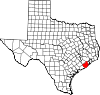
Chenango is an unincorporated area in Brazoria County, Texas located seven miles north of Angleton, Texas on State Highway 521.
History
Chenango was named after a town in the State of New York. It was centered around Chenango Plantation a 1,300 acres plantation during the 1800's. Along with the acreage that belong to S. Richarson and Joshua Abbot added about 3,000 acres to the plantation. In 1835 (circa) Benjamin Fort Smith bought a portion of the 3,000 acres, along with Monroe Edwards and Christopher Dart converted the cotton production of the plantation to sugarcane. Monroe Edwards and Christopher Dart also used the plantation for slave smuggling to Texas form Cuba. The Eight Texas Calvary Terry's Texas Rangers owned the plantation during the 1860's.
A post office was opened in Chenango in 1869 and closed in 1871, reopened in 1877 and closed after 1930.
In 1906 Chenango had a white school with two teachers and twenty pupils. It also had a black school with 180 pupils and five teachers. By 1947 the white children attended school in the Angleton Independent School District while the black children continued to attend school in Chenango.External Links
Chenango, Texas by the Handbook of Texas
Municipalities and communities of Brazoria County, Texas County seat: Angleton Cities Alvin | Angleton | Brazoria | Brookside Village | Clute | Danbury | Freeport | Lake Jackson | Liverpool | Manvel | Oyster Creek | Pearland‡ | Richwood | Sandy Point | Surfside Beach | Sweeny | West Columbia
Towns Villages CDPs Unincorporated
communitiesAmsterdam | Anchor | Chenango | China Grove | Chocolate Bayou | Danciger | East Columbia | English | Lochridge | Old Ocean | Otey | Rosharon | Snipe | Silverlake | Turtle Cove
Footnotes ‡This populated place also has portions in an adjacent county or counties
Coordinates: 29°15′15″N 95°27′32″W / 29.25417°N 95.45889°W
Categories:- Populated places in Brazoria County, Texas
- Populated places established in 1869
- Unincorporated communities in Texas

Wikimedia Foundation. 2010.