- Chocolate Bayou, Texas
-
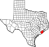
Chocolate Bayou — Unincorporated area — Location within the state of Texas
 Chocolate Bayou
Coordinates: 29°18′48″N 95°15′08″W / 29.31333°N 95.25222°WCoordinates: 29°18′48″N 95°15′08″W / 29.31333°N 95.25222°W Country United States State Texas County Brazoria Time zone Central (CST) (UTC-6) – Summer (DST) CDT (UTC-5) ZIP codes FIPS code GNIS feature ID 2034890 Chocolate Bayou is an unincorporated area in Brazoria County, Texas, United States.
Education
Angleton Independent School District operates schools in the area.
External links
- Chocolate Bayou, Texas from the Handbook of Texas Online
- U.S. Geological Survey Geographic Names Information System: Chocolate Bayou, Texas
Municipalities and communities of Brazoria County, Texas Cities Alvin | Angleton | Brazoria | Brookside Village | Clute | Danbury | Freeport | Lake Jackson | Liverpool | Manvel | Oyster Creek | Pearland‡ | Richwood | Sandy Point | Surfside Beach | Sweeny | West Columbia
Towns Villages CDPs Unincorporated
communitiesAmsterdam | Anchor | Chenango | China Grove | Chocolate Bayou | Danciger | East Columbia | English | Lochridge | Old Ocean | Otey | Rosharon | Snipe | Silverlake | Turtle Cove
Footnotes ‡This populated place also has portions in an adjacent county or counties
Categories:- Populated places in Brazoria County, Texas
- Unincorporated communities in Texas


Wikimedia Foundation. 2010.