- Moelfre
-
For the Welsh hill, see Moelfre (hill).
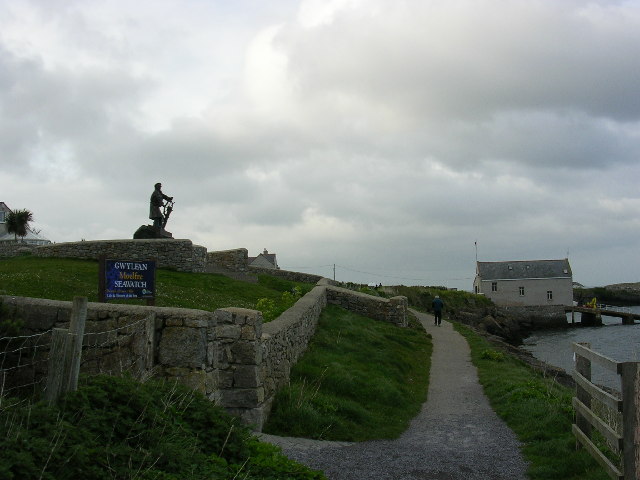
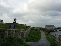 The Lifeboat station and Seawatch Centre
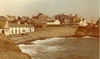 The shore and seawall
Moelfre is a village and community on the east coast of Isle of Anglesey in Wales, and on the Anglesey Coastal Path. It has a population of 1,129.[1]The Royal Mail postcode begins LL72.
It was the site of the wreck in 1859 of the hybrid ship The Royal Charter near the end of its voyage from Australia to Liverpool. The village today has 502 households and 5% unemployment. In the village there is a post office, a bakery, a fish and chip shop, one restaurant, Ann's Pantry, the Oak Lodge Inn (which trades as a pub, a bed and breakfast and a restaurant), and a second pub, The Kinmel Arms Hotel. There were no street lights in the village until well after the Second World War.
Moelfre RNLI Lifeboat Station is open to the public, and has a famous history, including the Hindlea rescue in 1959, when all the crew were rescued.
This area is popular as it is right by the large sandy beach Traeth Lligwy, which is an excellent spot for water and beach sports, and the ancient stone homestead of Din Lligwy. Nearby Ynys Moelfre is also a haven for birds, and seals and porpoises may be seen. The village is easily accessible being only 5 minutes from the A5025. The nearest mainline railway stations are in Bangor and Llanfairpwllgwyngyll. These can be reached in under half an hour on the bus services which run through the village.
The meaning of the Welsh language word Moelfre translated in English is 'bald or barren hill', which describes the land behind the village, as seen from the sea.
References
- Chris and Lesley Holden (2009). Life and Death on the Royal Charter. Calgo Publications 2009 ISBN 978-0-9545066-2-9.
External links
Coordinates: 53°21′13″N 4°14′08″W / 53.35351°N 4.23560°W
Categories:- Villages in Anglesey


Wikimedia Foundation. 2010.