Church Island

Church Island

Coordinates: 53°13′21.9″N 4°10′16.6″W / 53.22275°N 4.171278°W / 53.22275; -4.171278

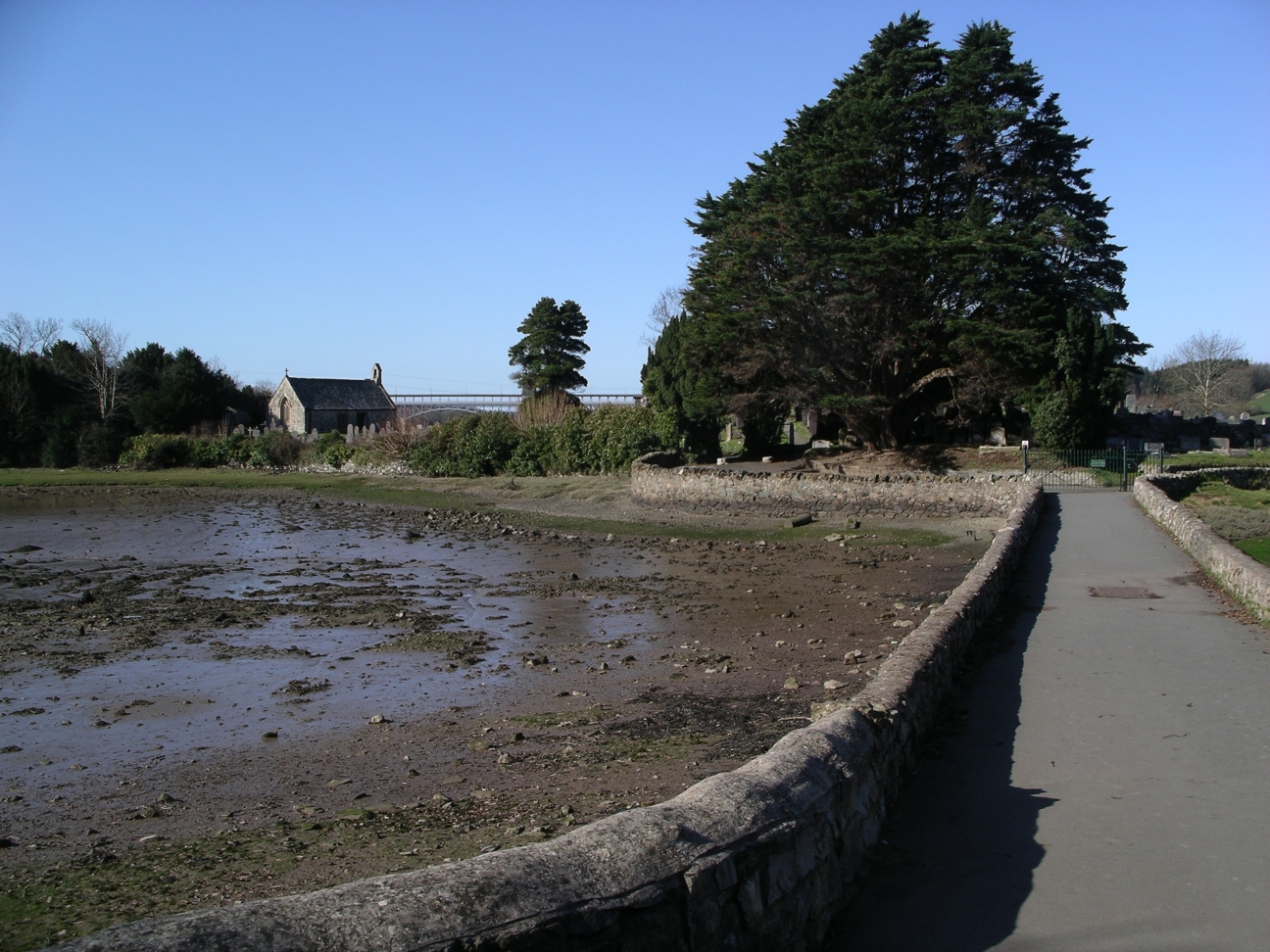
Church Island and Causeway

Church Island (Welsh: Ynys Dysilio) is a small island in the Menai Strait on the shores of Anglesey to which it is attached by a short causeway that is reachable only on foot off the Belgian Promenade[1]. The whole 2.7 acres (11,000 m2) of the island is taken up with St Tysilio's church, constructed in the 15th century,[2] and the churchyard. The 20th-century bard Cynan (Albert Evans-Jones) is buried in the churchyard. The Anglesey Coastal Path passes the head of the causeway.

On top of the highest point of the small island is a memorial to the local men who died during the World wars. This is also the best place on the island from which to view the Menai Strait and the two bridges that cross it[1].

In 2002, Little Egrets bred in Wales for the first time on a small islet just off Church Island.

References

External links

  • Prosiect Menai A Community celebrating the two bridges along the Menai Strait and the surrounding area.

Wikimedia Foundation. 2010.

Игры ⚽ Поможем написать курсовую

Look at other dictionaries:

  • Church Island — ist der Name mehrerer Inseln im englischen Sprachraum: Church Island (Menai Straße), Wales Church Island (Lough Gill), Binneninsel in Irland Church Island (Valentia Harbour), Irland Church Island (Lough Beg), Binneninsel in Irland Church Island… …   Deutsch Wikipedia

  • Church Island (Lough Carra) — Church Island ist eine ehemalige, heute mittels Damm mit dem Festland verbundene Insel auf der Westseite des Lough Carra im Zentrum des County Mayo in Irland. Die 1993 erfolgte Ausgrabung des Platzes lieferte Anschauungsmaterial über frühe… …   Deutsch Wikipedia

  • Church Island (Lough Garadice) — Vorlage:Infobox Insel/Wartung/Bild fehltVorlage:Infobox Insel/Wartung/Fläche fehltVorlage:Infobox Insel/Wartung/Höhe fehlt Church Island Gewässer Lough Garadice Geographische Lage …   Deutsch Wikipedia

  • Church Island (Menai-Straße) — Vorlage:Infobox Insel/Wartung/Fläche fehltVorlage:Infobox Insel/Wartung/Höhe fehlt Church Island (Menai Straße) Church Island mit Damm …   Deutsch Wikipedia

  • Church Island, River Thames — The tail of Church Island Church Island is an island in the River Thames in England on the reach above Penton Hook Lock, near Staines Bridge in Staines, Spelthorne, Surrey. It connects by a footbridge to Church Street, Staines, near a recreation… …   Wikipedia

  • Church Island (Lough Currane) — Vorlage:Infobox Insel/Wartung/Bild fehltVorlage:Infobox Insel/Wartung/Fläche fehltVorlage:Infobox Insel/Wartung/Höhe fehlt Church Island (Lough Currane) Gewässer Lough Currane Geographische Lage …   Deutsch Wikipedia

  • Church Island (Lough Gill) — Vorlage:Infobox Insel/Wartung/Bild fehltVorlage:Infobox Insel/Wartung/Fläche fehltVorlage:Infobox Insel/Wartung/Höhe fehlt Church Island Gewässer Lough Gill Geographische Lage …   Deutsch Wikipedia

  • Church Island (Lough Beg) — Vorlage:Infobox Insel/Wartung/Bild fehltVorlage:Infobox Insel/Wartung/Fläche fehltVorlage:Infobox Insel/Wartung/Höhe fehlt Church Island Gewässer Lough Beg Geographische Lage …   Deutsch Wikipedia

  • Church Island (Valentia Harbour) — Vorlage:Infobox Insel/Wartung/Bild fehltVorlage:Infobox Insel/Wartung/Fläche fehltVorlage:Infobox Insel/Wartung/Höhe fehlt Church Island Gewässer Atlantischer Ozean Geographische Lage …   Deutsch Wikipedia

  • Church of Jesus Christ of Latter Day Saints (Strangite) — 1856 daguerreotype of James Strang, taken on Beaver Island, Lake Michigan. Classification Latter Day Saint movement …   Wikipedia

Share the article and excerpts

Direct link
Do a right-click on the link above
and select “Copy Link”