- Afon Cefni
Geobox|River
name =
native_name = Afon Cefni
other_name =
category =
etymology =
nickname =
image_caption =
country = Wales | country_
state =
region_type = Counties | region =
district =
municipality =
parent =
tributary_left =
tributary_right =
city =
landmark =
source = Llyn Cefni
source_location = | source_region = | source_country =
source_elevation =
source_lat_d = | source_lat_m = | source_lat_s = | source_lat_NS =
source_long_d = | source_long_m = | source_long_s = | source_long_EW =
source1 =
source1_location = | source1_region = | source1_country =
source1_elevation =
source1_lat_d = | source1_lat_m = | source1_lat_s = | source1_lat_NS =
source1_long_d = | source1_long_m = | source1_long_s = | source1_long_EW =
source_confluence =
source_confluence_location = | source_confluence_region = | source_confluence_country =
source_confluence_elevation =
source_confluence_lat_d = | source_confluence_lat_m = | source_confluence_lat_s = | source_confluence_lat_NS =
source_confluence_long_d = | source_confluence_long_m = | source_confluence_long_s = | source_confluence_long_EW =
mouth = Irish Sea
mouth_location = Malltraeth Sands | mouth_region = | mouth_country =
mouth_elevation =
mouth_lat_d = | mouth_lat_m = | mouth_lat_s = | mouth_lat_NS =
mouth_long_d = | mouth_long_m = | mouth_long_s = | mouth_long_EW =
length = 16.9
width =
depth =
volume =
watershed =
discharge =
discharge_max =
discharge_min =
free = | free_type =
map_caption =
map_background =
map_locator =
map_locator_x =
map_locator_y =
website =
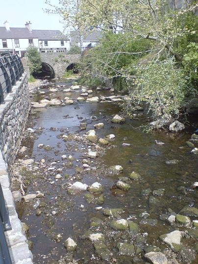
footnotes =Afon Cefni is one of the major
rivers on the island ofAnglesey ,Wales . It is convert|16.9|km|mi|0 long. The river starts at theLlyn Cefni in the centre of the island and then runs south through the county town ofLlangefni . Just north of the A55 the river turns and flows south-west. It passes through the flatlands of theMalltraeth Marshes, where the river course was altered intocanal in 1824. Finally it flows into theIrish Sea at Malltraeth Sands in the south-west of the island.In February 2007 one of the most bizarre moments in the rivers history took place. A local
cheese making company was fined £4,000 and ordered to pay £1,585 in costs after some convert|100|L|impgal|0|lk=on ofcream was discharged into the Afon Cefni via their surface water drainage system. In August 2007 toxicalgae was found in a strech of the river flowing through The Dingle near Llangefni.

Wikimedia Foundation. 2010.