- Monte Alto, Texas
-
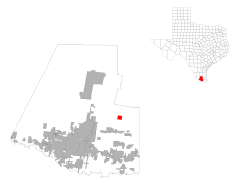
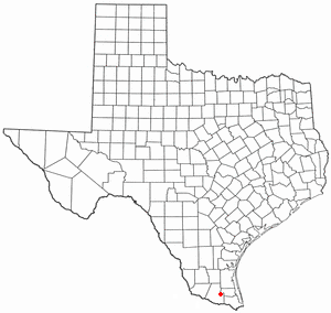
Monte Alto, Texas — CDP — Location of Monte Alto, Texas
Coordinates: 26°22′25″N 97°58′21″W / 26.37361°N 97.9725°WCoordinates: 26°22′25″N 97°58′21″W / 26.37361°N 97.9725°W Country United States State Texas County Hidalgo Area – Total 2.2 sq mi (5.8 km2) – Land 2.2 sq mi (5.8 km2) – Water 0.0 sq mi (0.0 km2) Elevation 52 ft (16 m) Population (2000) – Total 1,611 – Density 718.3/sq mi (277.3/km2) Time zone Central (CST) (UTC-6) – Summer (DST) CDT (UTC-5) ZIP code 78538 Area code(s) 956 FIPS code 48-49080[1] GNIS feature ID 1341816[2] Monte Alto is a census-designated place (CDP) in Hidalgo County, Texas, United States. The population was 1,611 at the 2000 census. It is part of the McAllen–Edinburg–Mission Metropolitan Statistical Area.
Contents
Geography
Monte Alto is located at 26°22′25″N 97°58′21″W / 26.37361°N 97.9725°W (26.373686, -97.972377)[3].
According to the United States Census Bureau, the CDP has a total area of 2.2 square miles (5.7 km2), all of it land.
Demographics
As of the census[1] of 2000, there were 1,611 people, 419 households, and 367 families residing in the CDP. The population density was 718.3 people per square mile (277.7/km²). There were 470 housing units at an average density of 209.6/sq mi (81.0/km²). The racial makeup of the CDP was 66.29% White, 0.50% Native American, 0.06% Asian, 31.47% from other races, and 1.68% from two or more races. Hispanic or Latino of any race were 96.77% of the population.
There were 419 households out of which 50.4% had children under the age of 18 living with them, 66.8% were married couples living together, 14.3% had a female householder with no husband present, and 12.2% were non-families. 8.8% of all households were made up of individuals and 3.1% had someone living alone who was 65 years of age or older. The average household size was 3.84 and the average family size was 4.12.
In the CDP the population was spread out with 36.4% under the age of 18, 12.2% from 18 to 24, 27.0% from 25 to 44, 17.2% from 45 to 64, and 7.1% who were 65 years of age or older. The median age was 26 years. For every 100 females there were 93.4 males. For every 100 females age 18 and over, there were 101.6 males.
The median income for a household in the CDP was $20,313, and the median income for a family was $21,389. Males had a median income of $14,625 versus $15,750 for females. The per capita income for the CDP was $6,747. About 39.5% of families and 41.3% of the population were below the poverty line, including 48.7% of those under age 18 and 52.8% of those age 65 or over.
Education
Monte Alto is served by the Monte Alto Independent School District for grades Kindergarten through 8. Edcouch-Elsa Independent School District also serves the town.[4]
In addition, South Texas Independent School District operates magnet schools that serve the community.
References
- ^ a b "American FactFinder". United States Census Bureau. http://factfinder.census.gov. Retrieved 2008-01-31.
- ^ "US Board on Geographic Names". United States Geological Survey. 2007-10-25. http://geonames.usgs.gov. Retrieved 2008-01-31.
- ^ "US Gazetteer files: 2010, 2000, and 1990". United States Census Bureau. 2011-02-12. http://www.census.gov/geo/www/gazetteer/gazette.html. Retrieved 2011-04-23.
- ^ Handbook. Edcouch-Elsa Independent School District
Municipalities and communities of Hidalgo County, Texas Cities 
CDPs Abram-Perezville | Cesar Chavez | Citrus City | Cuevitas | Doffing | Doolittle | Faysville | Havana | Heidelberg | Indian Hills | La Blanca | La Homa | Laguna Seca | Llano Grande | Lopezville | Los Ebanos | Midway North | Midway South | Mila Doce | Monte Alto | Muniz | North Alamo | Nurillo | Olivarez | Palmview South | Relampago | San Carlos | San Manuel-Linn | Scissors | South Alamo | Villa Verde | West Sharyland
Unincorporated
communityHargill
Categories:- Populated places in Hidalgo County, Texas
- Census-designated places in Texas
- Populated places in Texas with Hispanic majority populations


Wikimedia Foundation. 2010.