- West Sharyland, Texas
Infobox Settlement
official_name = West Sharyland, Texas
settlement_type = CDP
nickname =
motto =
imagesize =
image_caption =
image_
imagesize =
image_caption =
image_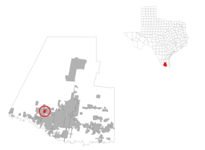
mapsize = 300px
map_caption =
mapsize1 =
map_caption1 =subdivision_type = Country
subdivision_name =United States
subdivision_type1 = State
subdivision_name1 =Texas
subdivision_type2 = County
subdivision_name2 = Hidalgogovernment_footnotes =
government_type =
leader_title =
leader_name =
leader_title1 =
leader_name1 =
established_title =
established_date =unit_pref = Imperial
area_footnotes =area_magnitude =
area_total_km2 = 6.0
area_land_km2 = 6.0
area_water_km2 = 0.0
area_total_sq_mi = 2.3
area_land_sq_mi = 2.3
area_water_sq_mi = 0.0population_as_of = 2000
population_footnotes =
population_total = 2947
population_density_km2 = 492.5
population_density_sq_mi = 1275.5timezone = Central (CST)
utc_offset = -6
timezone_DST = CDT
utc_offset_DST = -5
elevation_footnotes =
elevation_m = 52
elevation_ft = 171
latd = 26 |latm = 16 |lats = 37 |latNS = N
longd = 98 |longm = 20 |longs = 18 |longEW = Wpostal_code_type =
postal_code =
area_code =
blank_name = FIPS code
blank_info = 48-77866GR|2
blank1_name = GNIS feature ID
blank1_info = 1852783GR|3
website =
footnotes =West Sharyland is a
census-designated place (CDP) in Hidalgo County,Texas ,United States . The population was 2,947 at the 2000 census. It is part of the McAllen–Edinburg–Mission Metropolitan Statistical Area.Geography
West Sharyland is located at coor dms|26|16|37|N|98|20|18|W|city (26.276838, -98.338393)GR|1.
According to the
United States Census Bureau , the CDP has a total area of 2.3square mile s (6.0km² ), all of it land.Demographics
As of the
census GR|2 of 2000, there were 2,947 people, 676 households, and 648 families residing in the CDP. Thepopulation density was 1,275.5 people per square mile (492.6/km²). There were 743 housing units at an average density of 321.6/sq mi (124.2/km²). The racial makeup of the CDP was 85.34% White, 0.03% African American, 0.07% Native American, 0.24% Pacific Islander, 13.98% from other races, and 0.34% from two or more races. Hispanic or Latino of any race were 98.10% of the population.There were 676 households out of which 69.1% had children under the age of 18 living with them, 78.3% were married couples living together, 14.5% had a female householder with no husband present, and 4.1% were non-families. 3.7% of all households were made up of individuals and 1.9% had someone living alone who was 65 years of age or older. The average household size was 4.36 and the average family size was 4.44.
In the CDP the population was spread out with 42.3% under the age of 18, 12.5% from 18 to 24, 28.9% from 25 to 44, 12.3% from 45 to 64, and 3.9% who were 65 years of age or older. The median age was 22 years. For every 100 females there were 93.9 males. For every 100 females age 18 and over, there were 89.6 males.
The median income for a household in the CDP was $24,602, and the median income for a family was $24,393. Males had a median income of $17,283 versus $15,125 for females. The
per capita income for the CDP was $8,383. About 31.5% of families and 30.9% of the population were below thepoverty line , including 36.0% of those under age 18 and 32.9% of those age 65 or over.Development
The areas growth is largely a result of the economic changes spawned by the
North American Free Trade Agreement (NAFTA) http://www.time.com/time/covers/1101010611/fnafta.html] ).The region is also becoming popular as a bedroom community for white collar workers and professionals working in McAllen and Mission. A 1998 Census Bureau study found that McAllen-Mission is the third fastest growing metropolitan area in the United States.Education
The area is served by the
Sharyland Independent School District .HVDC back-to-back station
At present a back-to-back HVDC is under construction. It will operate with a bipolar voltage of 21 kV and allow a maximum power exchange between USA and Mexico of 150 MW. Inauguration of this facility, which is built by ABB will be in 2007 [http://www.abb.com/cawp/gad02181/b12c1d8468eee62bc12570c80038289b.aspx?=] .
Famous and Prominent Sharyland Residents
John H. Shary (1872-1945) Founder of Sharyland and the Rio Grande Valley citrus industry. His daughter, Marialice, married Texas GovernorAllan Shivers .John J. Conway (18??-1946) Purchased the land that would become Sharyland from the Catholic Church before selling much of it to John Shary. Conway played an instrumental role in developing an irrigation system for local farms, and founded the city of Mission Texas; much of unincorporated Sharyland actually lies within Mission's city limits.Lloyd Bentsen (1921-2006) Born in Sharyland and graduated from Sharyland High School. Bentsen was a four-term Senator, vice-presidential candidate, and from 1993-94 served asBill Clinton 's Treasury Secretary.William Jennings Bryan (1860-1925) Retired to Sharyland after his third unsuccessful run for the Presidency in 1908. Bryan and his wife remained in Sharyland until 1913 when PresidentWoodrow Wilson made him Secretary of State. After leaving the cabinet in 1915, Bryan sold the "Bryan House" in Sharyland and moved to Florida. Bryan achieved his greatest fame shortly before his death when he squared off againstClarence Darrow in the famous "Scopes Trial ", which tested whetherevolution could be taught in the classroom.Tom Landry (1924-2000) TheDallas Cowboys ' legendary coach was born and grew up on a farm in Sharyland, although he is usually associated more with the city of Mission which claims him as its most famous native son.See also
*
Sharyland High School References
External links
* [http://texashistory.unt.edu/search/?q=shary&t=fulltext Photographs of Sharyland Excursions] from the University of Texas-Pan American hosted by the [http://texashistory.unt.edu/ Portal to Texas History]
Wikimedia Foundation. 2010.