- Palmhurst, Texas
Infobox Settlement
official_name = Palmhurst, Texas
settlement_type =City
nickname =
motto =
imagesize =
image_caption =
image_
mapsize = 250x200px
map_caption = Location of Palmhurst, Texas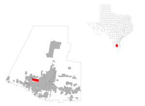
mapsize1 = 250px
map_caption1 =subdivision_type = Country
subdivision_name =United States
subdivision_type1 = State
subdivision_name1 =Texas
subdivision_type2 = County
subdivision_name2 = Hidalgogovernment_footnotes =
government_type =
leader_title =
leader_name =
leader_title1 =
leader_name1 =
established_title =
established_date =unit_pref = Imperial
area_footnotes =area_magnitude =
area_total_km2 = 15.7
area_land_km2 = 15.7
area_water_km2 = 0.0
area_total_sq_mi = 6.1
area_land_sq_mi = 6.1
area_water_sq_mi = 0.0population_as_of = 2000
population_footnotes =
population_total = 4872
population_density_km2 = 310.4
population_density_sq_mi = 804.0timezone = Central (CST)
utc_offset = -6
timezone_DST = CDT
utc_offset_DST = -5
elevation_footnotes =
elevation_m = 49
elevation_ft = 161
latd = 26 |latm = 15 |lats = 3 |latNS = N
longd = 98 |longm = 18 |longs = 27 |longEW = Wpostal_code_type =
ZIP code
postal_code = 78573
area_code = 956
blank_name = FIPS code
blank_info = 48-54780GR|2
blank1_name = GNIS feature ID
blank1_info = 1378825GR|3
website =
footnotes =Palmhurst is a city in Hidalgo County,
Texas ,United States . The population was 4,872 at the 2000 census. It is part of the McAllen–Edinburg–Mission Metropolitan Statistical Area.History
The community was incorporated in
1966 .Geography
Palmhurst is located at coor dms|26|15|3|N|98|18|27|W|city (26.250924, -98.307607)GR|1.
According to the
United States Census Bureau , the city has a total area of 6.1square mile s (15.7km² ), all of it land.Palmhurst is four miles north of Mission on state highway 107 and is west of McAllen. It is several miles north of the
Rio Grande and the international border withMexico .Demographics
As of the
census GR|2 of 2000, there were 4,872 people, 1,226 households, and 1,110 families residing in the city. Thepopulation density was 804.0 people per square mile (310.4/km²). There were 1,739 housing units at an average density of 287.0/sq mi (110.8/km²). The racial makeup of the city was 84.67% White, 0.25% African American, 0.25% Native American, 0.39% Asian, 13.71% from other races, and 0.74% from two or more races. Hispanic or Latino of any race were 87.48% of the population.There were 1,226 households out of which 60.3% had children under the age of 18 living with them, 76.2% were married couples living together, 11.7% had a female householder with no husband present, and 9.4% were non-families. 7.3% of all households were made up of individuals and 2.0% had someone living alone who was 65 years of age or older. The average household size was 3.97 and the average family size was 4.18.
In the city the population was spread out with 38.9% under the age of 18, 10.1% from 18 to 24, 29.5% from 25 to 44, 16.8% from 45 to 64, and 4.7% who were 65 years of age or older. The median age was 26 years. For every 100 females there were 94.0 males. For every 100 females age 18 and over, there were 89.9 males.
The median income for a household in the city was $22,847, and the median income for a family was $24,549. Males had a median income of $27,500 versus $21,833 for females. The
per capita income for the city was $11,275. About 35.6% of families and 37.9% of the population were below thepoverty line , including 48.6% of those under age 18 and 20.4% of those age 65 or over.Education
About half of Palmhurst is served by the
Mission Consolidated Independent School District . The other half is served by theSharyland Independent School District .In addition,
South Texas Independent School District operates magnet schools that serve the community.References
External links
* [http://www.tsha.utexas.edu/handbook/online/articles/PP/hlpau.html Brief information on Palmhurst, Texas]

Wikimedia Foundation. 2010.