- Dobwalls
-
Coordinates: 50°27′28″N 4°30′57″W / 50.4577°N 4.5158°W
Dobwalls Cornish: Fos an Mogh 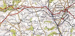

Dobwalls and district from the 1940s Ordnance Survey Popular Edition One Inch to the Mile map.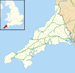
 Dobwalls
Dobwalls shown within CornwallPopulation 3,662 (2001 UK census) OS grid reference SX215650 Parish Dobwalls and Trewidland Shire county Cornwall Region South West Country England Sovereign state United Kingdom Post town LISKEARD Postcode district PL14 Dialling code 01579 Police Devon and Cornwall Fire Cornwall Ambulance South Western EU Parliament South West England UK Parliament South East Cornwall List of places: UK • England • Cornwall Dobwalls (Cornish: Fos an Mogh) is a village in south-east Cornwall, United Kingdom. It is situated three miles (5km) west of Liskeard[1].
The name is spelt Dubwalls on Bartholomew's map and Black's Guide of 1879.
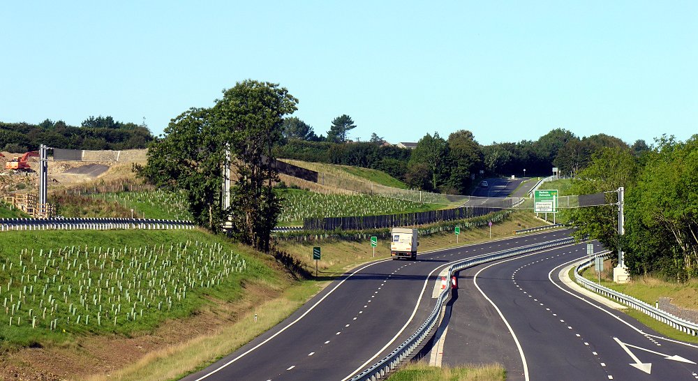
The A38 trunk road ran through the village until the bypass was opened on 19 December 2008.[2][3]. The bypass has two of the most elaborate bat bridges built so far in the UK (previous examples in Wales being wooden posts with cables). [4] Twelve native species of bats are found in the area.[5]
Until 2006, the Dobwalls Adventure Park tourist attraction was located north of the village.
References
- ^ Ordnance Survey: Landranger map sheet 201 Plymouth & Launceston ISBN 9780319231463
- ^ "Bottleneck bypassed 40 years on". BBC News website. BBC. 19 December 2008. http://news.bbc.co.uk/2/hi/uk_news/england/cornwall/7791387.stm. Retrieved 2008-12-19.
- ^ [1] Highways Agency website. Retrieved April 2010
- ^ "New Bat bridge for bypass : Marishal Thompson Group - Tree Subsidence, Arboriculture, Ecology and Landscape Architecture throughout the UK". Marishalthompson.co.uk. http://marishalthompson.co.uk/news/new-bat-bridge-for-bypass/. Retrieved 2009-09-12.
- ^ "House of Lords Written Answers 10 November 2009: Bats". United Kingdom Parliament. http://services.parliament.uk/hansard/Lords/ByDate/20091110/writtenanswers/part002.html. Retrieved 5 June 2011.
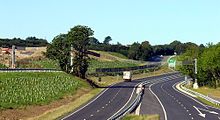 Bat Bridge on the A38 Dobwalls Bypass, Cornwall, UK. (2009)
External links
 Media related to Dobwalls at Wikimedia Commons
Geography of Cornwall Cornwall Portal Unitary authorities Major settlements Bodmin • Bude • Callington • Camborne • Camelford • Falmouth • Fowey • Hayle • Helston • Launceston • Liskeard • Looe • Lostwithiel • Marazion • Newlyn • Newquay • Padstow • Par • Penryn • Penzance • Porthleven • Redruth • Saltash • St Austell • St Blazey • St Columb Major • St Ives • St Just-in-Penwith • St Mawes • Stratton • Torpoint • Truro • Wadebridge
See also: Civil parishes in CornwallRivers Topics History • Status debate • Flag • Culture • Places • People • The Duchy • Diocese • Politics • Hundreds/shires • Places of interest • full list...Categories:- Villages in Cornwall
- Cornwall geography stubs


Wikimedia Foundation. 2010.