- Montmartre, Saskatchewan
-
Village of Montmartre — Village — Motto: Paris of the Prairies Location of Montmartre in Saskatchewan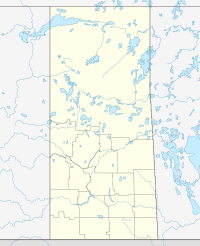

Coordinates: 50°12′47″N 103°24′54″W / 50.213°N 103.415°W Country Canada Province Saskatchewan Region Saskatchewan Census division 6 Rural Municipality Montmartre Post office Founded N/A Incorporated (Village) N/A Incorporated (Town) N/A Government – Mayor Calvin D. Abrahamson – Administrator Brenner Dale – Governing body Montmartre Village Council Area – Total 1.28 km2 (0.5 sq mi) Population (2006) – Total 413 – Density 81.3/km2 (210.6/sq mi) Time zone CST Postal code S0G 3M0 Area code(s) 306 Highways Highway 48 Waterways Kemoca Regional Park Website http://www.montmartre-sk.com [1] Montmartre is a village in the Canadian province of Saskatchewan.
Contents
Demographics
Canada census – Montmartre, Saskatchewan Community Profile 2006 Population:
Land area:
Population density:
Median age:
Total private dwellings:
Mean household income:413 (-11.2% from 2001)
1.63 km2 (0.63 sq mi)
284.9 /km2 (738 /sq mi)
50.2 (males: 47.3, females: 53.2)
225
$52,500
Notable people
- Norm Beaudin, (born November 28, 1941 in Montmartre) is a retired professional ice hockey forward who played 25 games in the National Hockey League and 335 in the World Hockey Association.
Notable structures
The village is home to a 1:38 scale replica of the Eiffel Tower.[3]
See also
References
- ^ National Archives, Archivia Net, Post Offices and Postmasters, http://www.collectionscanada.gc.ca/databases/post-offices/001001-119.01-e.php?&isn_id_nbr=10561&interval=24&&PHPSESSID=ijdn7p43il51jp9in0oiend171
- ^ "2006 Community Profiles". Statistics Canada. Government of Canada. 2009-02-24. http://www12.statcan.ca/census-recensement/2006/dp-pd/prof/92-591/index.cfm?Lang=E. Retrieved 2009-02-24.
- ^ White, Patrick (July 7, 2009). "We'll always have Paris, even in Saskatchewan". The Globe and Mail. The Globe and Mail Inc.. http://www.montmartre-sk.com/Globe%20article%20July%2009.htm. Retrieved 2011-03-29.
External links
- Official website
- Montmartre - 2006 Community Profiles
- Kemoca Regional Park
- Saskatchewan City & Town Maps
- Saskatchewan Gen Web - One Room School Project
- Post Offices and Postmasters - ArchiviaNet - Library and Archives Canada
- Saskatchewan Gen Web Region
- Online Historical Map Digitization Project
- GeoNames Query

Sintaluta Moffat Kendal 
Candiac  Montmartre

Fillmore, Saskatchewan  Subdivisions of Saskatchewan
Subdivisions Communities Cities Estevan · Flin Flon (part) · Humboldt · Lloydminster (part) · Martensville · Meadow Lake · Melfort · Melville · Moose Jaw · North Battleford · Prince Albert · Regina · Saskatoon · Swift Current · Weyburn · YorktonTopics Categories:- Villages in Saskatchewan

Wikimedia Foundation. 2010.