- Lima District
-
For other uses, see Lima District (disambiguation).
Lima — District — The Lima Cathedral
Coat of armsLocation of the Lima District in Lima
Coordinates: 12°2′36″S 77°1′42″W / 12.04333°S 77.02833°WCoordinates: 12°2′36″S 77°1′42″W / 12.04333°S 77.02833°W Country  Peru
PeruRegion Lima Province Lima Founded 1535 Capital Lima Government – Mayor Susana Villarán
(2011-hasta la fecha)Area – Total 21.88 km2 (8.4 sq mi) Elevation 2.87 m (9 ft) Population (2005 census) – Total 278,804 – Density 12,742.4/km2 (33,002.7/sq mi) Time zone PET (UTC-5) UBIGEO 150101 Website munlima.gob.pe Lima (known in Spanish as Cercado de Lima) is a district of the Lima Province in Peru. It is not where the inner city zone of Lima, the country's capital city, is located, San Isidro District being such area in Lima.
This district is the oldest in Lima and as such, vestiges of the city's colonial era remain today in the Historic centre of Lima, which was declared a UNESCO World Heritage Site in 1988.
Currently, the mayor (alcaldesa) of the Lima District is Susana Villarán and its postal code is 1.
Contents
Geography
The district has a total land area of 21.98 km². Its administrative center is located at 154 meters above sea level.
Boundaries
- North: The Rímac River marks the district's border with the San Martín de Porres and Rímac districts.
- East: El Agustino
- South: La Victoria, Lince, Jesús María, Breña and Pueblo Libre.
- West: San Miguel District; and the Callao Region districts of Bellavista, Callao and Carmen de la Legua Reynoso.
Demographics
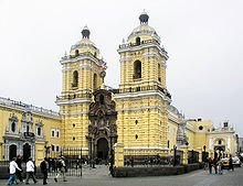 San Francisco de Asís Church
According to a 2005 estimate by the INEI, the district has 278,804 inhabitants and a population density of 15,736.9 persons/km². In 1999, there were 75,595 households in the district.
The high point of Lima's religious calendar for the masses is a month of festivities in October dedicated to the Lord of Miracles, during which take place several processions in the city.
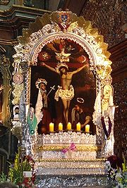 Señor de los Milagros
Neighborhoods
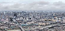 View of Lima District from the San Cristobal hill, showing the Acho bullring.
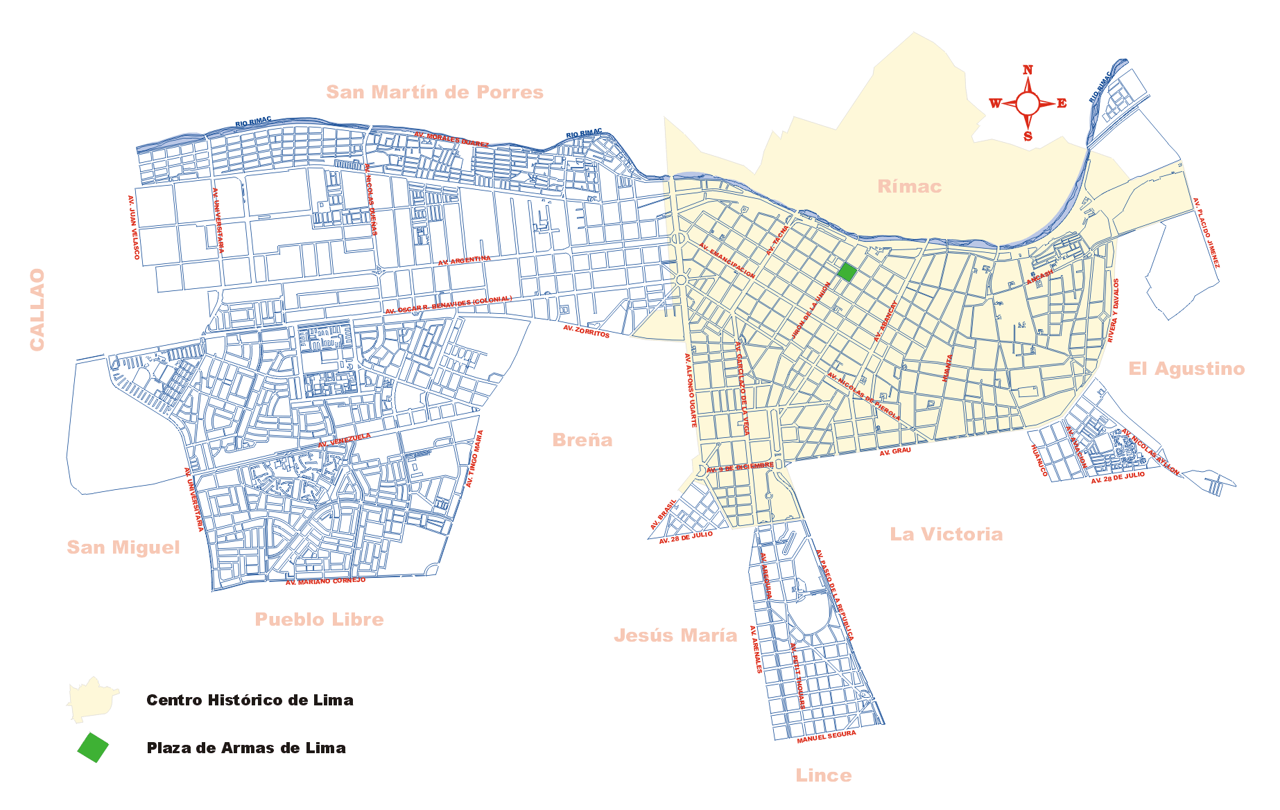
Central Lima (known as Cercado proper) is limited by Avenida Alfonso Ugarte on the west and Jirón Huánuco (Huánuco Street) on the east. It is divided into West and East sides by Jirón de la Unión (Union Street), from which cuadras (blocks) are numbered beginning at 100 and changing the first numbers at the next block. Unlike New York's Fifth Avenue, though, Jirón de la Unión is not paved for cars, but almost entirely a shopping and pedestrian street; the main thoroughfares for cars and buses are Tacna Ave. on the West side and Abancay Ave. on the East. Both are separated from Jirón de la Unión by 4 blocks. The Plaza de Armas (Grand Army Plaza), which is the main square, is located on block 2 of Jirón de la Unión, facing the Peruvian government palace and the Metropolitan Municipality of Lima (City Hall).
East of the center is the Barrios Altos (Uptown) neighborhood. Here the oldest, though least stable, buildings in Central Lima are located. Two cemeteries, El Angel and Presbítero Maestro, form the eastern border with El Agustino. Parts of the long-demolished colonial city walls can be seen here.
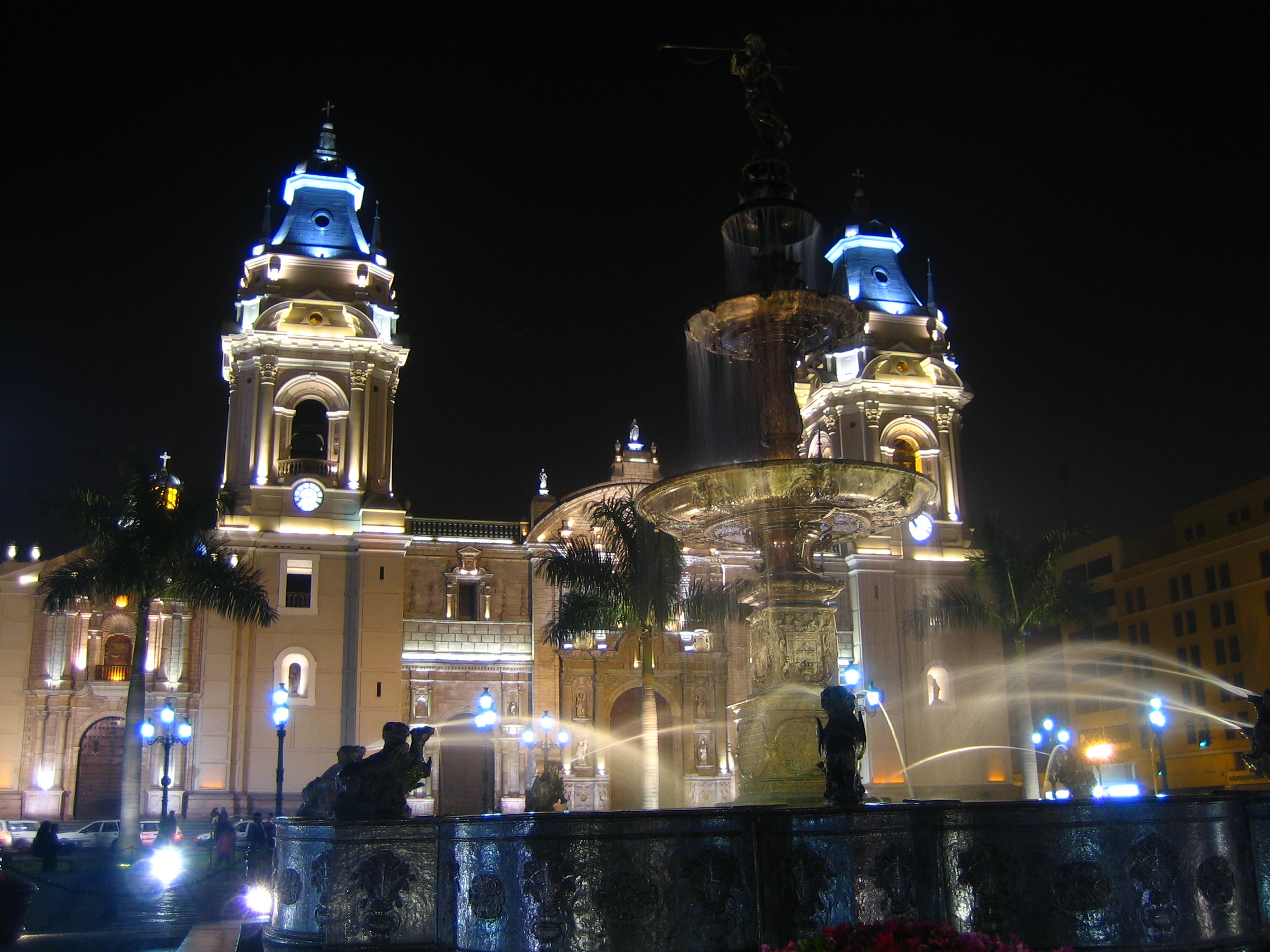
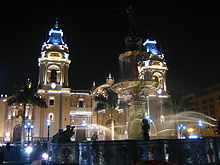 Cathedral of Lima facing the Plaza de Armas
South of the West Side is Santa Beatriz section, which contains residential buildings and the Parque de la Reserva. Santa Beatriz is locally famous for containing the buildings for the state TV network TNP (Ch. 7), and the top two private TV networks, America Television (Ch. 4) and Panamericana Television (Ch. 5). Its main thoroughfare is Arequipa Avenue, a narrow boulevard lined with trees of all sizes. Santa Beatriz is also home to the city (and country)'s main football stadium, the Estadio Nacional (National Stadium).
 A detailed map of the district, showing important avenues.
West of the center is the Industrial Area, an industrial belt extending into neighboring Callao Region, and home to the main industries in both city and country. Most of the area is covered by large blocks containing large factories.
At its northern and southern edges, there are clusters of residential areas, particularly in the southern zone bordering Pueblo Libre, San Miguel and Callao Region's Bellavista District.
External links
- (Spanish) Municipalidad Metropolitana de Lima - Metropolitan Lima Municipal Council official website
Lima and Callao Metropolitan Area Culture · History · Landmarks · Notable people · Mayors · Other elected officials · Transportation Districts Central Lima Breña · La Victoria · Lima · Rimac South Central Lima Barranco · Jesús María · La Molina · Lince · Magdalena · Miraflores · Pueblo Libre ·San Borja · San Isidro · San Miguel · Santiago de Surco · Surquillo Cono Este Ate · Cieneguilla · Chaclacayo · El Agustino · Lurigancho (Chosica) · San Juan de Lurigancho · San Luis · Santa Anita Cono Norte Ancón · Carabayllo · Comas · Independencia · Los Olivos · Puente Piedra · San Martin de Porres · Santa Rosa Cono Sur Chorrillos · Lurín · Pachacamac · Pucusana · Punta Hermosa · Punta Negra · San Bartolo · San Juan de Miraflores · Santa María del Mar · Villa el Salvador · Villa María del Triunfo Callao Bellavista · Callao District · Carmen de la Legua Reynoso· La Perla · La Punta · Ventanilla Categories:- Districts of Lima
- Central business districts


Wikimedia Foundation. 2010.