- Breña
Infobox District Peru
district = Breña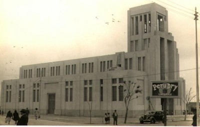
image_size =
image_caption = Side perspective of the Desamparados' Church
cofarms =
region =
province =Lima Province
founded =
capital =
elevation =
hamlets =
ubigeo =
pop = 94,808
density = 29,443.5
area = 3.22
mayor = Jose Antonio Gordillo Abad
web = www.munibrena.gob.peBreña is a district of the
Lima Province inPeru . It is part ofLima city metropolitan area.Officially established as a district onJuly 15 ,1949 , the currentmayor ("alcalde ") of Breña is José Gordillo Abad. The district'spostal code is LIM05.History
Pre-Hispanic Period
In pre-Hispanic times this zone would have been part of "Curacazgo" or "Señorío" of Ichma (Lima), with center in Pachacámac, that extended from the river and valley of Lurín to the Rímac. The small "Curacazgos" were formed in around the irrigation channels that allowed ample agricultural zones to maintain settlers. One of these was the channel of the Magdalena, that had its origin in the Rímac and started behind the present Palace of Government, went north to south crossing the district (by the current streets of Aguarico and Loreto, towards the avenue of the Rio de Pueblo Libre).
In the North area of the first boundary, was the huaca or complex of Makatampu (Macatambo), constructed during the Early Interval associated with the Lima or Maranga cultures (0-600 d.C.) Made of adobitos, adobones(Mud Bricks) and stones, with intrusive burials corresponding to the Late Interval (900-1470 d.C.). The location was the old property of the Count de las Torres, towards the north of 27th block of the Argentina avenue. This huaca disappeared by urban expansion between years 1940 and 1948.
To the south of the first district boundary is the archaeological complex Mateo Salado or Huaca de Azcona, who would have been host to the Curacazgo of Lima. Constituted by five constructed pyramids with big mudwalls, measures around 1,2 hectares. It is considered that it is of the Late Interval ( 900 DC - 1470 DC) and the Late Horizon Horizon (1470 DC -1532 DC). Formerly it was connected by a closed walled street with the archaeological group of Maranga. There are also references of the existence of a small huaca (Panteoncito) towards the third block of Brazil avenue.
Colonial Period
From 1618 the construction of a wall to defend the city of Lima from the possible pirate or Indian attacks had been requested from the population of Lima. More than half century later it was the Flemish presbyter Jean Raymond Coninck born in Mechelen, known astrologist of the Kingdom, that executed the project. He arrived at Peru in 1655 and due to his unique architectonic knowledge for his time because he had been disciple of the Jesuit scientists Gregorio of San Vicente and Andrés Jacquet.
The viceroy Melchor of Navarra y Rocaful, Duke of the Palata, insisted on the construction. The work began in 1685 and was inaugurated in 1687. The wall was more than 5 meters wide and 4,5 of height, and extended approximately 11,700 meters. It had 34 defensive bastions and 5 accesses to the city.
Republican Period
Lima was a walled city still in 1862, as is it shown on the 1862 map of the city made by Colonel Mariano Bolognesi. On December 2nd 1869 Peruvian president Jose Balta signs the decree by which the walls are taken down, to allow urban growth. In 1878, the traveler Edmundo Cotteau makes reference to that the walls had been demolished to make room for new streets. According to P. V. Jouanny map printed by F. Dafour in Paris (1880), the city of Lima finished by the west in the avenue Circumvallation (Alfonso Ugarte), drawn up on the space that had occupied the walls of the west.
In the map of Lima elaborated by State Engineer Santiago M. Basurco, dated 1904, towards the west of the avenue Alfonso Ugarte is located the place called Chacra Colorada. Following towards the south the same avenue and bordering the Piérola avenue (Brazil), is the Breña farm (from where the name of the district comes); more to the south the Desamparados and Azcona farms are shown.
In the topographic plane of Lima, Callao and its environs (1907), appear the denominated places Breña, Chacra Colorada, Azcona (sic) and Rios. The river (irrigation channel) Magdalena or Maranga crosses from north to south, dividing Azcona and Chacra Colorada, where it would exists now the Aguarico street, follow by Napo and ending at the Avenida del rio, which determined the layout of the urbanizations and streets. This is clearly seen in the map of Ricardo Tizón I Bueno, civil engineer and surveyor (1908).
On the same year it is the map of the Electrical Company Empresas Eléctricas Asociadas (by engineer Enrique E. Silgado), that shows first all the surface of Lima, Callao, beaches and farms. Between these, they appear Breña, Chacra Colorada, Azcona, Chacra Rios and Desamparados. At this time constructions on the west side of Avenida Circumvalacion, and on the zone closest to the city on the Avenida Progreso (Venezuela). On the first centenary of the battle of Ayacucho the panoramic map of Lima (1924), the Legend hides the lots between the highway to Callao (Colonial, today Benavides) and the avenue Breña (Arica).
Foundation as a District
During the Government of General Manuel Odría Amoretti, by Law Nº 11059 of July 15th 1949 the Breña district was created. It took the name of the property of the same name, that corresponds to the Spanish word meaning "earth between rocks and populated with weeds" and it does not make reference, as many think to Marshal Andrés A. Cáceres nor to the Campaign of the Breña.
Breña was thought like a large industrial zone that of this a went from avenue Alfonso Ugarte to the west to Callao, and from north to south from the Rimac river to Santa Beatriz farm. The relative economic bonanza of Peru as a result of World War II and the Korean War, allowed the planning for industry and worker quarters for this district. Worth to mention one of the catholic churches was devised like art Deco monument.
Unfortunately the second half of the XX century XX did live to expectations. The district, that included the urbanizations Breña, Chacra Colorada, Azcona, Chacra Rios, Dos de Mayo, Conde de las Torres and Wiese, was trimmed one decade later, losing almost half of its extension.
Geography
The district has a total land
area of 3.22 km². Its administrative center is located 102 meters abovesea level .Boundaries
* North, East and West: downtown Lima
* Southeast: Jesús María
* Southwest:Pueblo Libre Demographics
According to a
2002 estimate by the INEI, the district has 94,808 inhabitants and a population density of 29,443.5 persons/km². In1999 , there were 22,245 households in the district. It is the 26th most populated district in Lima.Mayors
# Luis B. Nicolini Peschiera (1949-1955)
# Juan Rissi Manfredi (1956-1962)
# Roberto Rubín Hudson (1962-1963)
# Fabio de la Torre Neyra (1963)
# Carlos Salazar Beraún (1964-1969)
# Víctor Graham Morales (1970-1976)
# Aurelio del Corral Salcedo (1977-1979)
# Pedro Villanueva Calderón (1979-1980)
# Alfredo Swayne de la Cruz (1981-1983)
# Luis A. Suito Tuesta (1984-1986)
# Rodolfo Galván Montoya (1987-1989)
# Rolando Velasco Vásquez (1990-1992)
# Juan José Gonzales Saldaña (1993-1995)
# Carlos Salazar Beraún (1996-1998)
# Carlos Sandoval Blancas (1999-2006)
# José Gordillo Abad (2007-2011)External links
*es icon [http://www.munibrena.gob.pe/ Municipality of Breña]
Wikimedia Foundation. 2010.